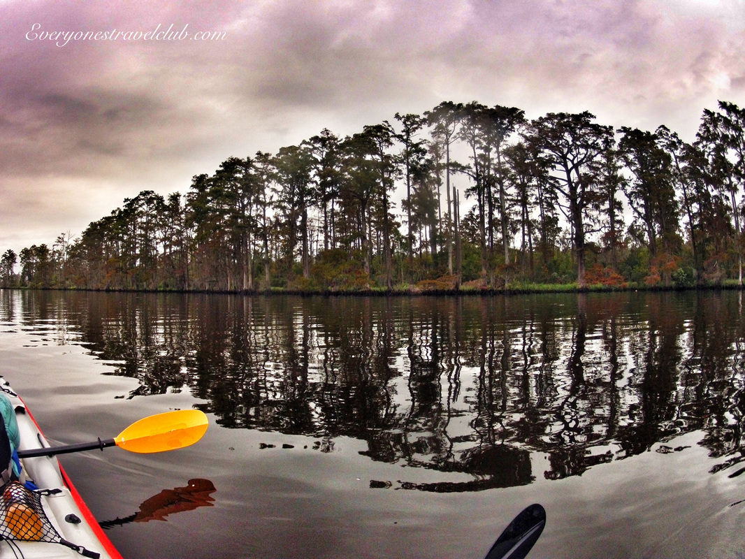
 I took a quick trip to North Carolina back in September - with my kayak in the carry-on of course - and with only a few days to explore. If you haven't been to North Carolina, I like to think of it as a combination of Missouri (where I'm originally from) and Florida (where my wife's from). Woods, beaches, country-folk, a few big cities, farms, and most importantly, lots of paddle-able water. Captain wifey's family lives near the town of New Bern. It's located at the end of the Neuse River, right where the river meets up with the Trent River and they both empty into the Pamlico Sound (which eventually leads to the Atlantic ocean). New Bern's a charming little town - we actually got married here - call it a truce between the Midwest & South Florida. 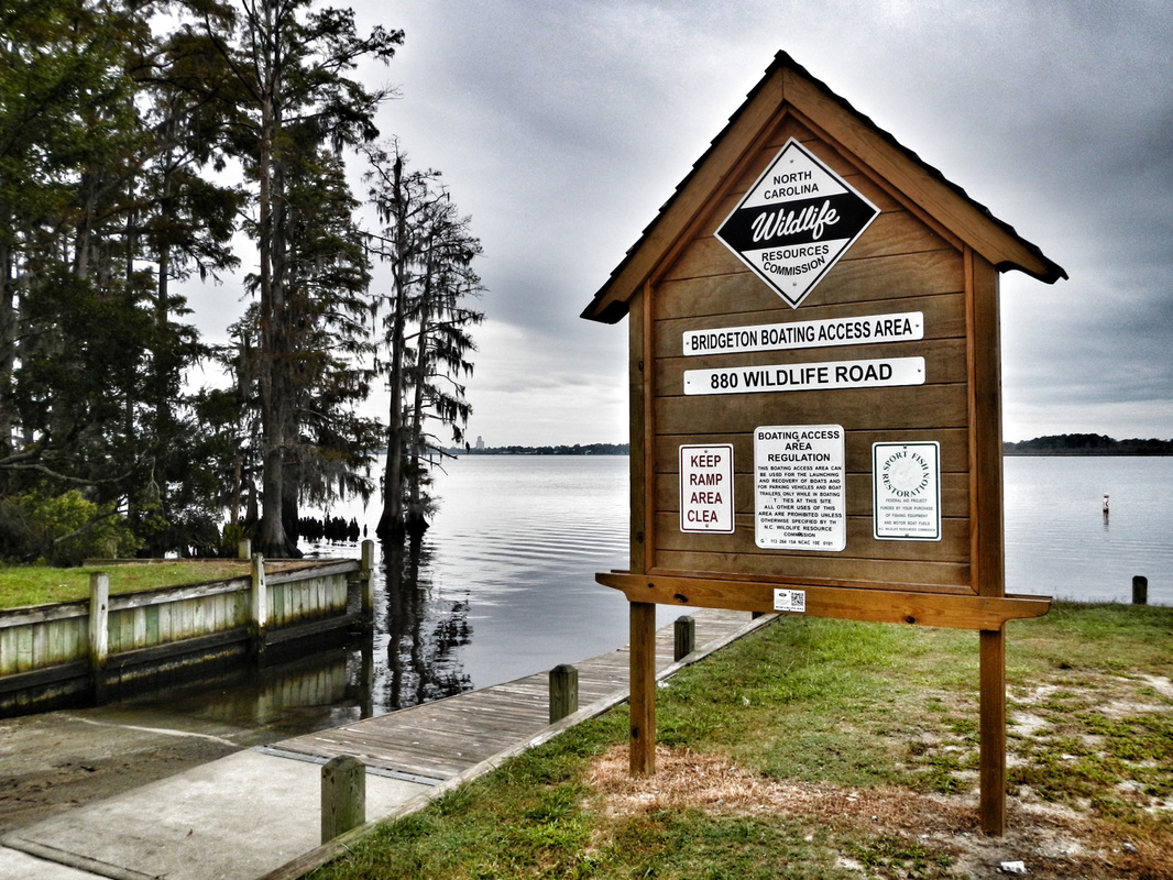 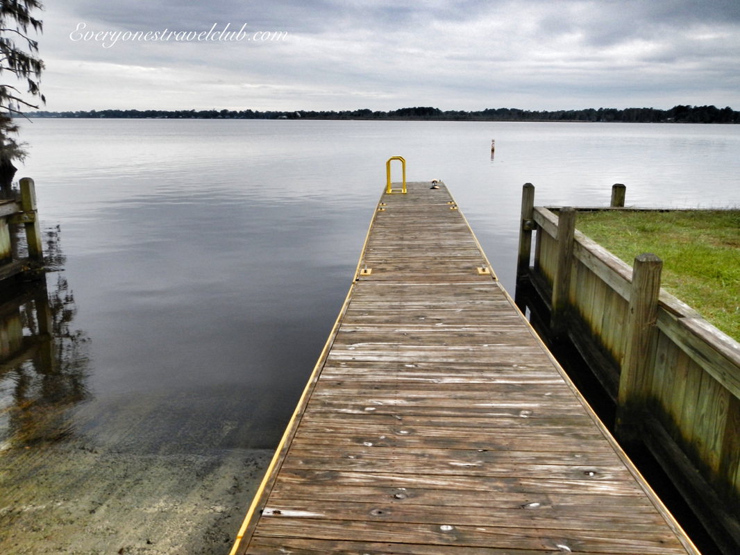 Our first order of business was to get our kayak in the water. We launched on the very end of the Neuse River from the Bridgeton Boating Area ramp on wildlife road - across the water from New Bern and just off US highway 17. It has a well-maintained dock/boat ramp/parking-lot. The dock was a little high (as usual) for launching a kayak, but we made it work (as usual). The river here was slow moving if moving at all - we paddled up and downriver against no noticeable current. 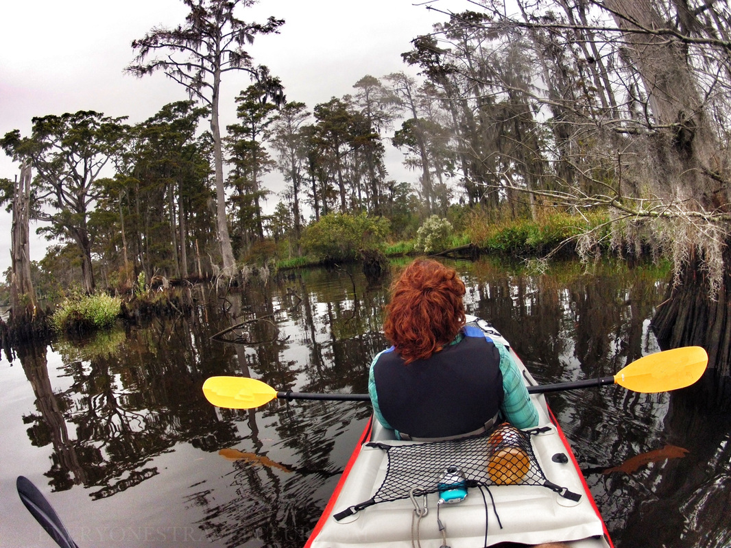 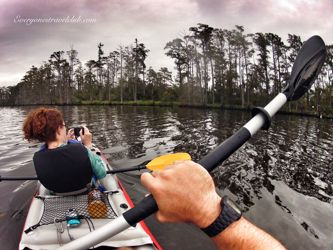 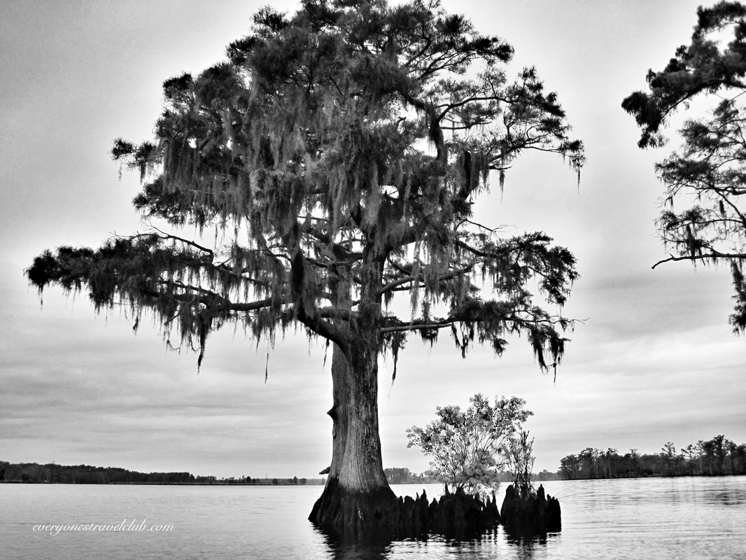 It's been awhile since I paddled on the East Coast. In photographer language this means I took way too many pictures. Every stick in the mud looks gorgeous. The textures are so different from my usual paddles here in the Northwest…I tried my best not to take too many pictures but failed…I got home with lots of pictures of sticks & mud (many I deleted). 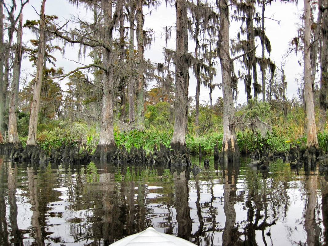 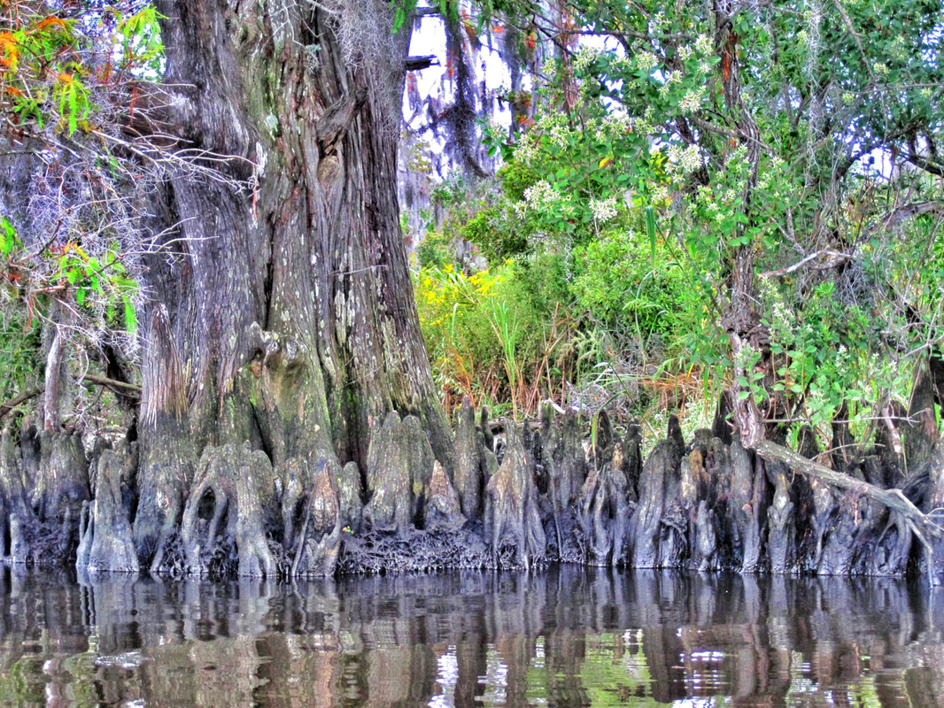 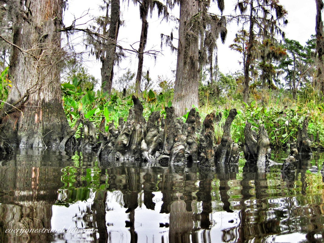 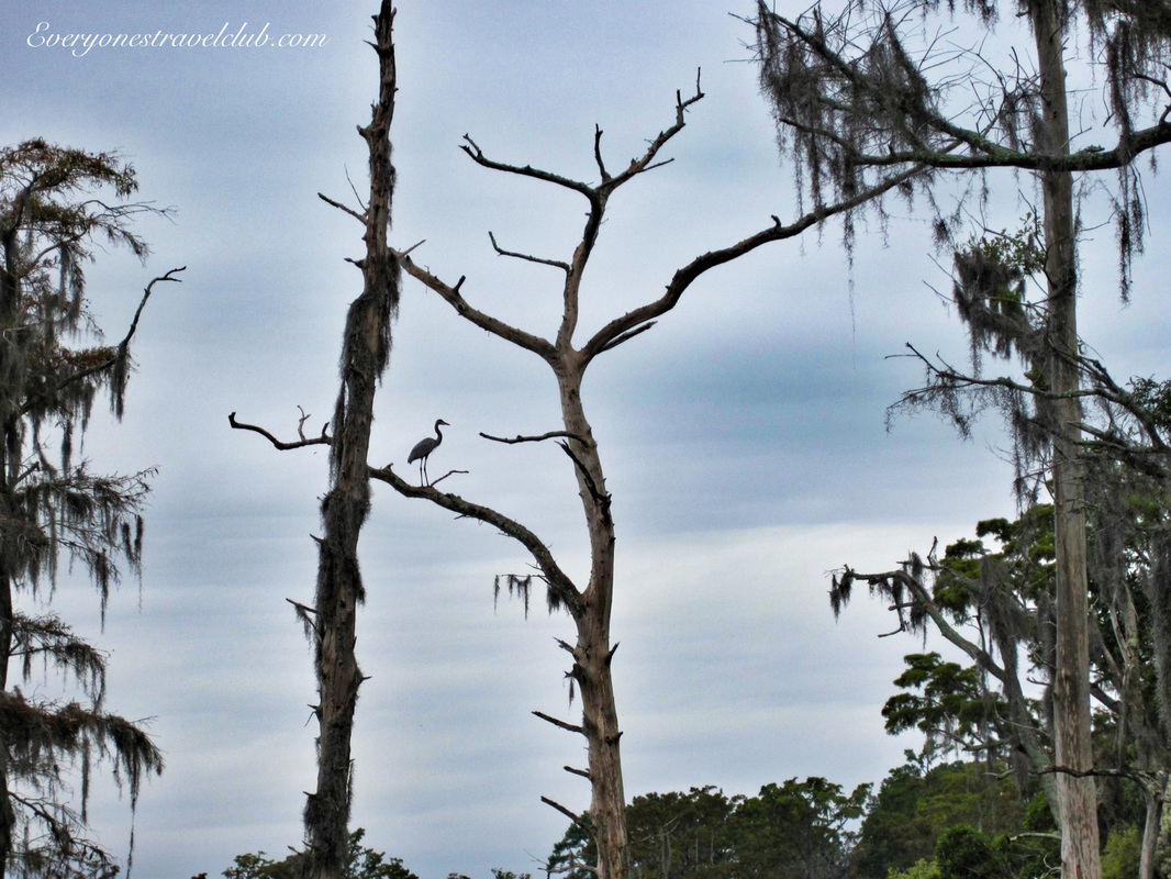 That's a cranky. In the tree, We saw plenty of crankies and a few bald eagles on our paddle - which we are super used to seeing in the NW - "Oh look honey, another bald eagle". We also had a very interesting fish jumping sequence where we were surrounded by a large school of decent size fish, all jumping out of the water at the same time for some reason (expect to see video soon on our video page). 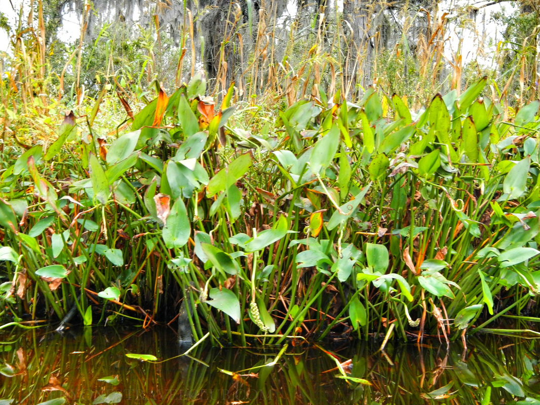 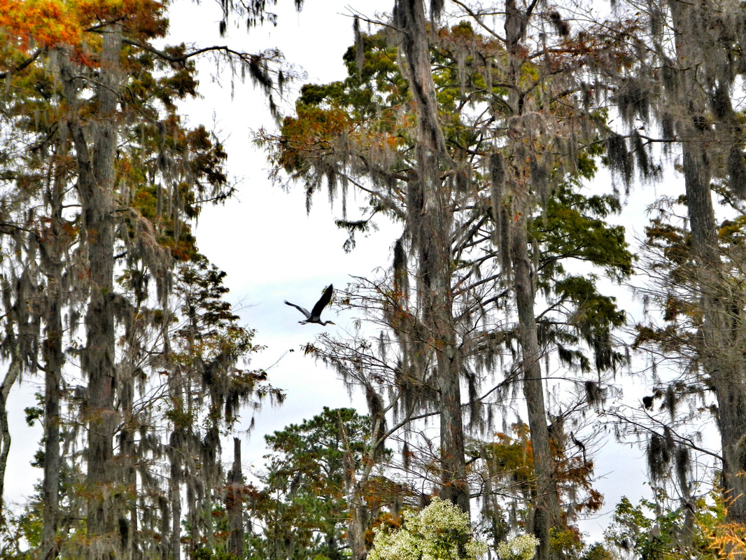 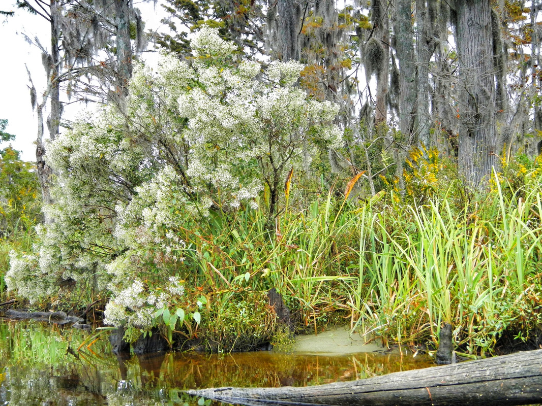 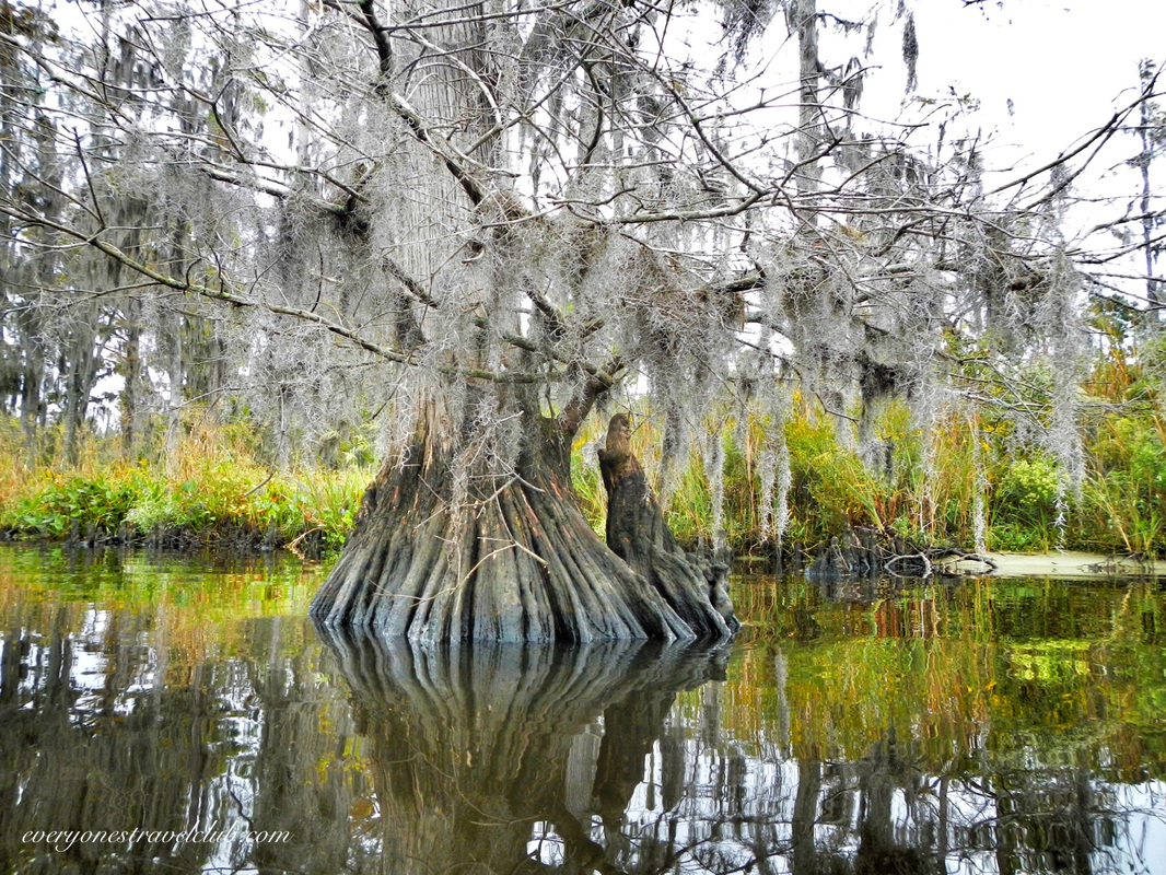 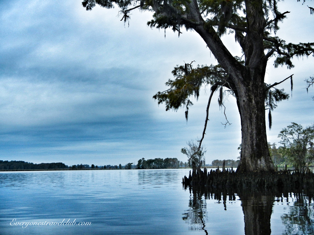 All & all, a nice little paddle on the amazing Neuse river. A little research revels that the Neuse is the longest river that is entirely in the state of North Carolina. It was once inhabited by (and named after) a Native American tribe called the Neusiok. Many other tribes once lived in this area of North Carolina too, including the Secotan, Weapomeoc, Coree, & the Tuscarora. The river begins North of Raleigh, near Falls Lake. It is about 275 miles long (with about 200 paddle-able miles below the lake and out to the Pamlico Sound), with the widest parts near the end at New Bern. The river has seen better days as far as water quality goes - it turns out that factories and farms dumping who knows what into the river over the years is complicating things. Be sure to check out what the Neuse Riverkeeper Foundation is doing to help protect this American waterway. 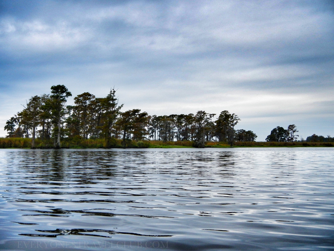 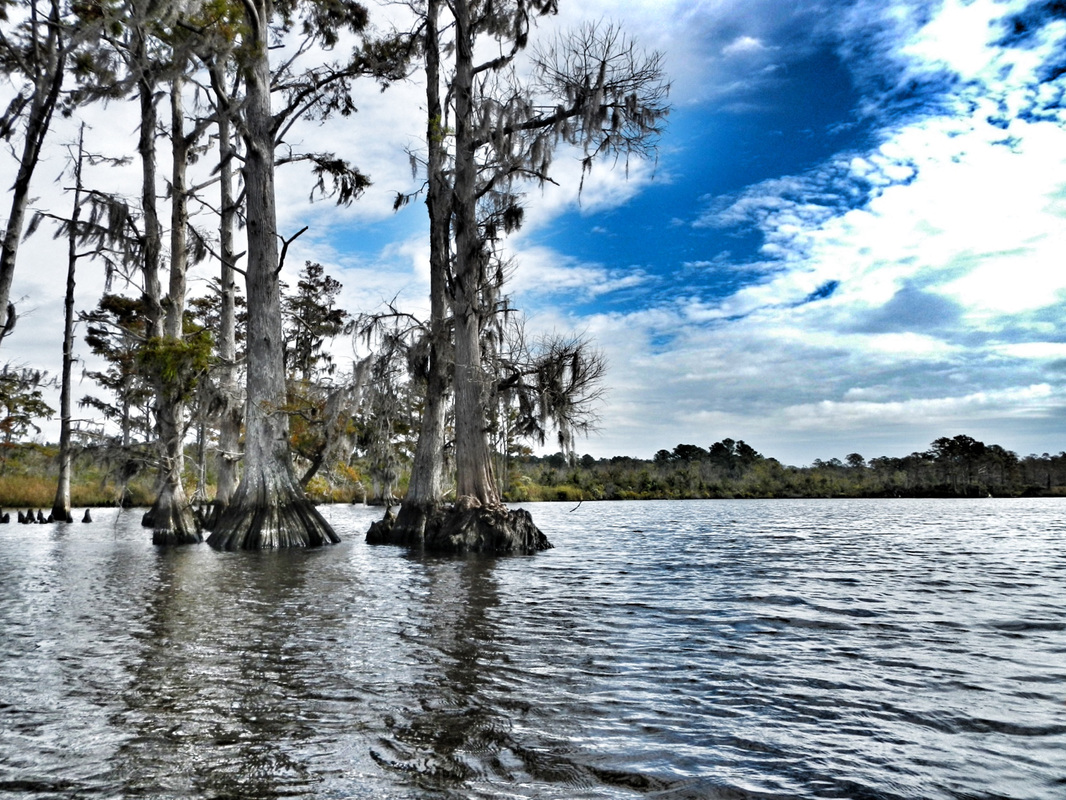 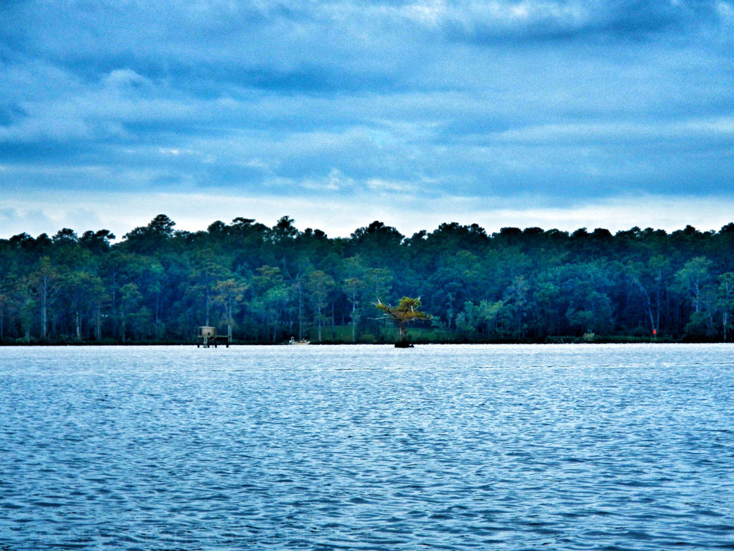 So, now it's time to pop the big question…not that question - remember, wifey and I already tied-the-knot here in New Bern a few years ago! Is there a longer Neuse River paddle in our future? Maybe all 200 miles? We hope so. Until then I will paddle vicariously through the many links I have provided below… ~Paul, Amber, Anna ETC For more info, check these please…do it. 1. A great video from Source to Sea, a retired? blogger who paddled the whole thing - it took him 9 days! 2. Sierra Club Trails post with info about Neuse River put-ins. 3. An informative (yet dated) brochure on Neuse River Recreation Area campground. 4. An interactive user-created Google Neuse River paddle map…this thing is sweet. 5. Another paddle map used by the paddler from #1 on this list. 6. The Neuse River section from the Source to Sea website. 7. Boating in North Carolina official stuff. 8. Neuse Riverkeeper Foundation 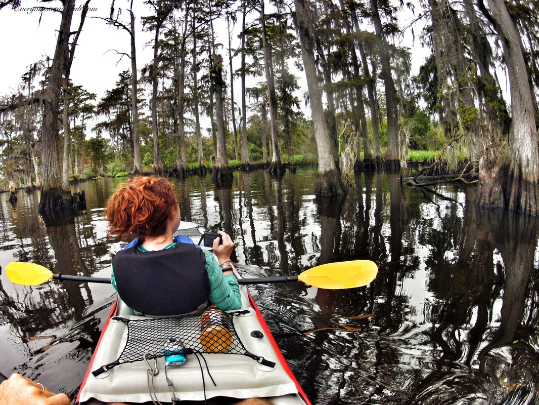 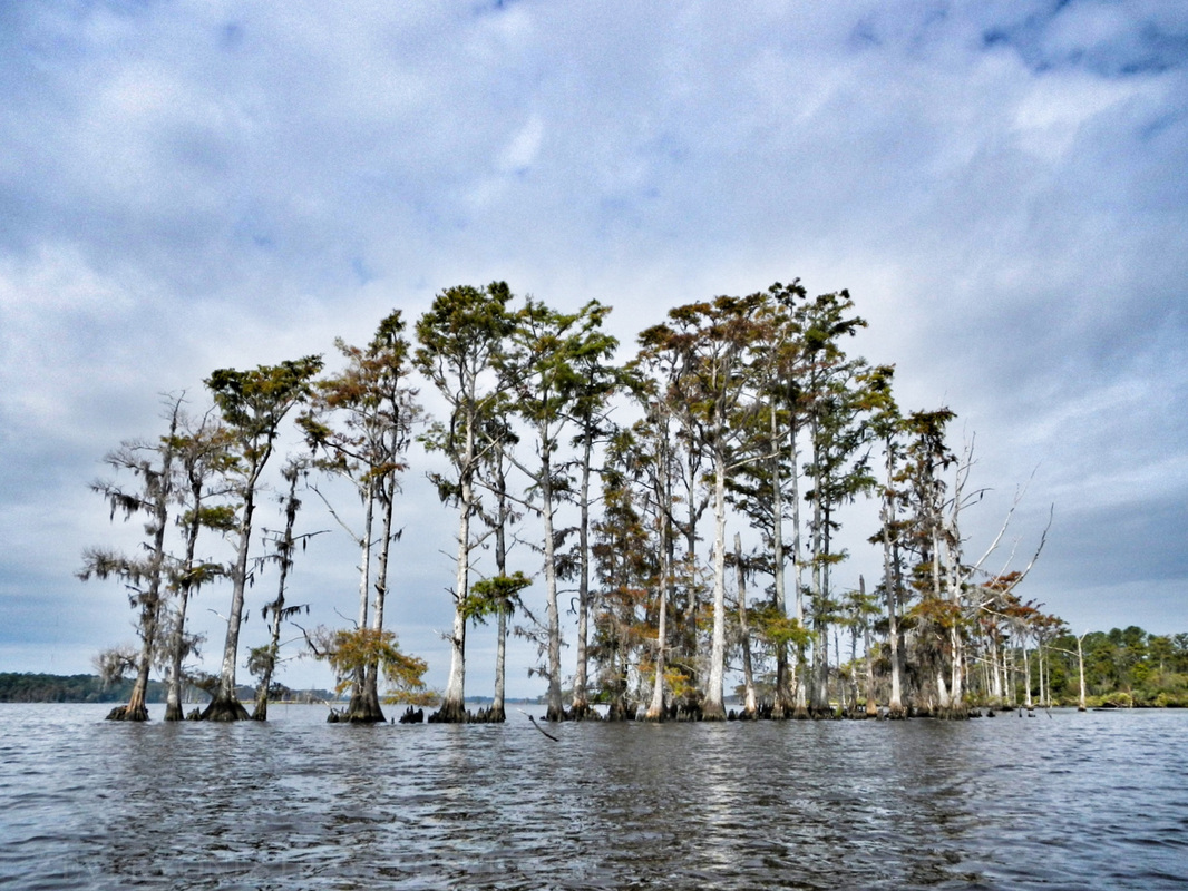 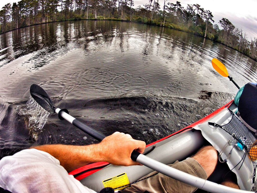 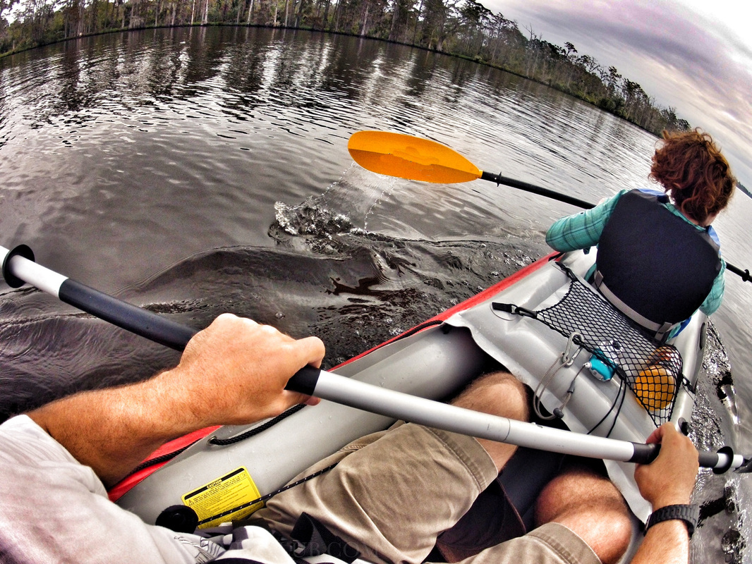 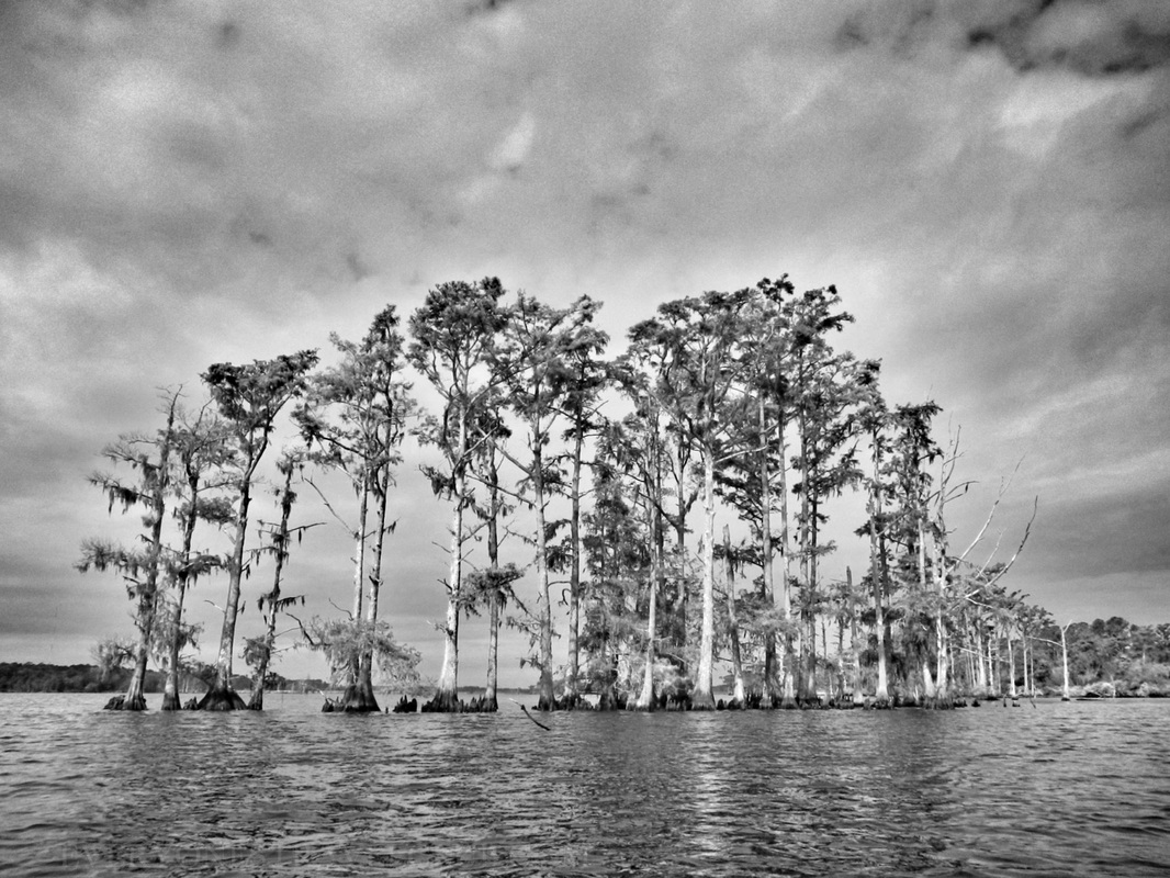
1 Comment
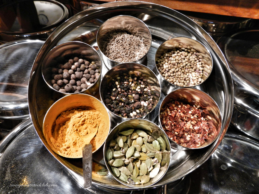
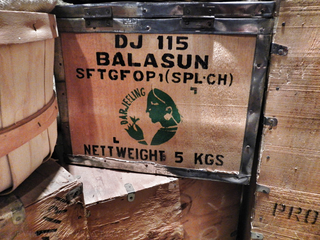
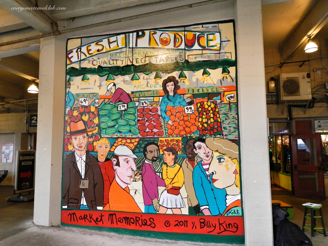
Walking around Seattle's Pike Place Market seems like it would be Harry-Potterish enough (did you see our last post?). The art, statues, vendors, musicians, magicians, & flying fish spark your imagination…but World Spice Merchants definitely seals the deal. 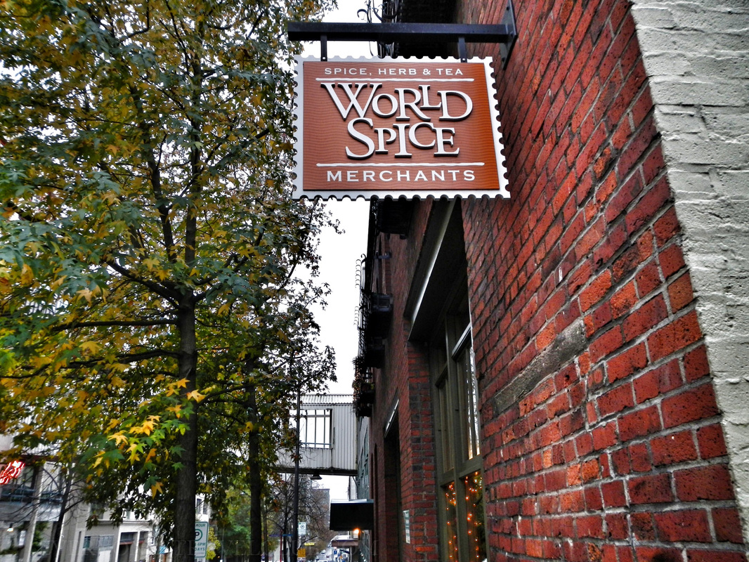 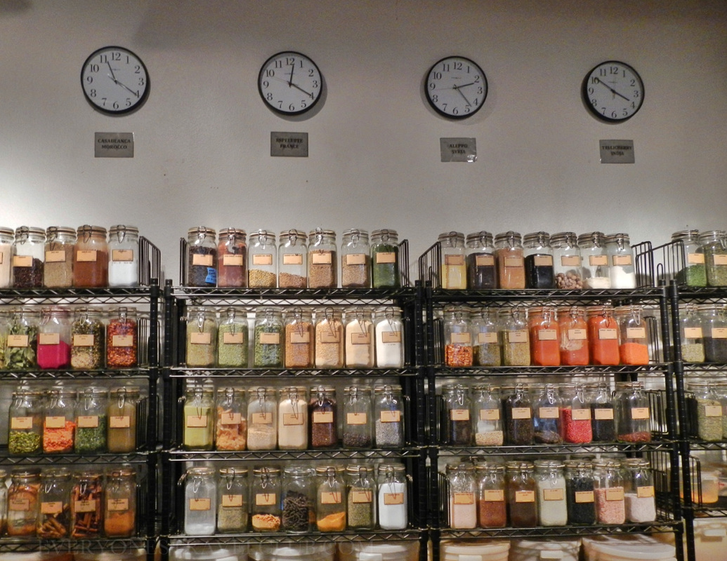 The shop is on the street that runs behind the market. It's also just up the street from the great Spanish & French groceries (you should check them out while you're there). Browsing this spice shop, whether you buy something or not, feels like visiting 3 continents in 20 minutes. Did I say feels? I meant smells - no wait, I guess it's both. There's something about this place that makes you feel like you're traveling. A lot of the spices, teas, & herbs come pre-packaged, some in nice little gift combos. The rest? Just grab a mini-clipboard with paper & pencil and start sniffing. Write down how many ounces you need, turn it in to the helpful dudes behind the counter, and they'll grind your order right up. 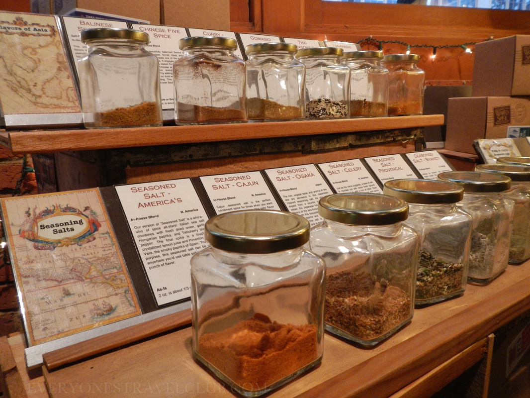
  So, sniff & shop, indulge your culinary imagination. Who knows? You might grab a magical spice that opens a door, sending you to Hogwarts! ~Paul & Amber ETC www.worldspice.com  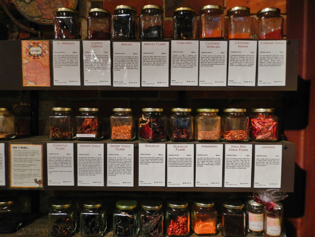 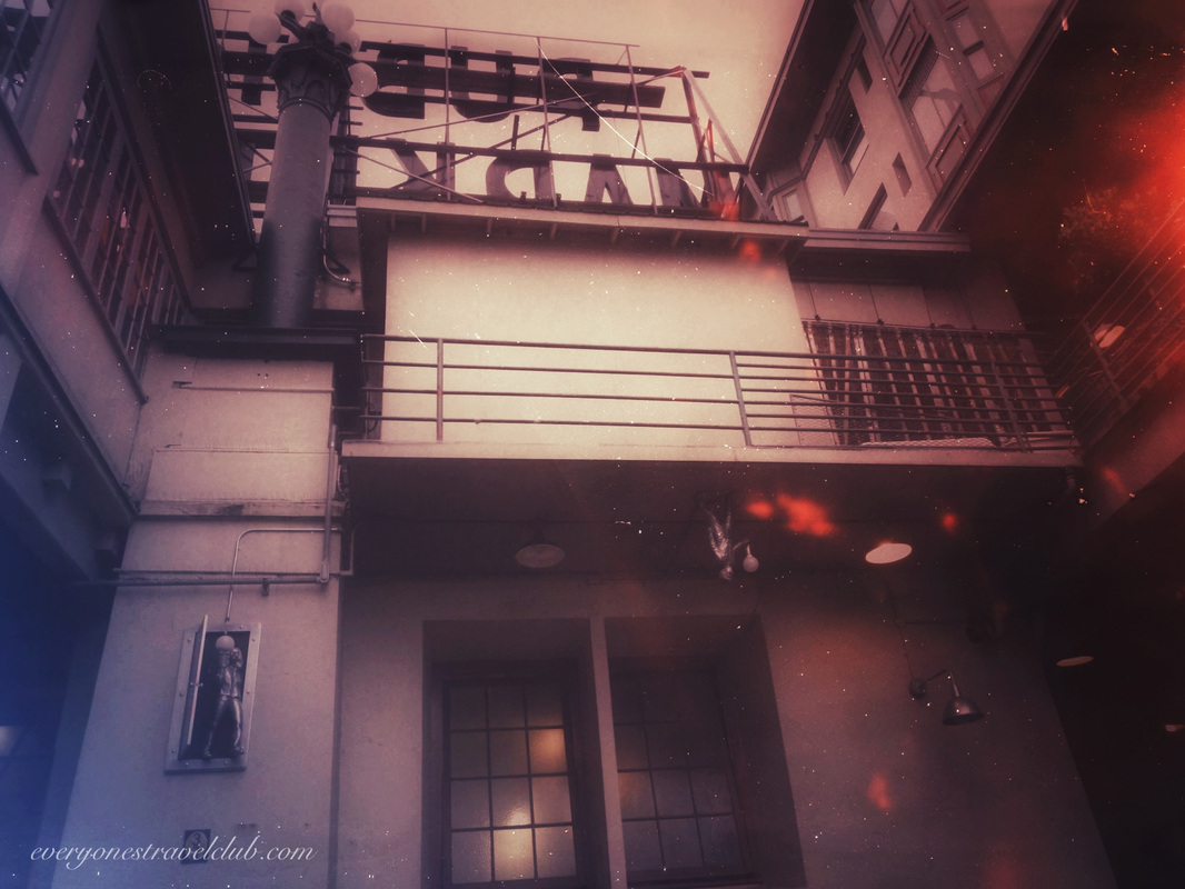
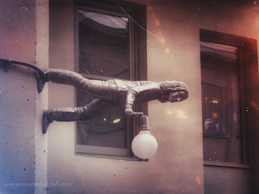
Just a quick photo set from Seattle's Pike Place Market. If you're a Seattle local (maybe a photographer?), every time you go there you probably tell yourself - "why don't I go there more often?" Paul & Amber ETC P.S. The statues below are right side up:) 

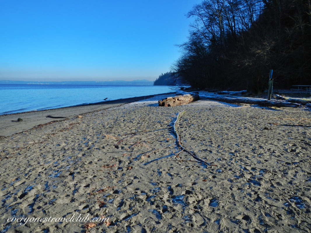
{Maybe}. Dash Point State Park might be a good place to camp on a multi-day paddle - it depends on your gear and how peaceful you want it. We visited the state park recently, not to be confused with Dash Point Park, located just south of this place (Dash Point Park has an L-shaped fishing pier…and is actually on Dash Point). The state park is on the Puget Sound, about 6 miles north of Tacoma and 20 miles south of Seattle, located in Federal Way. We visited in the winter and the place was empty. It's a pretty hilly park, heavily wooded, with a nice beach, lots of hiking trails, and a campground. A Discover Pass is required to park a vehicle. A cool thing about the park for folks in the South Sound - there is sand on the beach (instead of the usual NW rocks)! People actually swim here in the summer. Now, let's get this straight - I don't recommend swimming the usually-40-ish-degree Puget Sound. However, people swim here. A minor slope extends out a few thousand feet into the water here making it super shallow. When the sun warms the shallow water it must make it bearable to take the plunge…or NW people are a little kooky and will swim in any temperature of water (one of these statements is correct:). 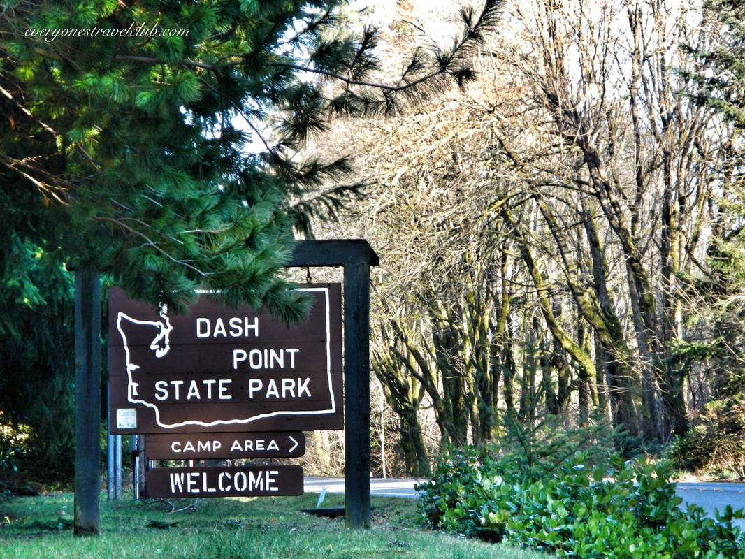 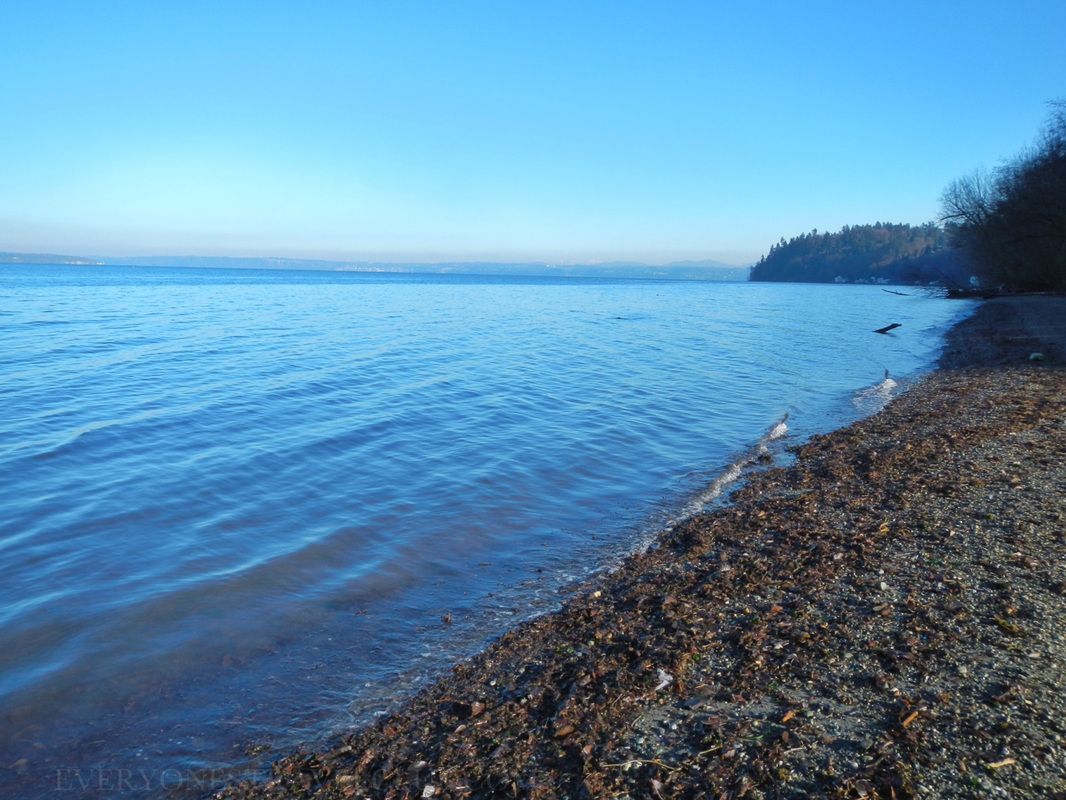  Alright, settle down people. Back to winter hiking and the possibility of one day kayak camping on an amazing paddle from Olympia to Seattle…or wherever your plans take you. From the online reviews of the park (which can or can't be trusted…I haven't decided), it seems like the state park can get pretty busy in the warmer months. The question is, will you want to deal with car-camper-party-folks after a long day of paddling? Probably not. With that said, they do have discounted water trail campsites available. It's nice to know it's here if you really needed it on a trek north or south. 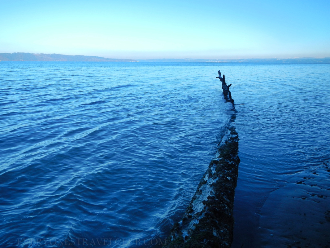
The hiking trails in the park connect to a somewhat larger network that seems pretty popular with mountain bikers. I would be careful hiking on the mountain bike trails - it's a collision waiting to happen! At low tide it is possible to walk down the beach to actual Dash Point and Dash Point Park/the fishing pier. A reason why it might-not be a OK place to camp on a multi-day paddle - the campground is a good distance from the water…and up a hill…only ok if you have a cart or an inflatable situation like us:) It really depends on your gear. 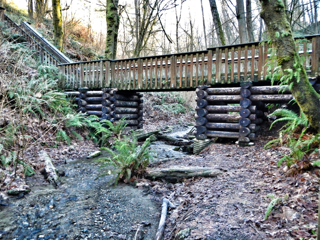 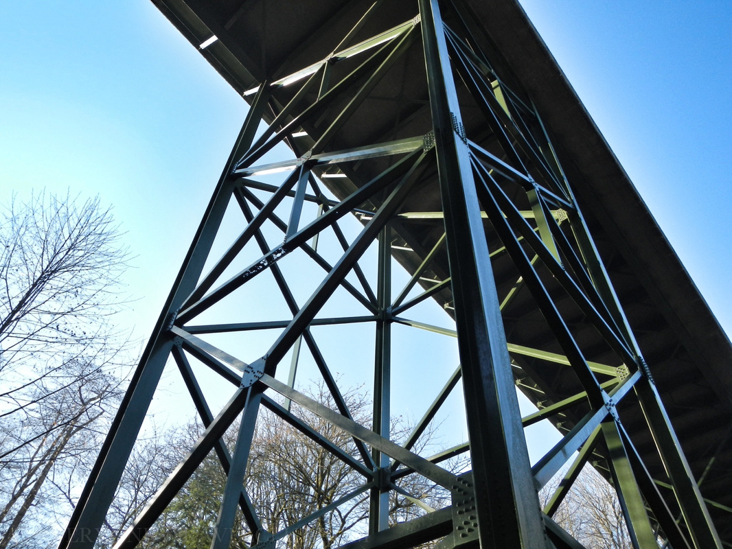 On our visit we walked from the state park parking lot to the beach (it was close). We then hiked all over the place, including hiking out of the park on other trails that put us in a nice residential area (neighborhood pics below) and up what is apparently called "Heart Attack Hill". P.S. Our wives always get mad when we hike on trails without mapping it out first and then end up in residential areas…it has surprisingly happened quite a few times…but who's counting? We left King county and entered it again, went off trail for a few minutes (our wives usually hate this too) and finally got back to where we started. It was nice to get out in the winter. The actual state park has around 11 miles of hiking trails and is just under 400 acres in size. So, Dash Point State Park is great for hiking and swimming, OK for camping, but you'd probably want to scope it out for kayak camping before you include it in you plans. They do take reservations in the summer months which is nice. There's a few links below to get you started, enjoy! ~Paul, Micah, John ETC Camping info from the state park website here. Map of the park and campground here. General info about the park (for camping) from www.stateparks.com A nice little article about the park from NW Tripfinder. 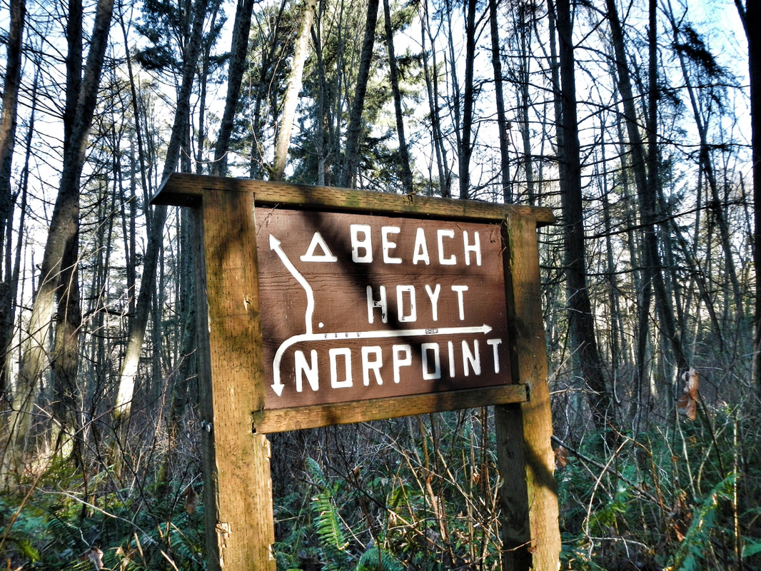 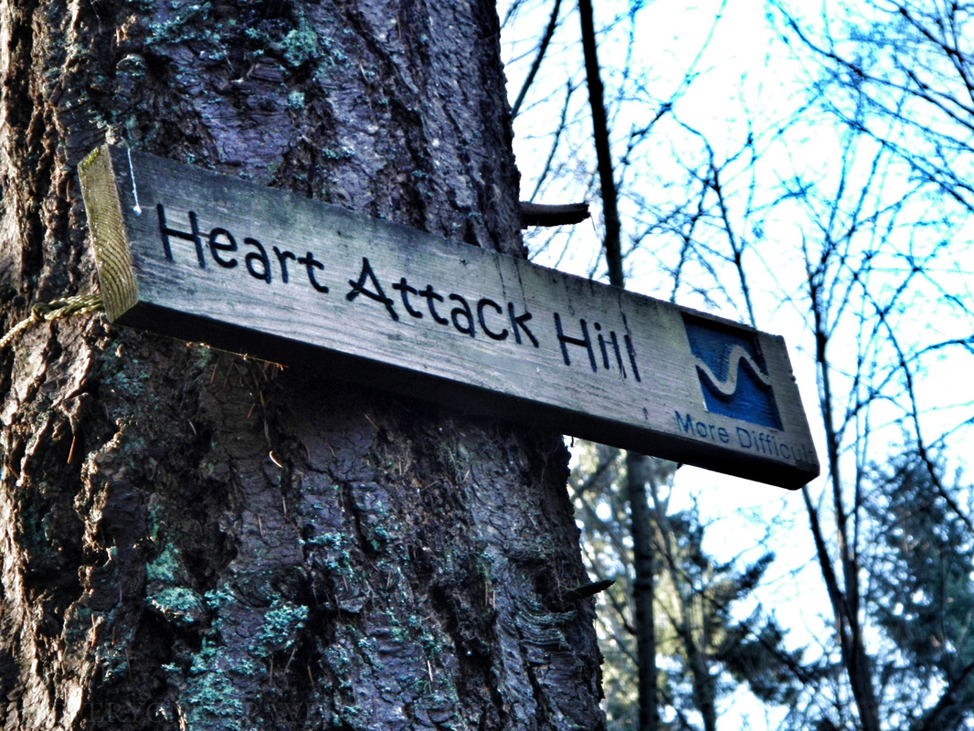 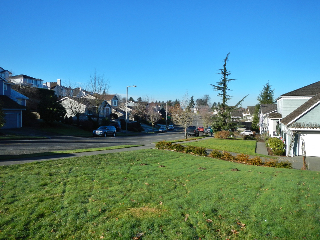 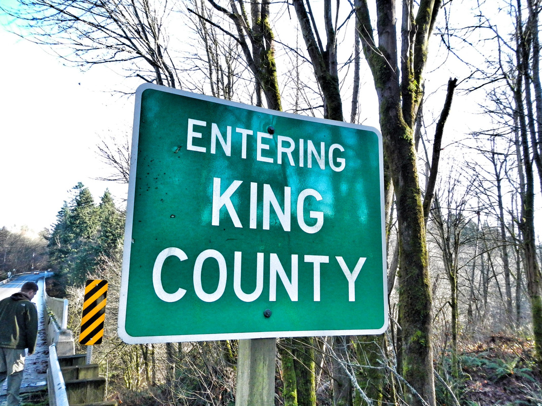 |
Follow us on Twitter and receive updates when we post (click the birdie).
 Archives
March 2014
|
 RSS Feed

|
Connect:Contact: |
[email protected] |