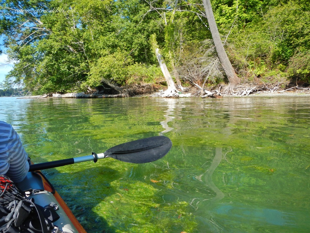
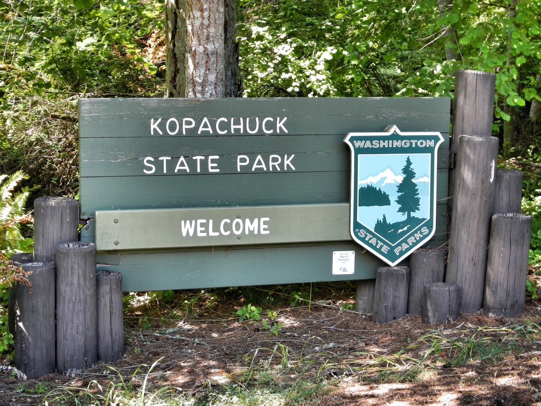
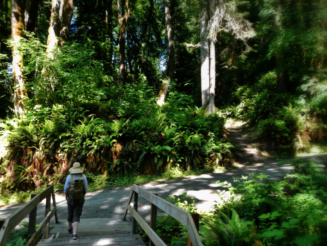
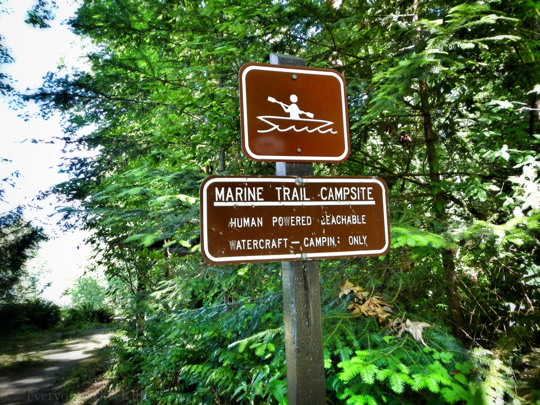
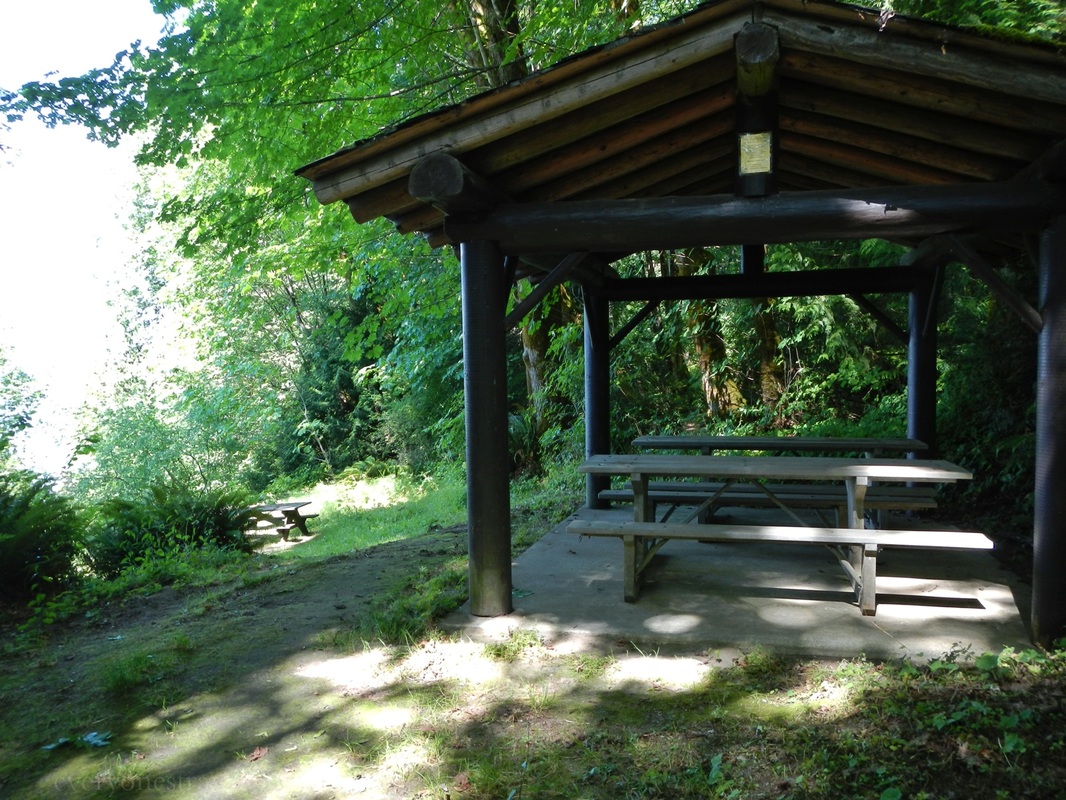
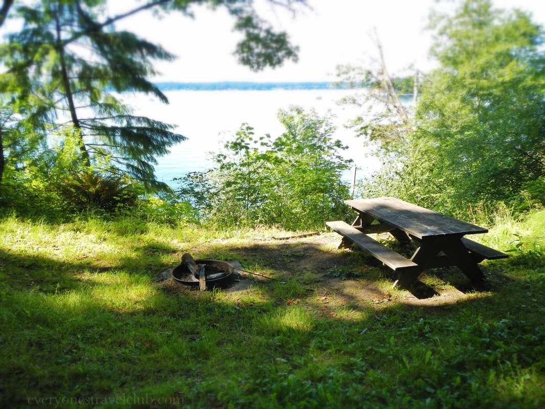
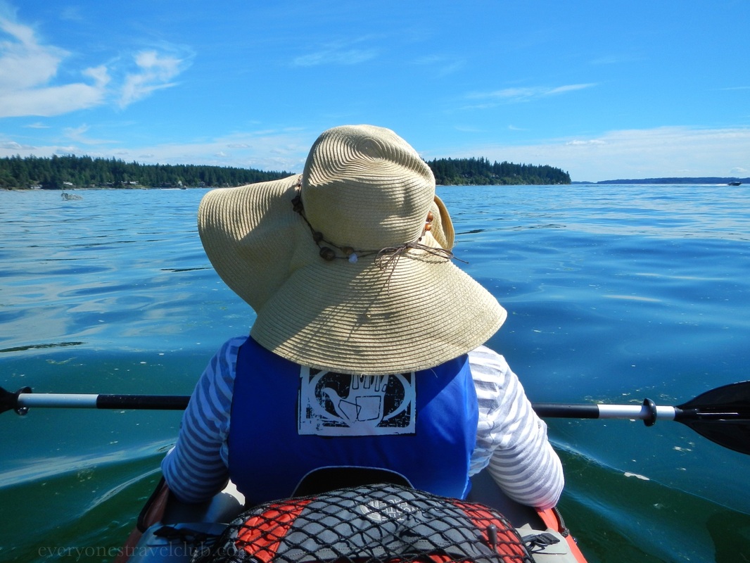
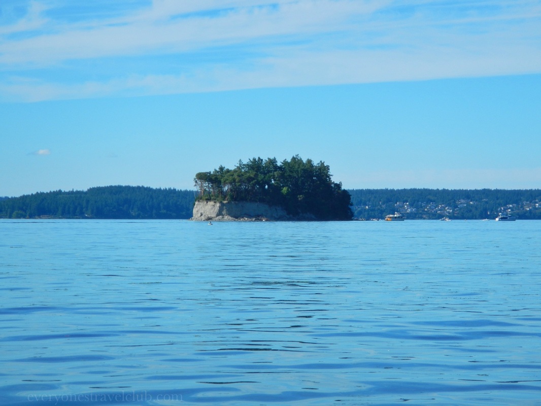
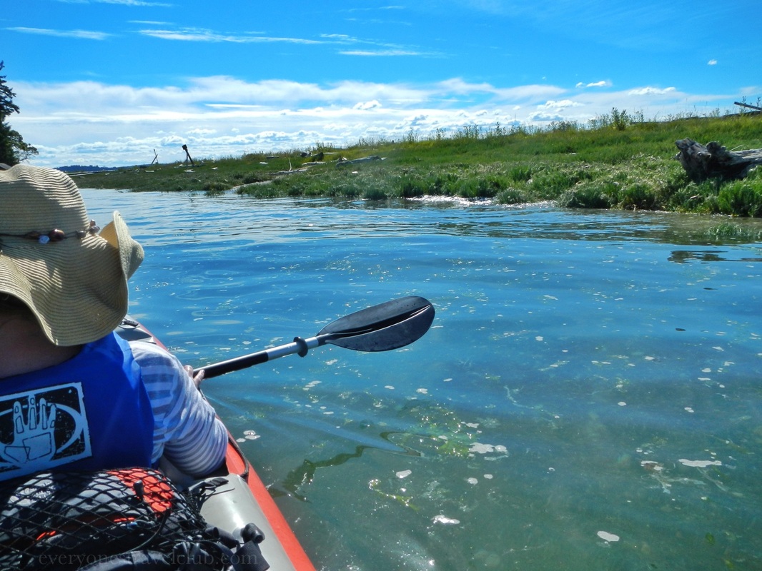
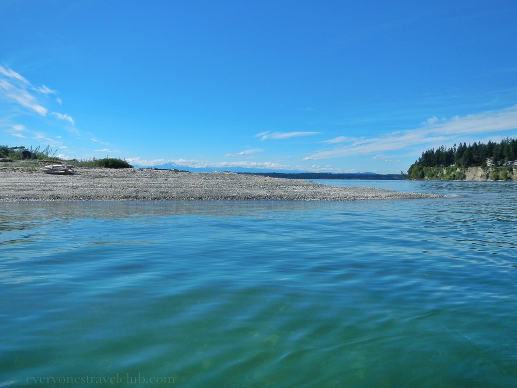
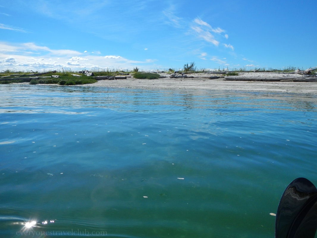
 Just a short drive from Gig Harbor exists Kopachuck State Park - a forested park on Henderson Bay with plenty of water access and some pretty cool nearby bays & islands to explore. There's lots of parking (Discover Pass required) but it's not that close to the water. If you've got hardshell kayaks, you'll have a little hike down the hill to the beach (I'd look at a map before you go). Luckily for us, our inflatable packs up nice and we made the short trip down the trail to the water. While hiking down to the beach we stumbled upon a marine trail campsite. It was cool to see in person since we recently joined the Washington Water Trails Association. It's a pretty sweet deal - a minimal annual membership for discounted, members only aquatic campsites up and down the Puget Sound allowing paddlers a place to camp (that way you could complete some super long paddling trips).  We eventually made it down to the water and started paddling south towards Horsehead Bay. It's popular to go the other way towards nearby Cutts Island State Park (some of the locals call it Deadman's Island!) or Raft Island, but we've been there done that. Also, it was a busy summer weekend day and several power boats were WAHHHH-ING!!! around the islands (we only like power boats WAHHHH-ING when we're actually in them:). 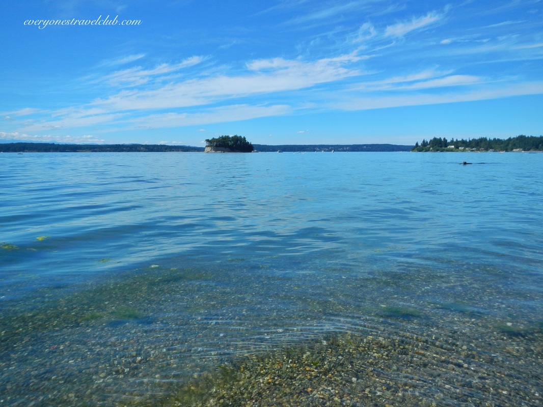 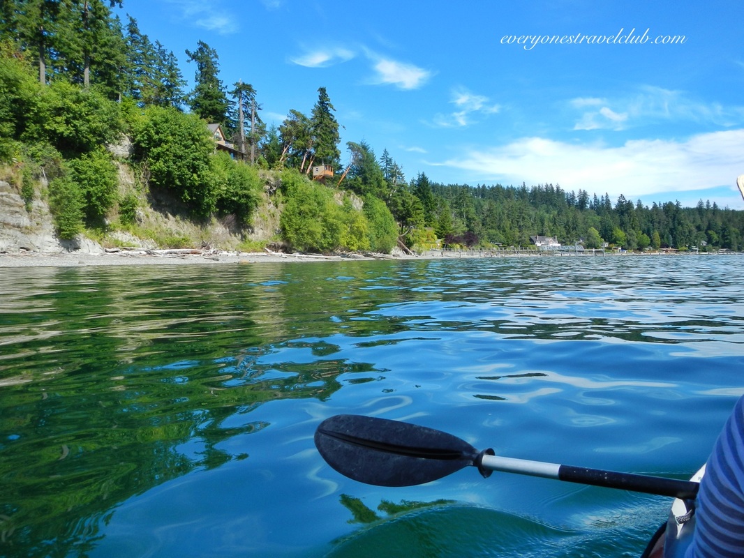 Paddling into Horsehead takes you past a tempting sand spit…tempting because it seems to be private property…otherwise it would be a great place to stop for a snack. We paddled in and out, pretend shopping for our favorite beach house, and eventually drifted back to our launch site at the park. Kopachuck is a nice day trip and it was cool to finally see a WWTA campsite. If you haven't paddled around here before it's definitely worth a visit. A circumnavigation of Raft Island (private/residential) is totally doable and exploring Cutts Island (beach and hike around) is fun too. You could do it all in one day pretty easily. If that day is a warm summer one you may not be alone!
There's lots of parking but not a whole lot of beach space - I'd choose a different beach if you planned to spend the day tanning (or, as tanning as Northwestern-ly possible:). However, word on the street is that at low tide a sandy beach appears…maybe there's tanning to do after all! ~Paul & Amber ETC
0 Comments
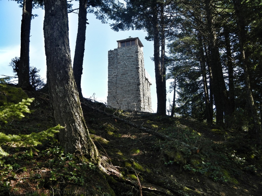
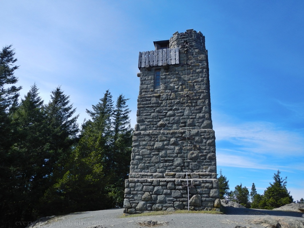
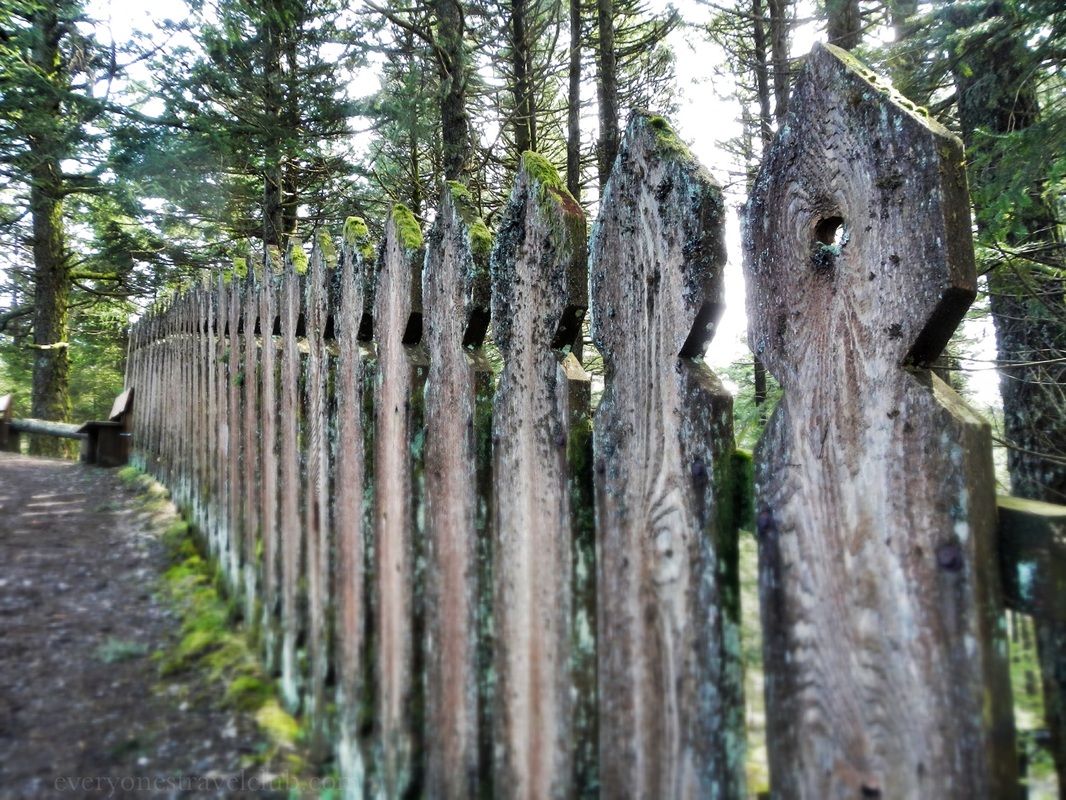
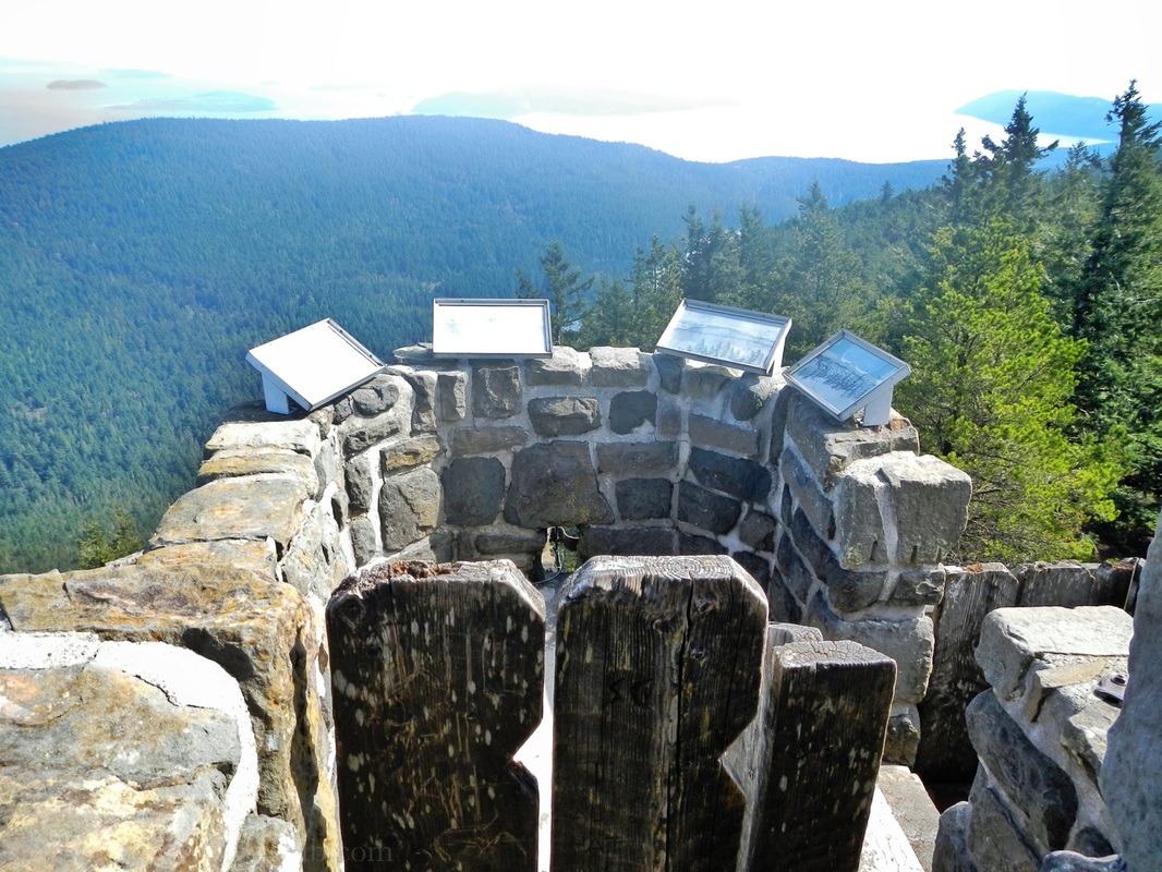
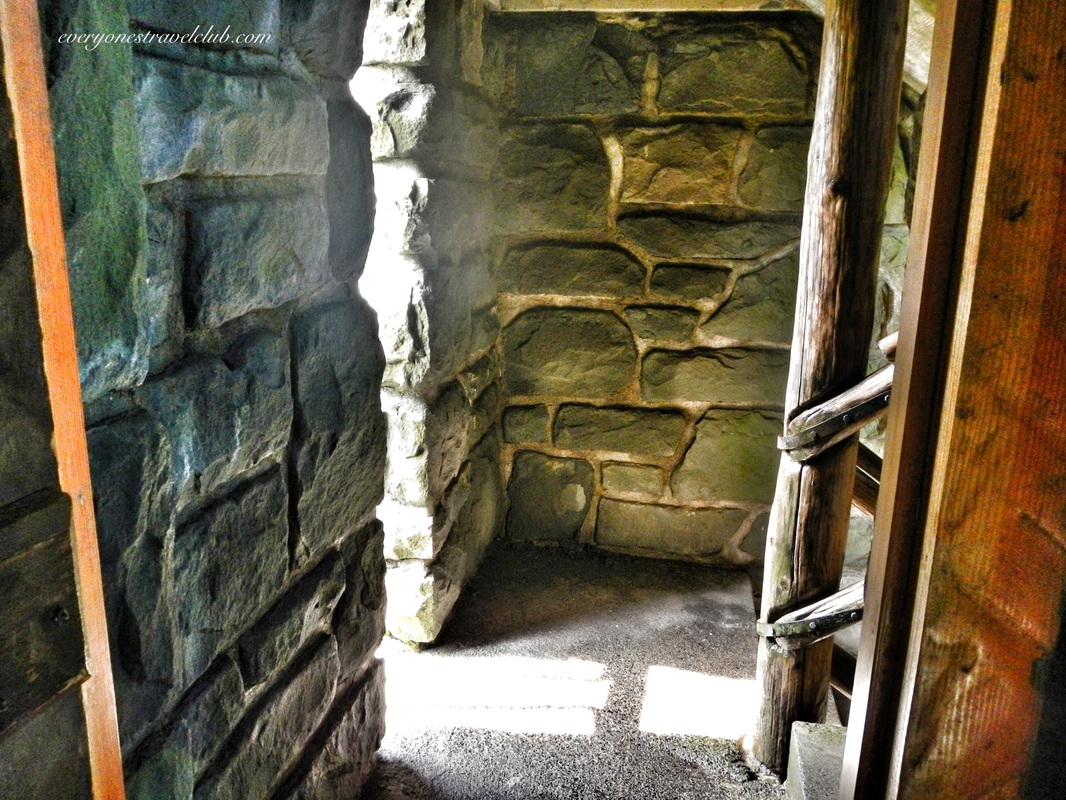
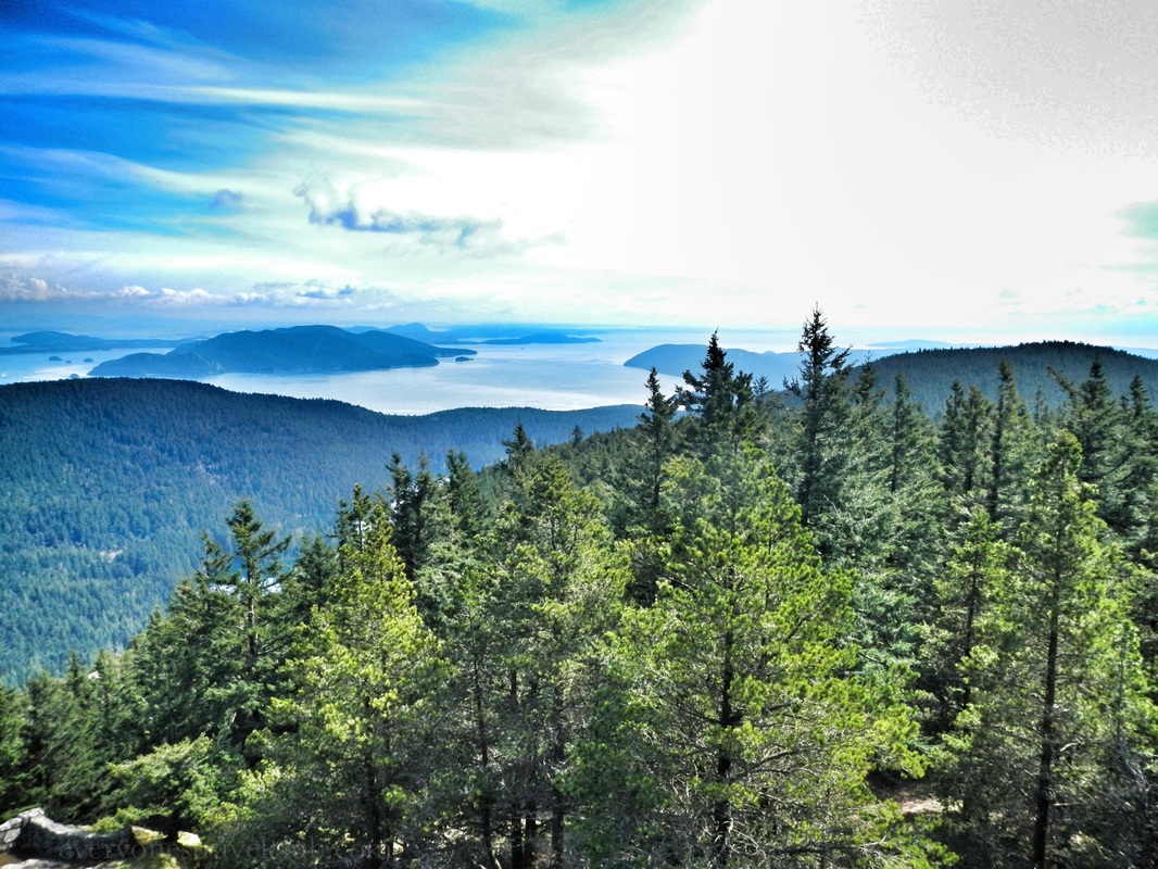
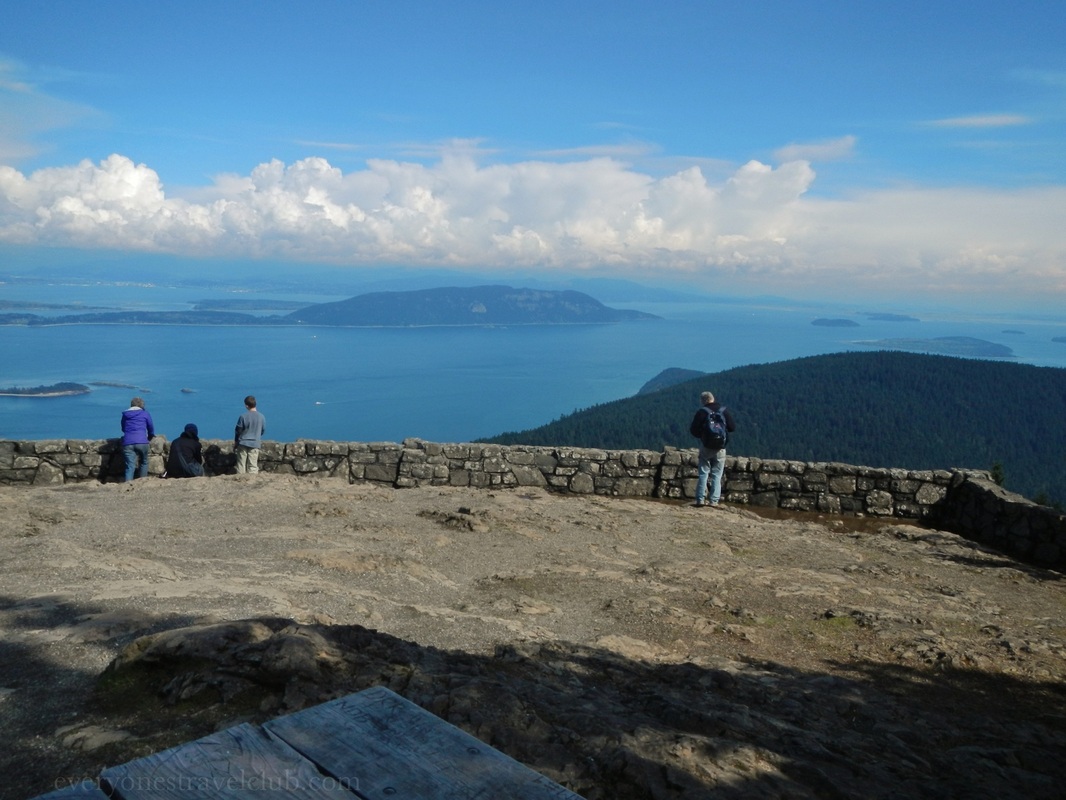
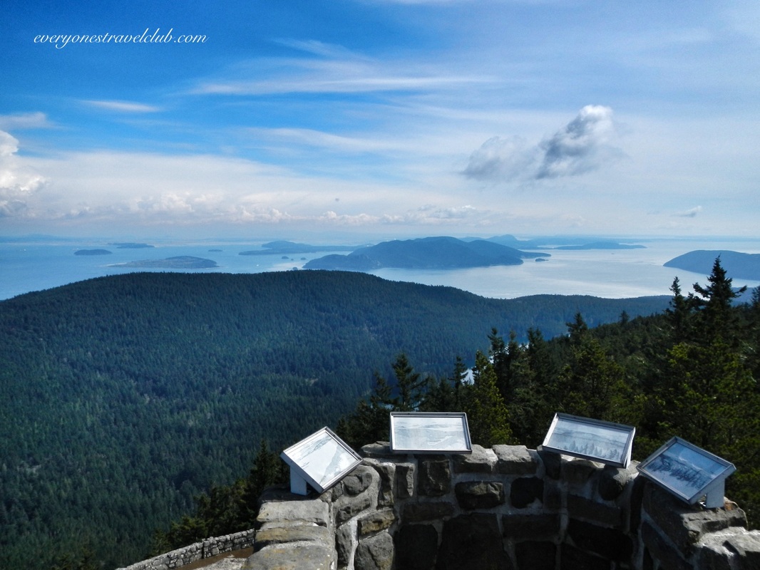 Our exploration of the San Juan Islands continues with a little trek to the tallest point on the islands - Mount Constitution. Located on Orcas Island (Orcas is the mountain-y one), Mount Constitution sits in Moran State Park, a 5,000 acre or so state park with lakes, mountains, waterfalls, lots of hiking trails, camping & day use areas. 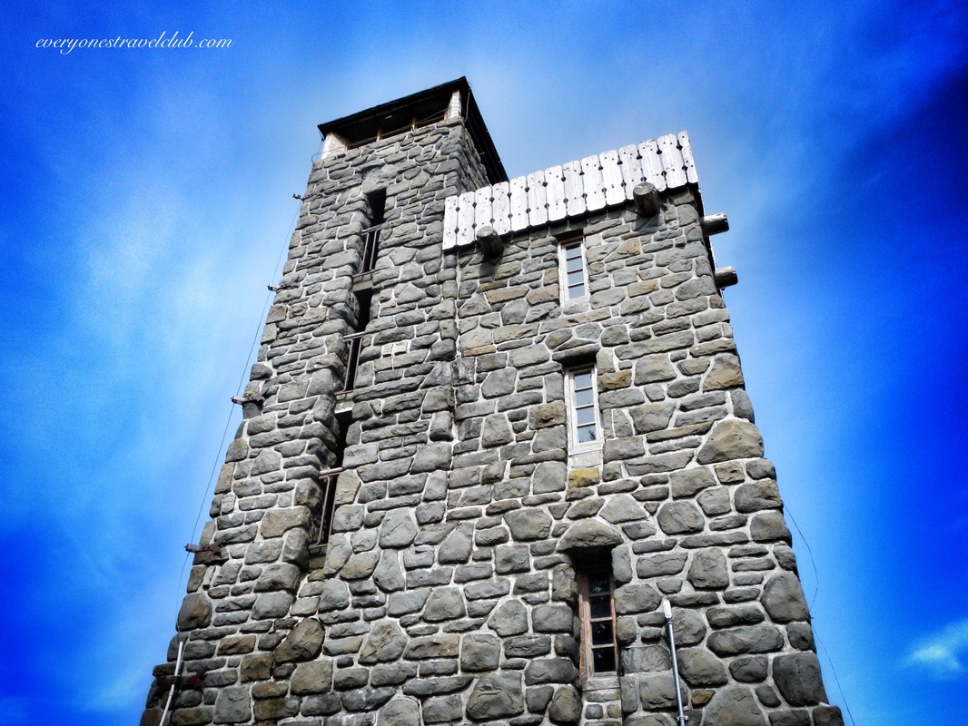 Mt. Constitution sports an awesome stone lookout tower (built in 1936). The views are excellent, you can actually go inside and up in the tower (as opposed to it being locked up like some sites in the NW), and there are bathrooms in the parking lot. Although you can park lower on the mountain and hike up (the popular trail is about 7 miles with a 1500 ft elevation gain), you can also just drive and park on the very top. Just know you'll need a Washington State Discover Pass ($10 a day or $30 a year) to park a vehicle at the park. We usually purchase ours each year at REI in Seattle and keep it in the glove box. Also, if you are hiking up, know that sometimes there isn't portable drinking water at the top so plan ahead! We highly recommend heading to the top and checking out the view - it's amazing! ~Paul & Amber ETC Links: Nice map of Moran State Park Check here at the State Park website for current info 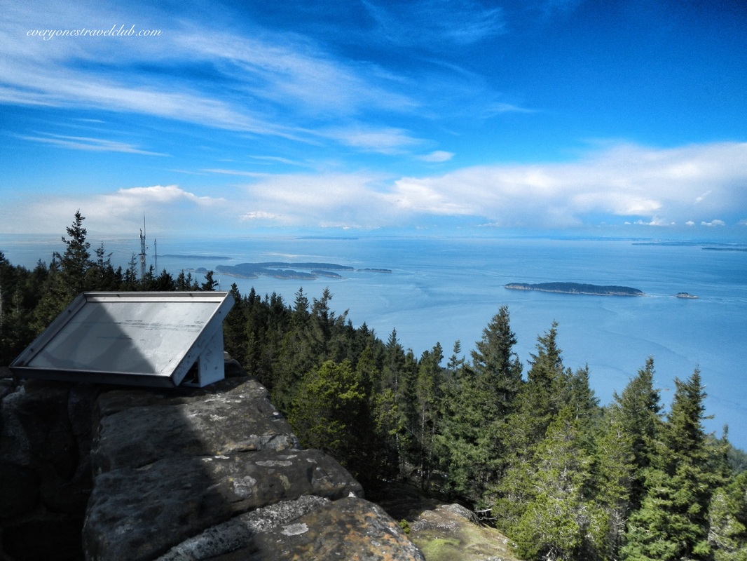 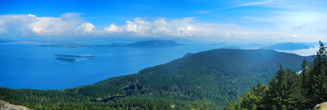 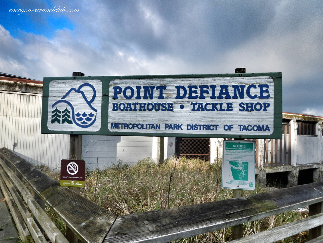
A little northwest of downtown Tacoma is the 702 acre Point Defiance Park. It's a city park…a giant city park. 702 acres puts it at one of the biggest city parks in the country. It sits on its own peninsula, jetting out into the south Puget Sound, pointing across the water to Gig Harbor & northward to Vashon Island. There is tons of stuff to do at the park - the Zoo & Aquarium, Rose Garden, Japanese Garden, Rhododendron Garden, beaches, trails, lots of picnic spots, dog park, Fort Nisqually (long story), ferry dock, boat ramp, boathouse, and more. 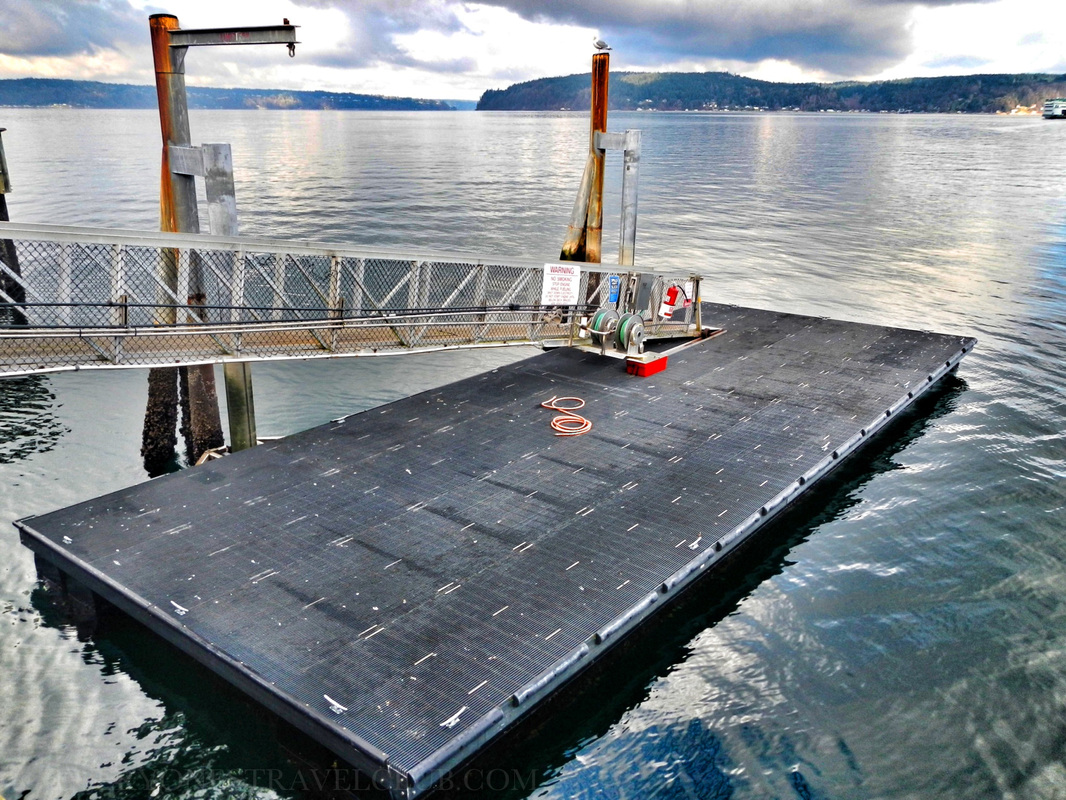 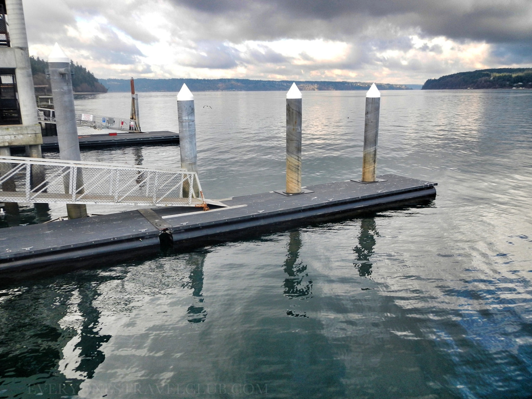 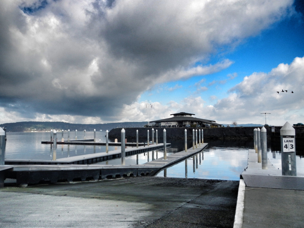 If you park near the boathouse & marina there's quite a few places to launch a kayak (there's also a boat ramp for trailered boats). A lot of the docks were nice and low…perfect for paddle-craft. It didn't really seem like you'd have to pay a launch fee, however, it's always a good idea to check the message boards at the boat ramp just in case. 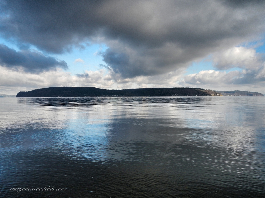
A look across the water to the north reveals the southern tip of Vashon Island. The Tahlequah ferry route takes you from Point Defiance to Tahlequah on Vashon (who knew there was a ferry dock here?). 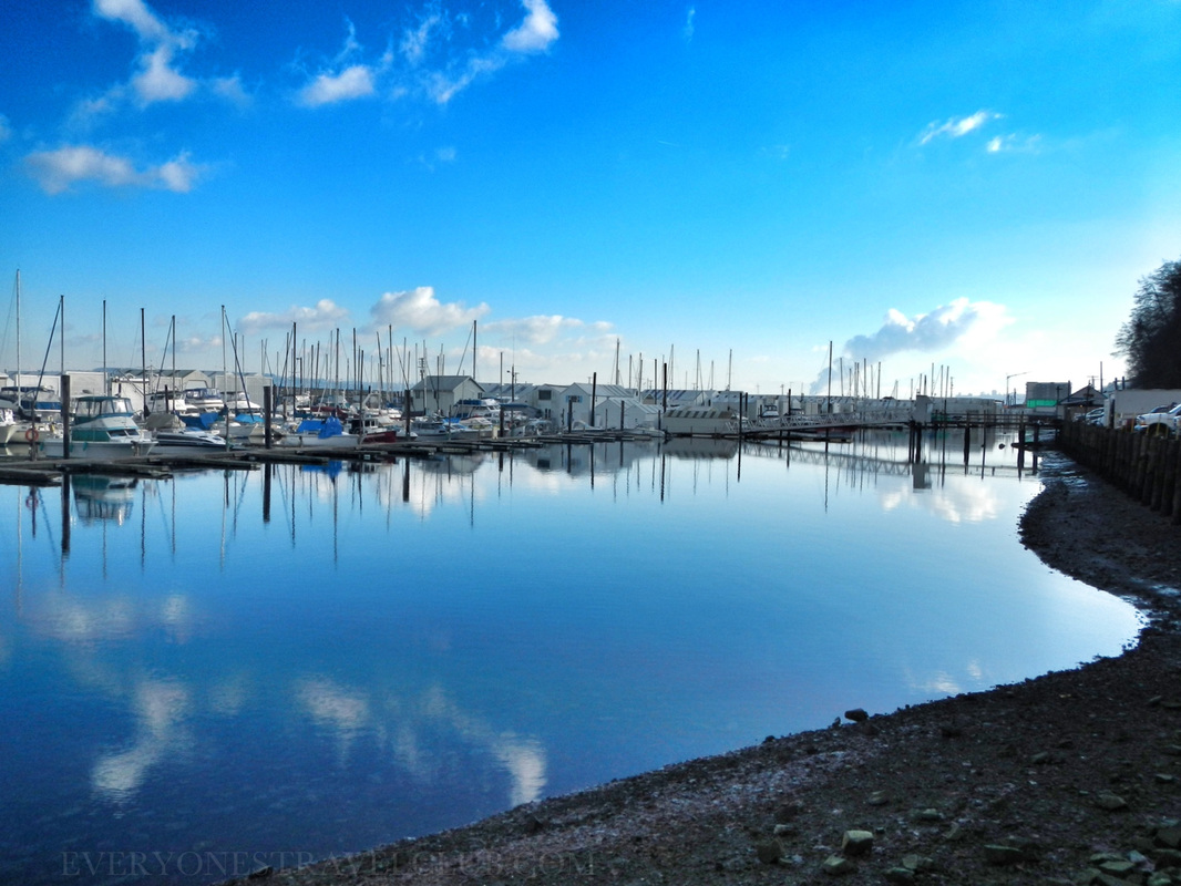  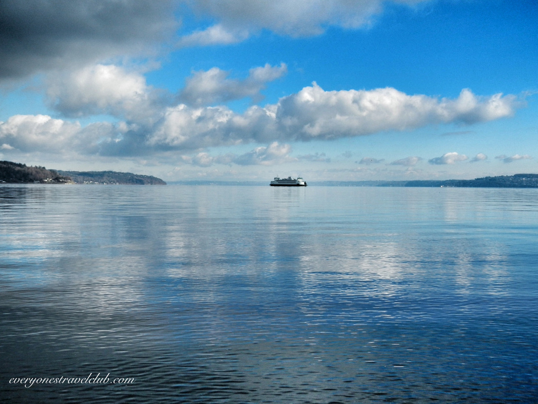
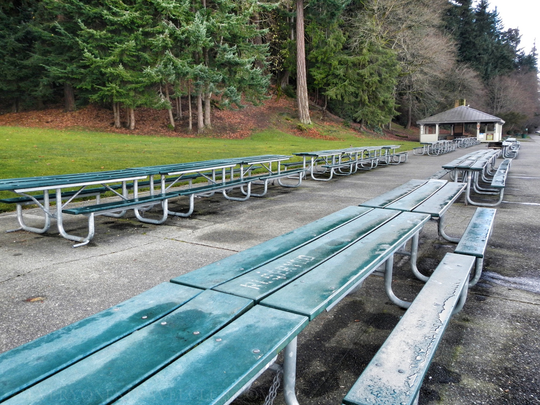 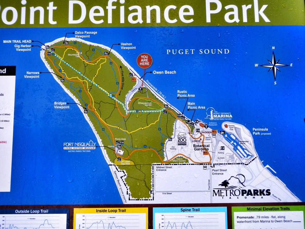 The park is big - don't get lost! We parked at the boathouse, walked down the beach to Owen beach & back, then got back in the car and drove to the Nisqually Fort area. It's cool to read about the history of the park on the boards near the boathouse - this was the place to be in the 1800s! 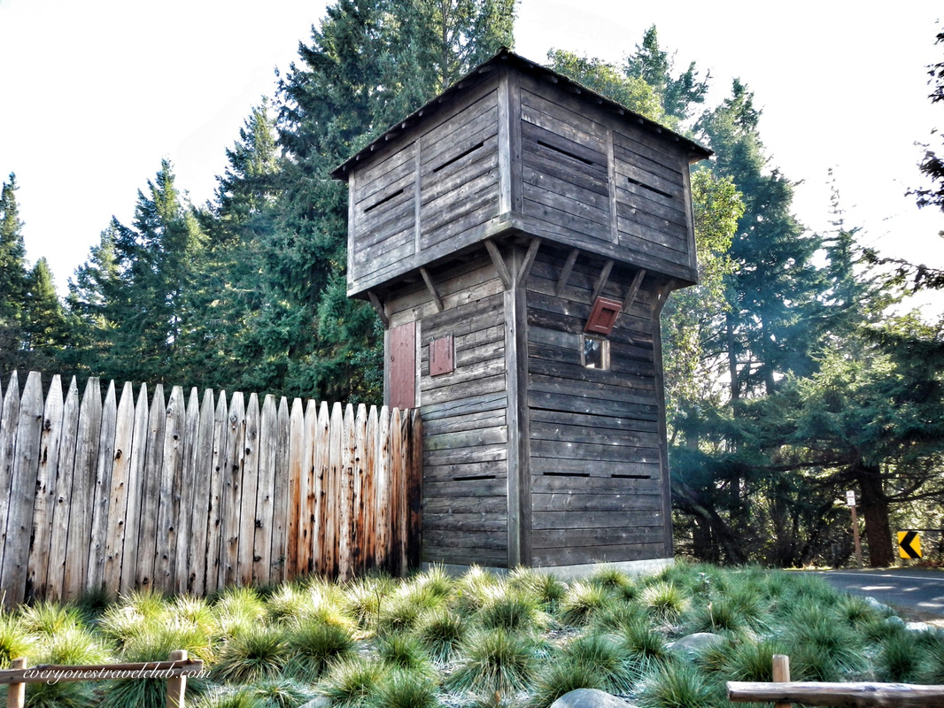
Huh, a giant fort in the park. Interesting. Luckily, we had just visited the Nisqually National Wildlife Reserve (our post here) so it kinda all made sense! The fort here is part replica, part relocation of the original fort 17 miles away near the Nisqually delta (it's not there anymore). Historically, this was the first European settlement in the Puget Sound. There's tons of info here from a friendly and knowledgable staff - we'll be back to take the tour soon. Check out more at their website. 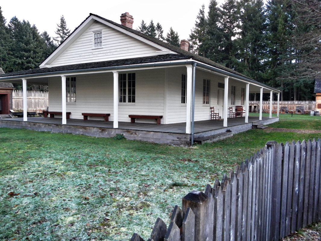      Just past the fort is the dog-park and trails that lead out to a great Tacoma Narrows lookout…watch your step - it's a long way down from these cliffs! 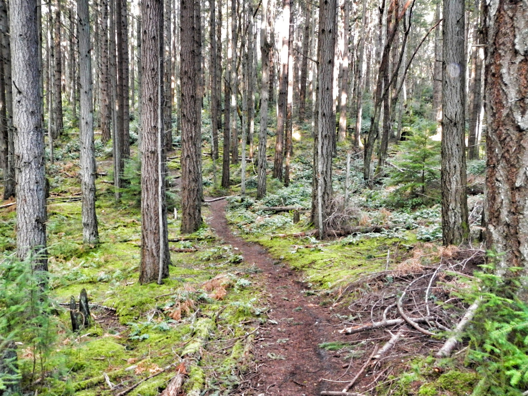 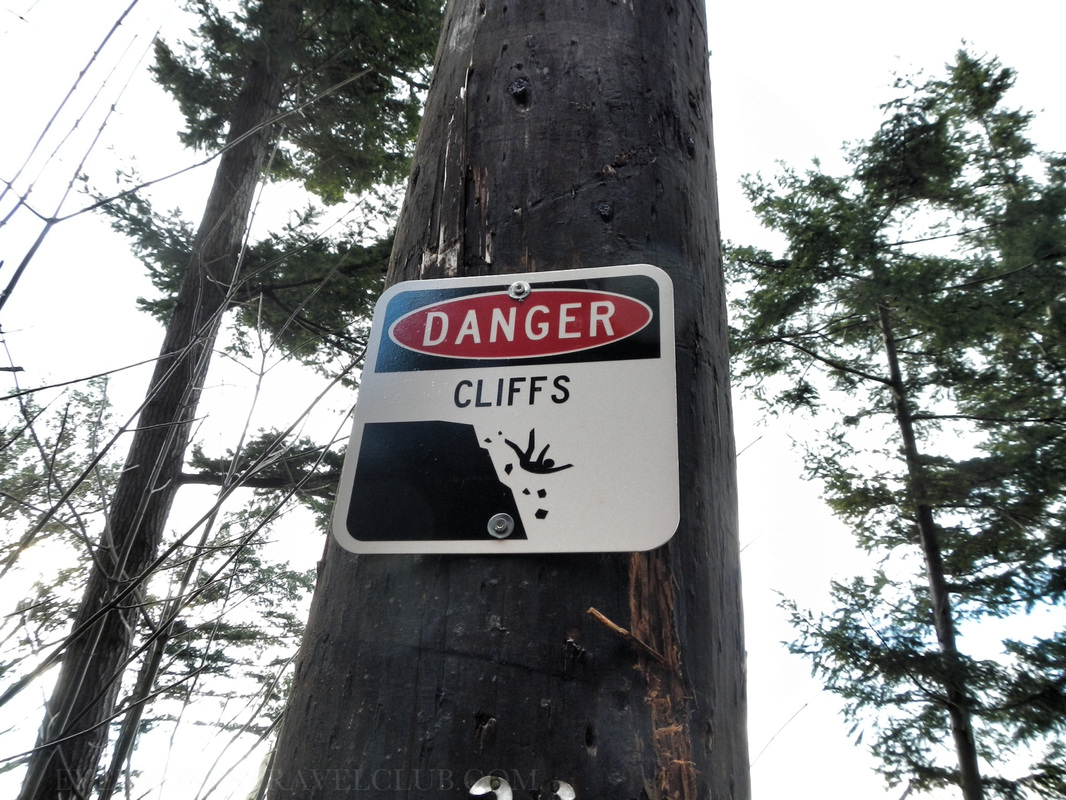 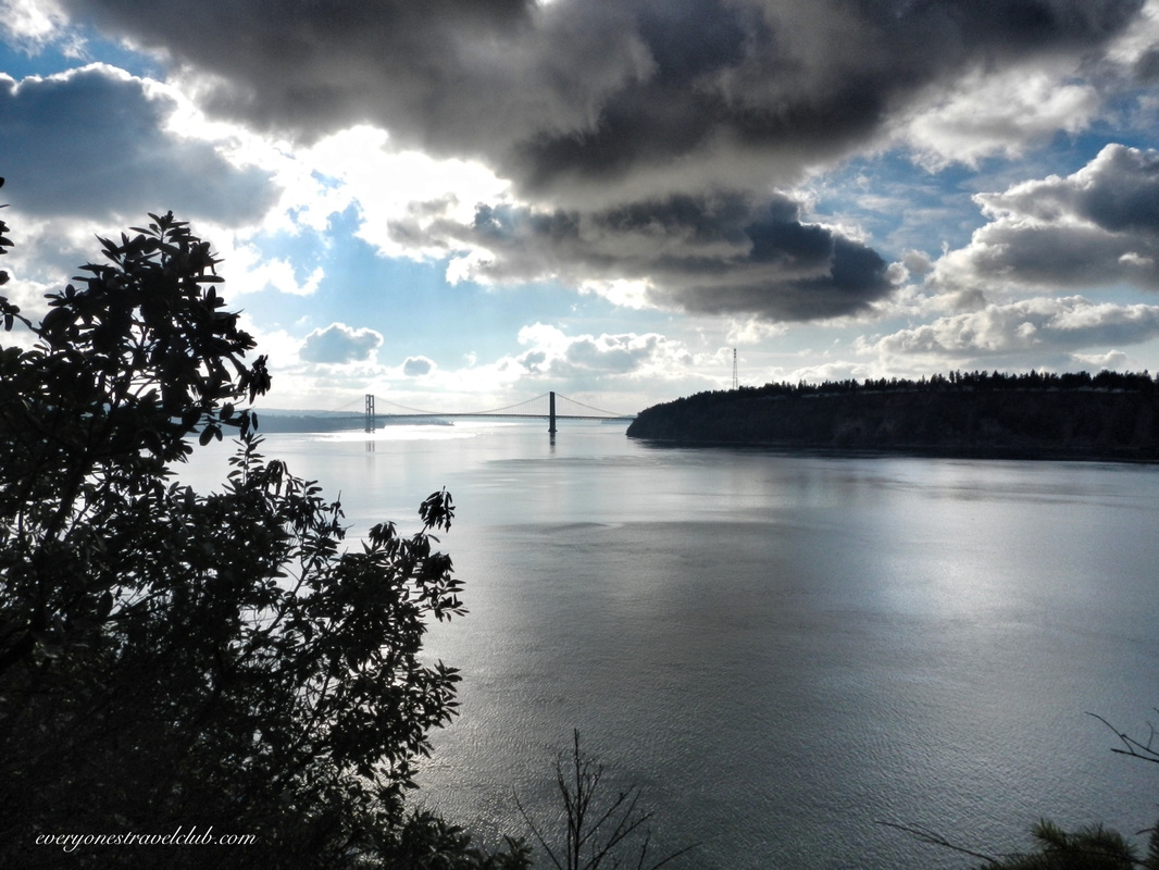
Pow. A sweet view of the Narrows from the edge of the park. The Tacoma Narrows bridge is in the distance (I think of this video every time I see it). There's also a tall power-line tower looking thingy to the right of the bridge…that's actually a tower with lines bringing electricity all the way from the Cushman Dam (Oh ya, I remember that place). 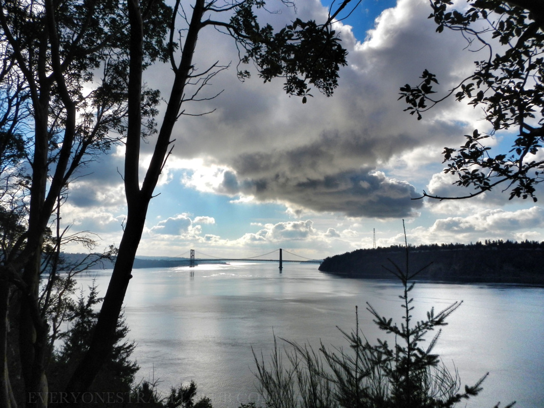
So, I think we've settled any uncertainty you might have about spending the day at Point Defiance Park. We did it without even showing you pics from the zoo, aquarium, & gardens. It's a cool place, check it out.
~Paul & Micah ETC 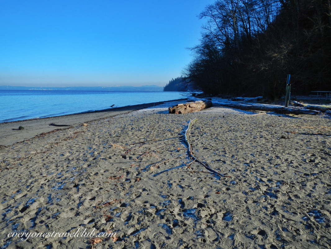
{Maybe}. Dash Point State Park might be a good place to camp on a multi-day paddle - it depends on your gear and how peaceful you want it. We visited the state park recently, not to be confused with Dash Point Park, located just south of this place (Dash Point Park has an L-shaped fishing pier…and is actually on Dash Point). The state park is on the Puget Sound, about 6 miles north of Tacoma and 20 miles south of Seattle, located in Federal Way. We visited in the winter and the place was empty. It's a pretty hilly park, heavily wooded, with a nice beach, lots of hiking trails, and a campground. A Discover Pass is required to park a vehicle. A cool thing about the park for folks in the South Sound - there is sand on the beach (instead of the usual NW rocks)! People actually swim here in the summer. Now, let's get this straight - I don't recommend swimming the usually-40-ish-degree Puget Sound. However, people swim here. A minor slope extends out a few thousand feet into the water here making it super shallow. When the sun warms the shallow water it must make it bearable to take the plunge…or NW people are a little kooky and will swim in any temperature of water (one of these statements is correct:). 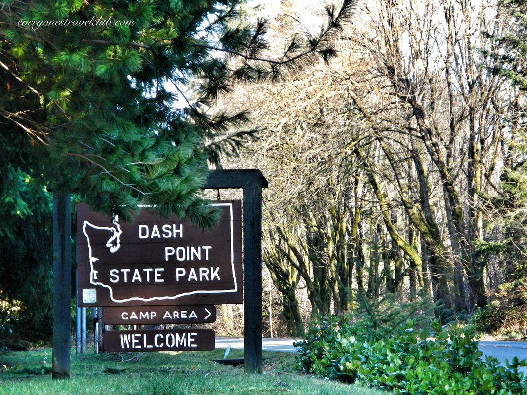 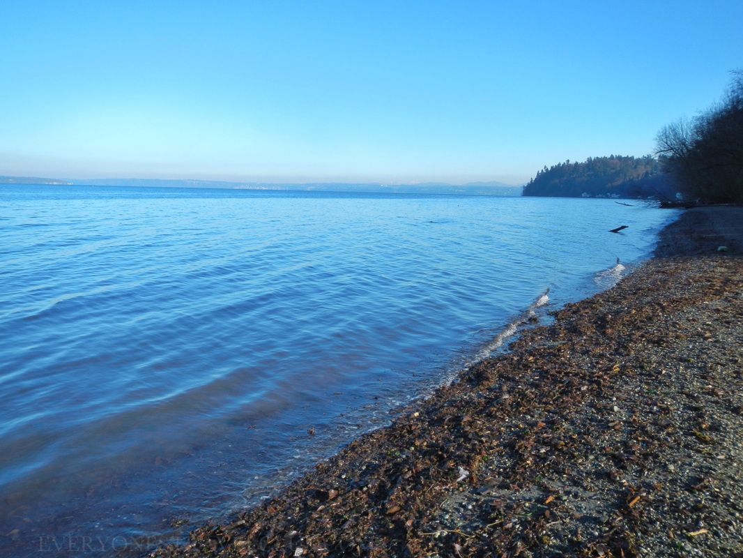 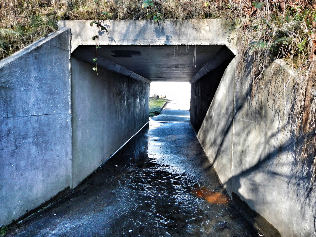 Alright, settle down people. Back to winter hiking and the possibility of one day kayak camping on an amazing paddle from Olympia to Seattle…or wherever your plans take you. From the online reviews of the park (which can or can't be trusted…I haven't decided), it seems like the state park can get pretty busy in the warmer months. The question is, will you want to deal with car-camper-party-folks after a long day of paddling? Probably not. With that said, they do have discounted water trail campsites available. It's nice to know it's here if you really needed it on a trek north or south. 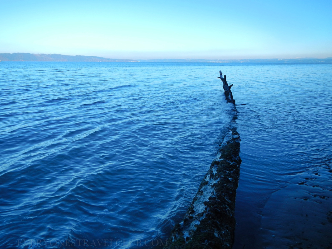
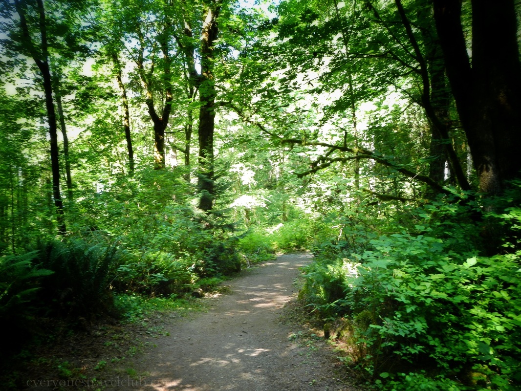
The hiking trails in the park connect to a somewhat larger network that seems pretty popular with mountain bikers. I would be careful hiking on the mountain bike trails - it's a collision waiting to happen! At low tide it is possible to walk down the beach to actual Dash Point and Dash Point Park/the fishing pier. A reason why it might-not be a OK place to camp on a multi-day paddle - the campground is a good distance from the water…and up a hill…only ok if you have a cart or an inflatable situation like us:) It really depends on your gear. 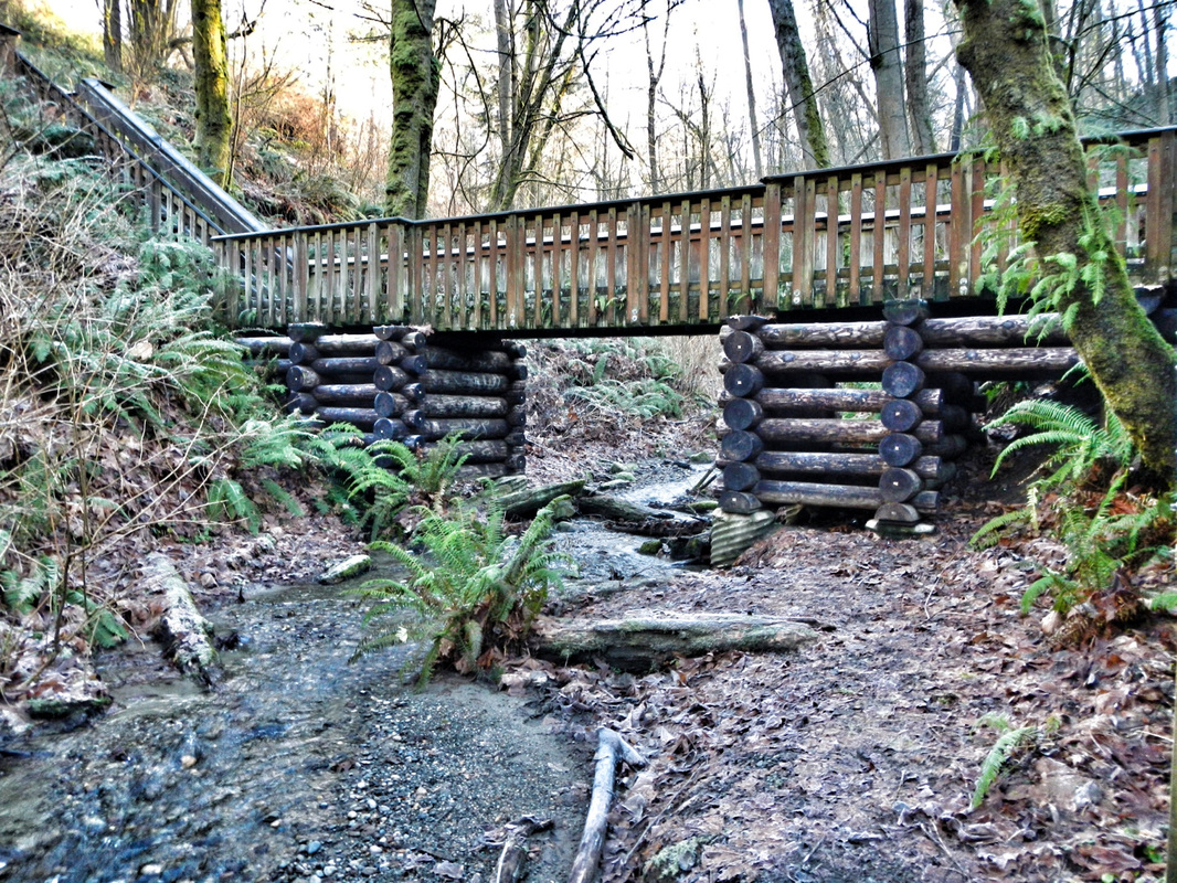 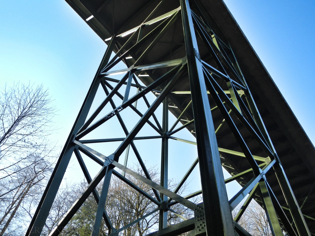 On our visit we walked from the state park parking lot to the beach (it was close). We then hiked all over the place, including hiking out of the park on other trails that put us in a nice residential area (neighborhood pics below) and up what is apparently called "Heart Attack Hill". P.S. Our wives always get mad when we hike on trails without mapping it out first and then end up in residential areas…it has surprisingly happened quite a few times…but who's counting? We left King county and entered it again, went off trail for a few minutes (our wives usually hate this too) and finally got back to where we started. It was nice to get out in the winter. The actual state park has around 11 miles of hiking trails and is just under 400 acres in size. So, Dash Point State Park is great for hiking and swimming, OK for camping, but you'd probably want to scope it out for kayak camping before you include it in you plans. They do take reservations in the summer months which is nice. There's a few links below to get you started, enjoy! ~Paul, Micah, John ETC Camping info from the state park website here. Map of the park and campground here. General info about the park (for camping) from www.stateparks.com A nice little article about the park from NW Tripfinder. 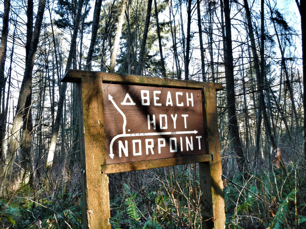 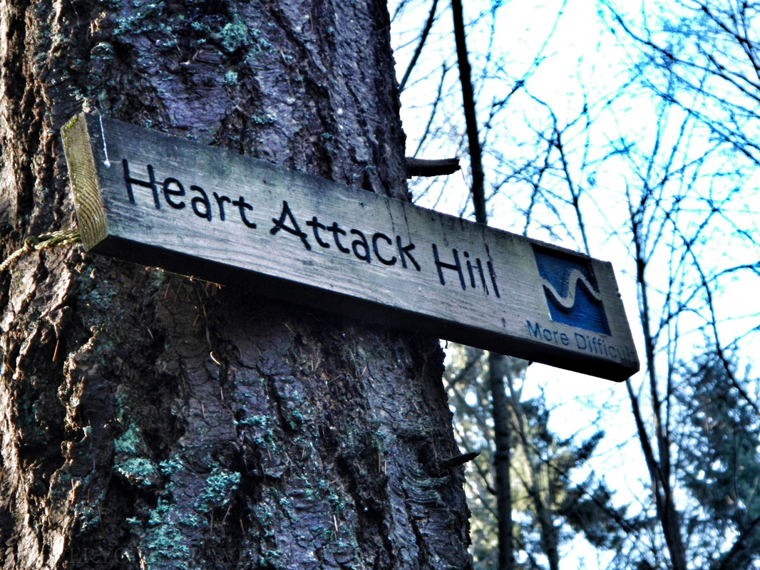 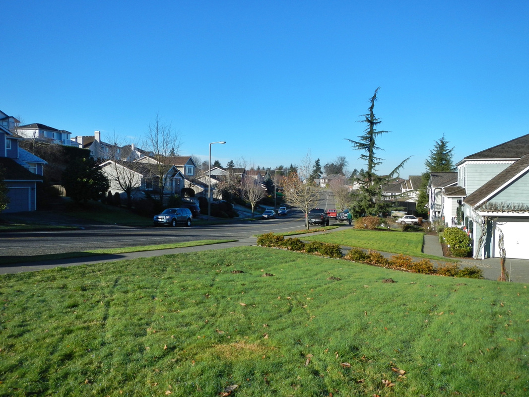 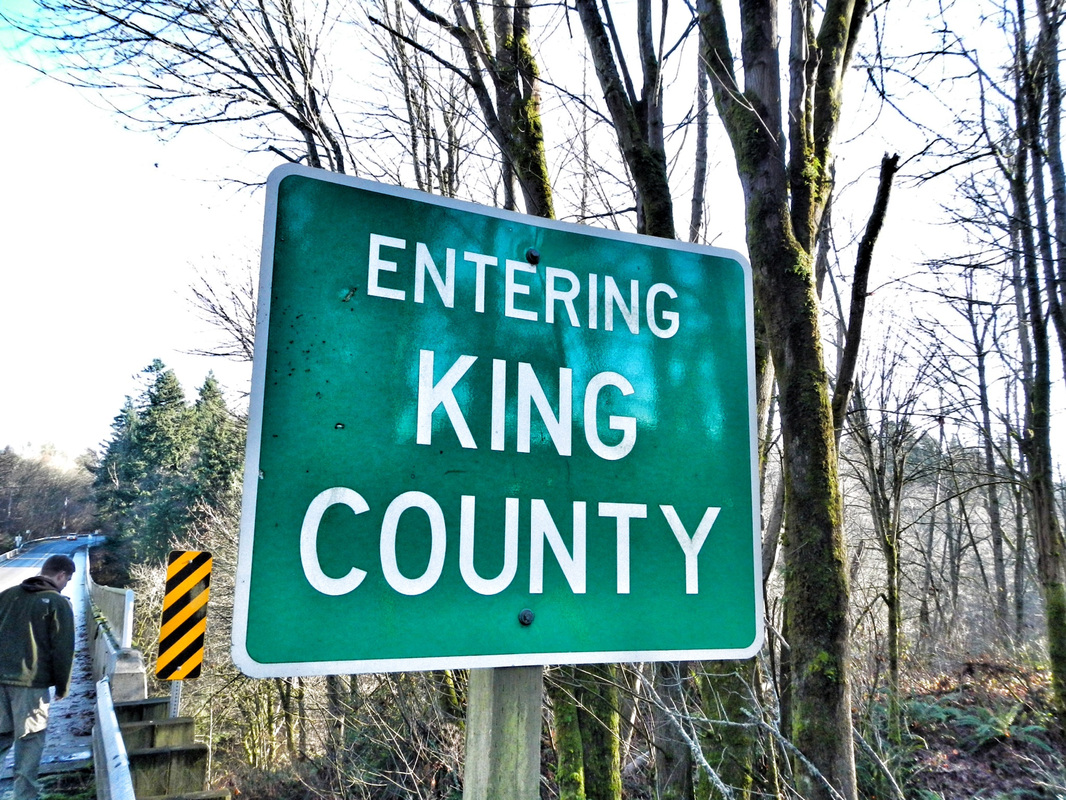 |
Follow us on Twitter and receive updates when we post (click the birdie).
 Archives
March 2014
|


 RSS Feed

|
Connect:Contact: |
everyonestravelclub@gmail.com |