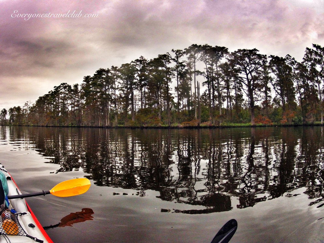
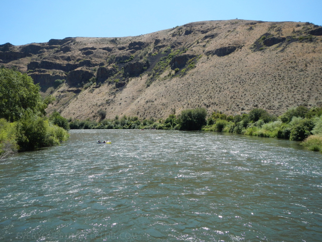
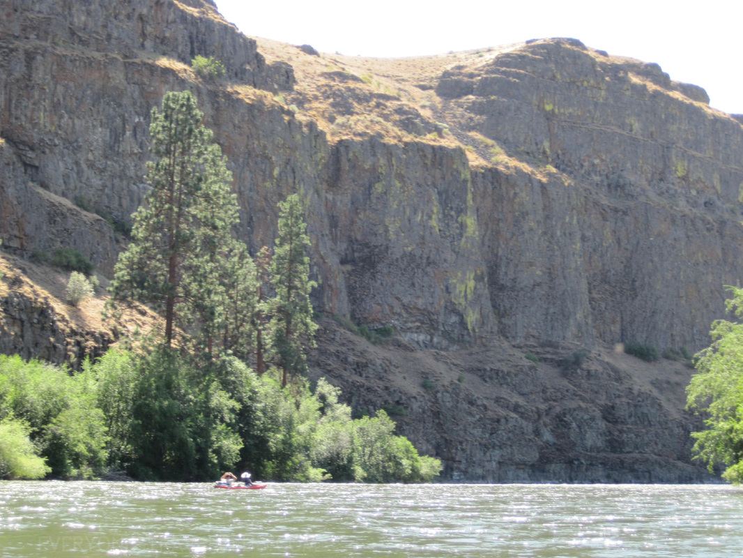
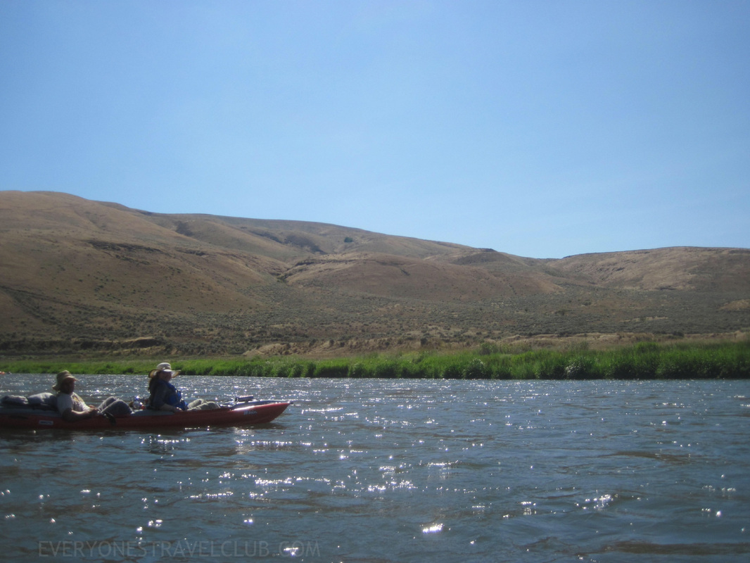
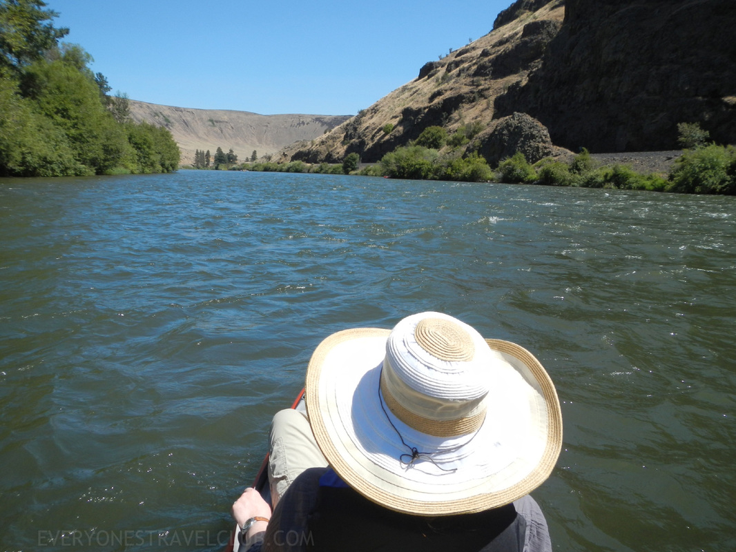
 I took a quick trip to North Carolina back in September - with my kayak in the carry-on of course - and with only a few days to explore. If you haven't been to North Carolina, I like to think of it as a combination of Missouri (where I'm originally from) and Florida (where my wife's from). Woods, beaches, country-folk, a few big cities, farms, and most importantly, lots of paddle-able water. Captain wifey's family lives near the town of New Bern. It's located at the end of the Neuse River, right where the river meets up with the Trent River and they both empty into the Pamlico Sound (which eventually leads to the Atlantic ocean). New Bern's a charming little town - we actually got married here - call it a truce between the Midwest & South Florida. 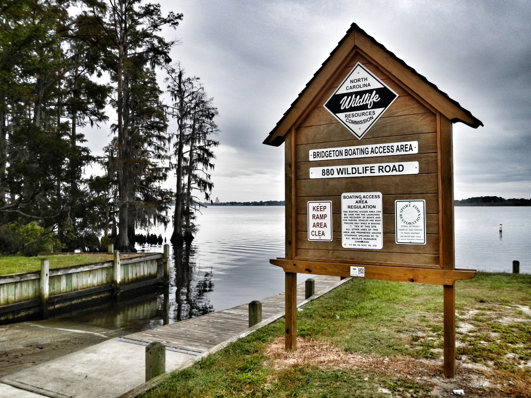 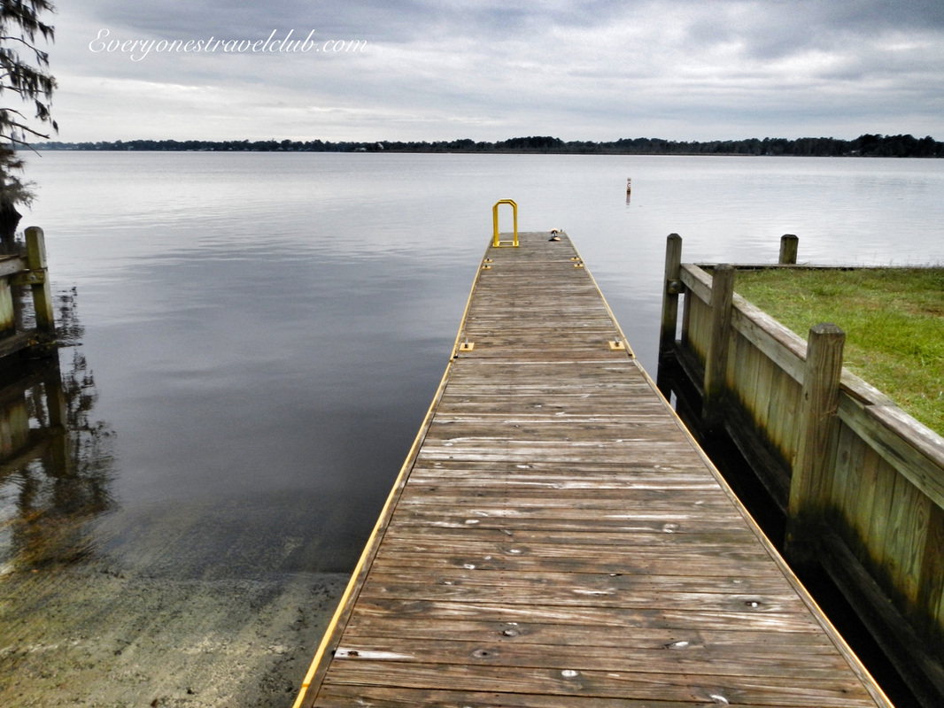 Our first order of business was to get our kayak in the water. We launched on the very end of the Neuse River from the Bridgeton Boating Area ramp on wildlife road - across the water from New Bern and just off US highway 17. It has a well-maintained dock/boat ramp/parking-lot. The dock was a little high (as usual) for launching a kayak, but we made it work (as usual). The river here was slow moving if moving at all - we paddled up and downriver against no noticeable current. 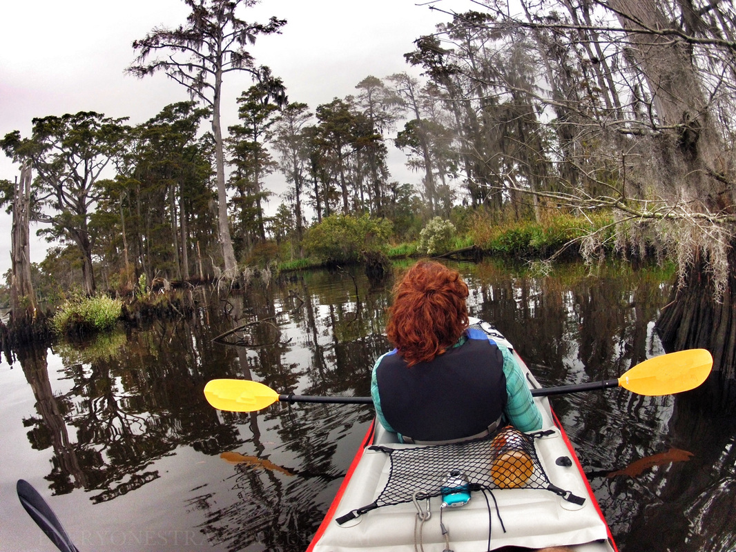 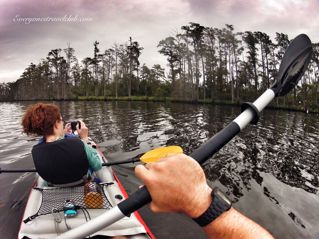 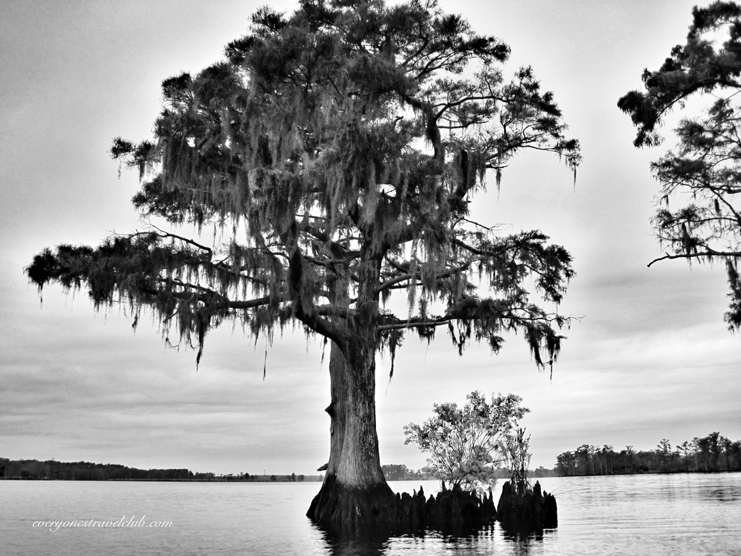 It's been awhile since I paddled on the East Coast. In photographer language this means I took way too many pictures. Every stick in the mud looks gorgeous. The textures are so different from my usual paddles here in the Northwest…I tried my best not to take too many pictures but failed…I got home with lots of pictures of sticks & mud (many I deleted). 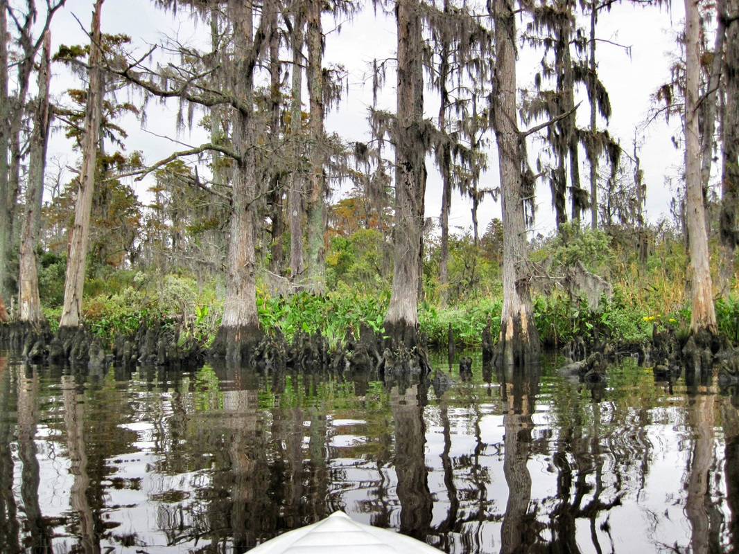 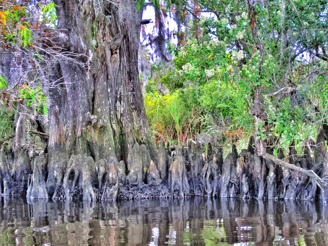   That's a cranky. In the tree, We saw plenty of crankies and a few bald eagles on our paddle - which we are super used to seeing in the NW - "Oh look honey, another bald eagle". We also had a very interesting fish jumping sequence where we were surrounded by a large school of decent size fish, all jumping out of the water at the same time for some reason (expect to see video soon on our video page).   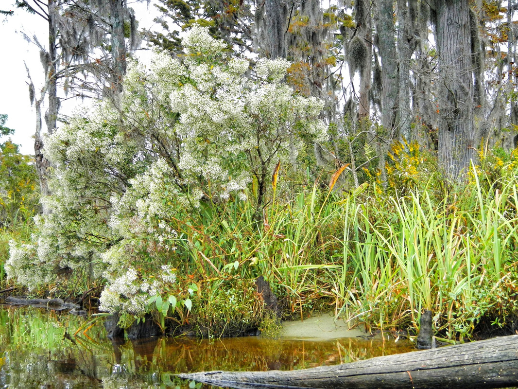 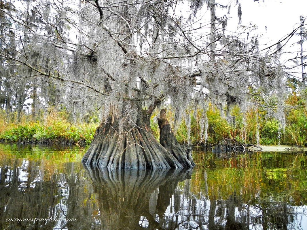 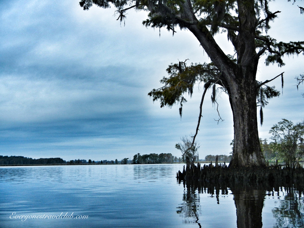 All & all, a nice little paddle on the amazing Neuse river. A little research revels that the Neuse is the longest river that is entirely in the state of North Carolina. It was once inhabited by (and named after) a Native American tribe called the Neusiok. Many other tribes once lived in this area of North Carolina too, including the Secotan, Weapomeoc, Coree, & the Tuscarora. The river begins North of Raleigh, near Falls Lake. It is about 275 miles long (with about 200 paddle-able miles below the lake and out to the Pamlico Sound), with the widest parts near the end at New Bern. The river has seen better days as far as water quality goes - it turns out that factories and farms dumping who knows what into the river over the years is complicating things. Be sure to check out what the Neuse Riverkeeper Foundation is doing to help protect this American waterway. 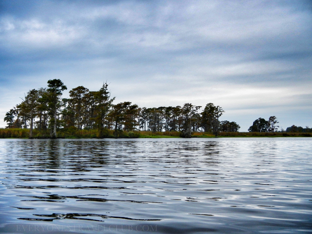 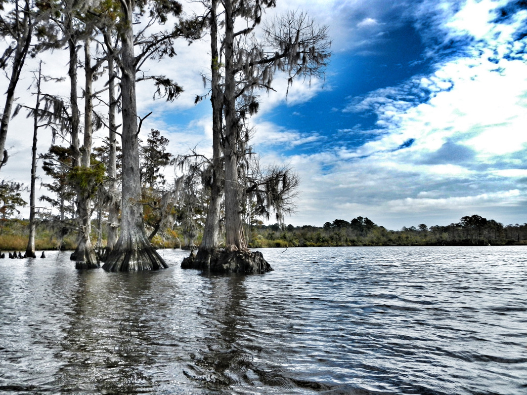 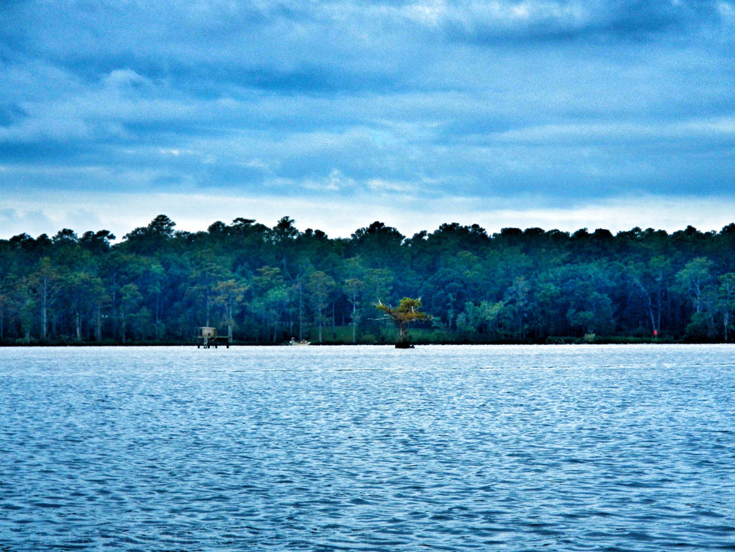 So, now it's time to pop the big question…not that question - remember, wifey and I already tied-the-knot here in New Bern a few years ago! Is there a longer Neuse River paddle in our future? Maybe all 200 miles? We hope so. Until then I will paddle vicariously through the many links I have provided below… ~Paul, Amber, Anna ETC For more info, check these please…do it. 1. A great video from Source to Sea, a retired? blogger who paddled the whole thing - it took him 9 days! 2. Sierra Club Trails post with info about Neuse River put-ins. 3. An informative (yet dated) brochure on Neuse River Recreation Area campground. 4. An interactive user-created Google Neuse River paddle map…this thing is sweet. 5. Another paddle map used by the paddler from #1 on this list. 6. The Neuse River section from the Source to Sea website. 7. Boating in North Carolina official stuff. 8. Neuse Riverkeeper Foundation 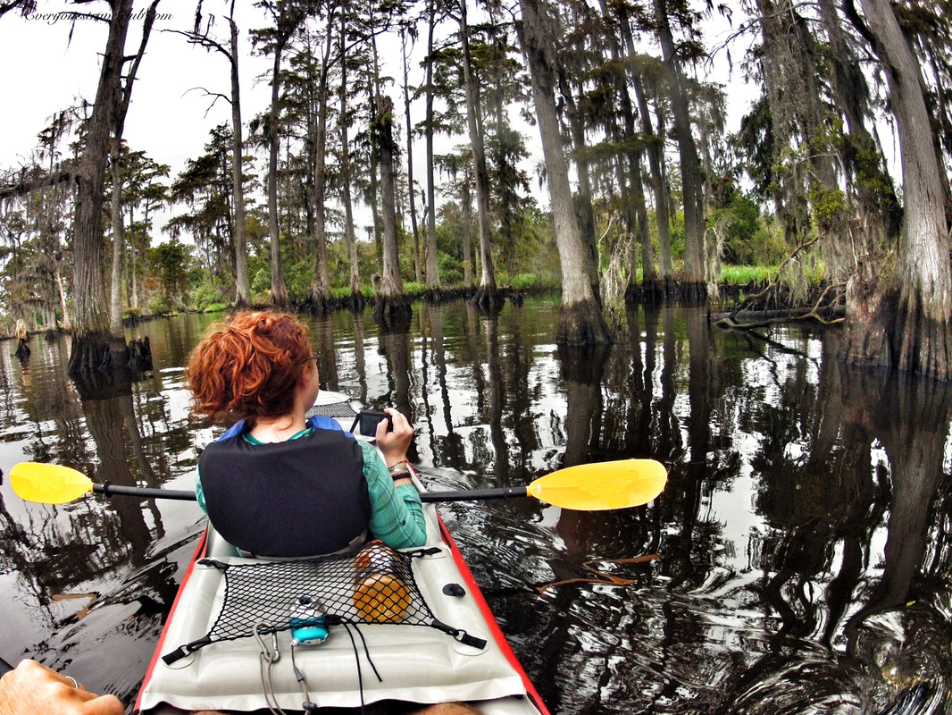 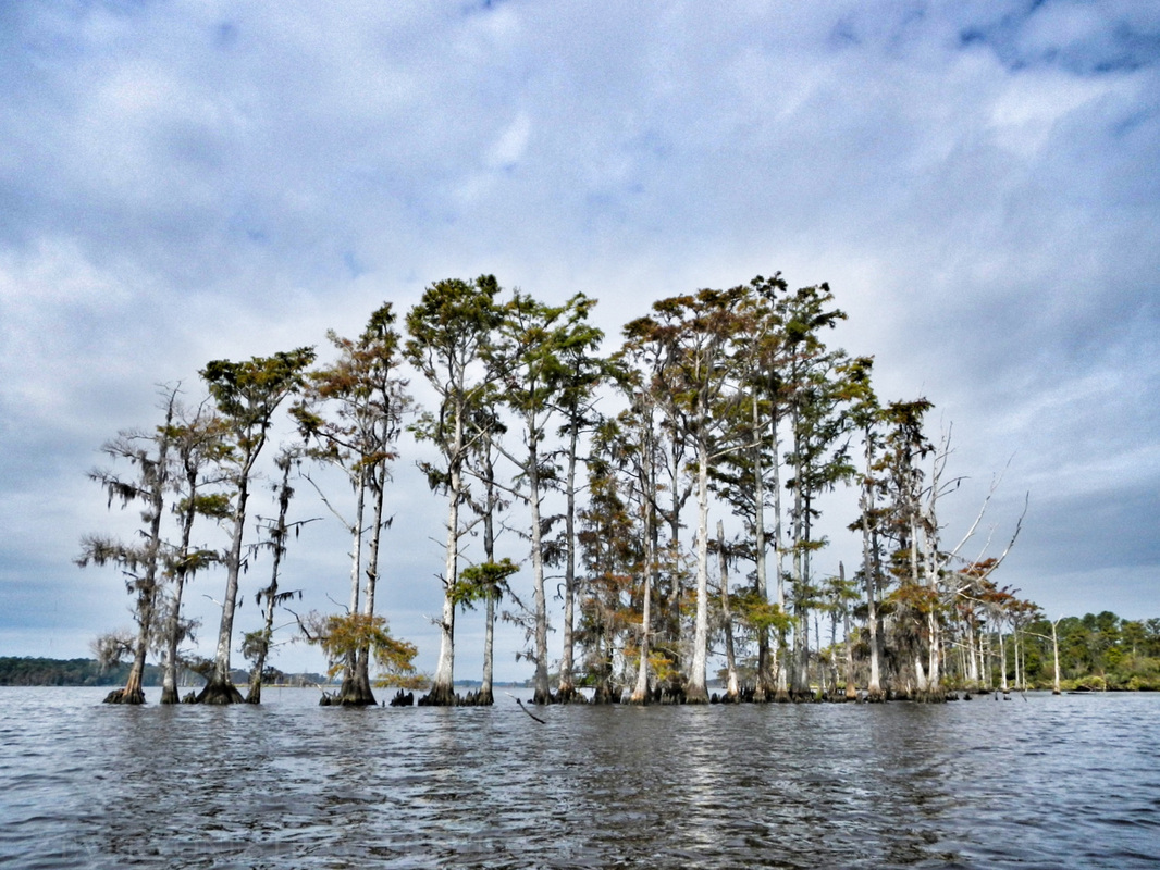 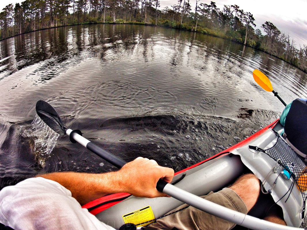 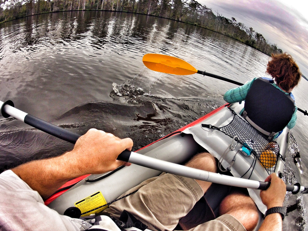 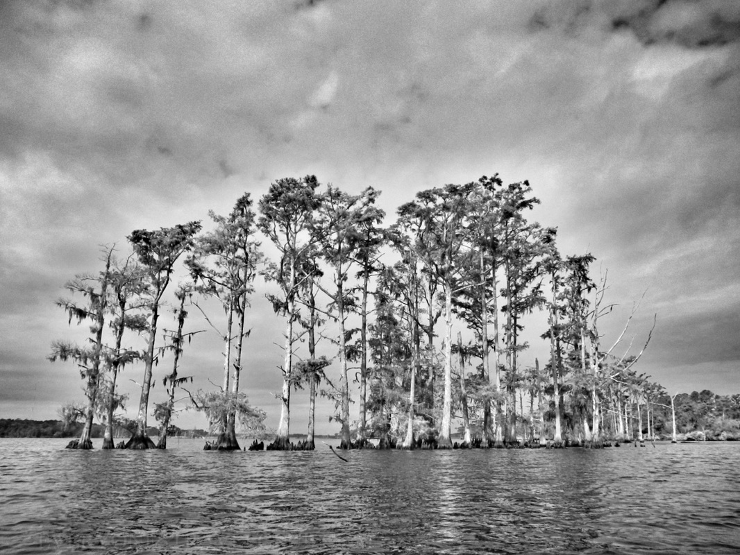
1 Comment
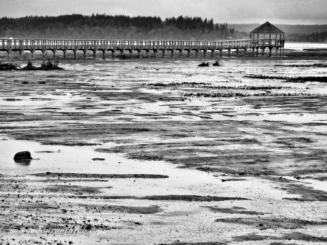 Lately we've been exploring some of the many parks scattered along the coast of Washington's Puget Sound. We like to visit them in the offseason (it's winter around here), mainly because they're usually free of crowds & traffic. It also helps us out for the upcoming summer - we know where to go, where to park, where to launch a kayak. Also, when I can, I like to see future paddle trips from the land first, it's helps orient things when I'm on the water. When we get home from a day out, I eventually download all of the pictures from the adventure, delete the blurry ones, edit, delete, import, export, move to this app, move to that one, upload, and download. Once I have the pictures organized in article format, I start researching where we've been. That's right. With most park visits: I research after we get home. Now, not all trips are like this - paddling & sailing trips are way different. We check the tides, check the currents, check the weather, check all kinds of stuff. With park visits it's sometimes nice going in ready to hike, ready to learn, ready to take pictures, ready to get lost, but not exactly knowing what's going on. 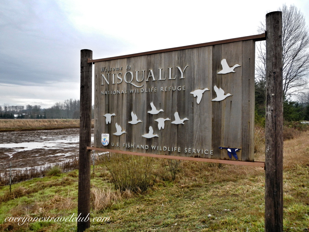 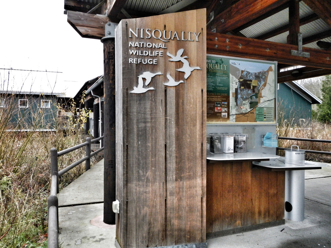 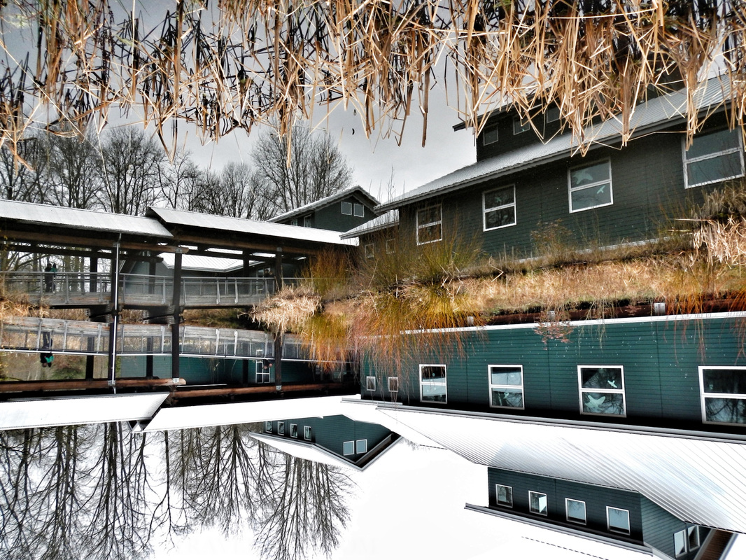 With this in mind we set out for the Nisqually National Wildlife Refuge. Located just off I-5 between Tacoma and Olympia Washington, the refuge is a protected estuary formed by the freshwater of the Nisqually River & McAlister Creek emptying out and meeting the saltwater of the Puget Sound. The Nisqually Delta is biologically diverse - animals all over the place - and is heavily influenced by the tide. I could tell this from the map - the refuge is a giant green spot. From paddling the Skagit & Stillaguamish river deltas I could kinda imagine what it would be like. You can see the refuge in the map below. Just follow the signs off of I-5 to get there, the 'A' on this map is a boat ramp (discover pass required), adjacent to the reserve, suitable for launching a kayak and paddling up McAlister Creek (most of the actual refuge is off limits to boats). 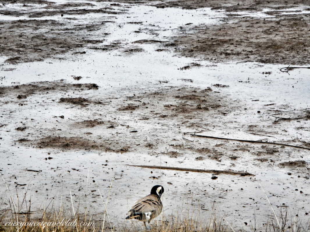 When you arrive at the refuge there is a $3 parking fee and lots of spots (I'm sure it gets crowded on the weekends in the summer). There is a nice visitor center & restrooms. There are a few trail choices - about the most you can go is the 4 mile roundtrip boardwalk trail, it's sort of an out and back. Since the tide is in and out a couple times per day, the Washington Fish & Wildlife department worked to build the boardwalk that takes you out to the far reaches of the refuge. Informational boards are around to give you an idea of what exactly is going on with the thousands of migrating birds, various mammals, amphibians, and reptiles that live and/or frequent the area. 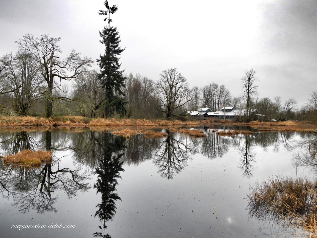 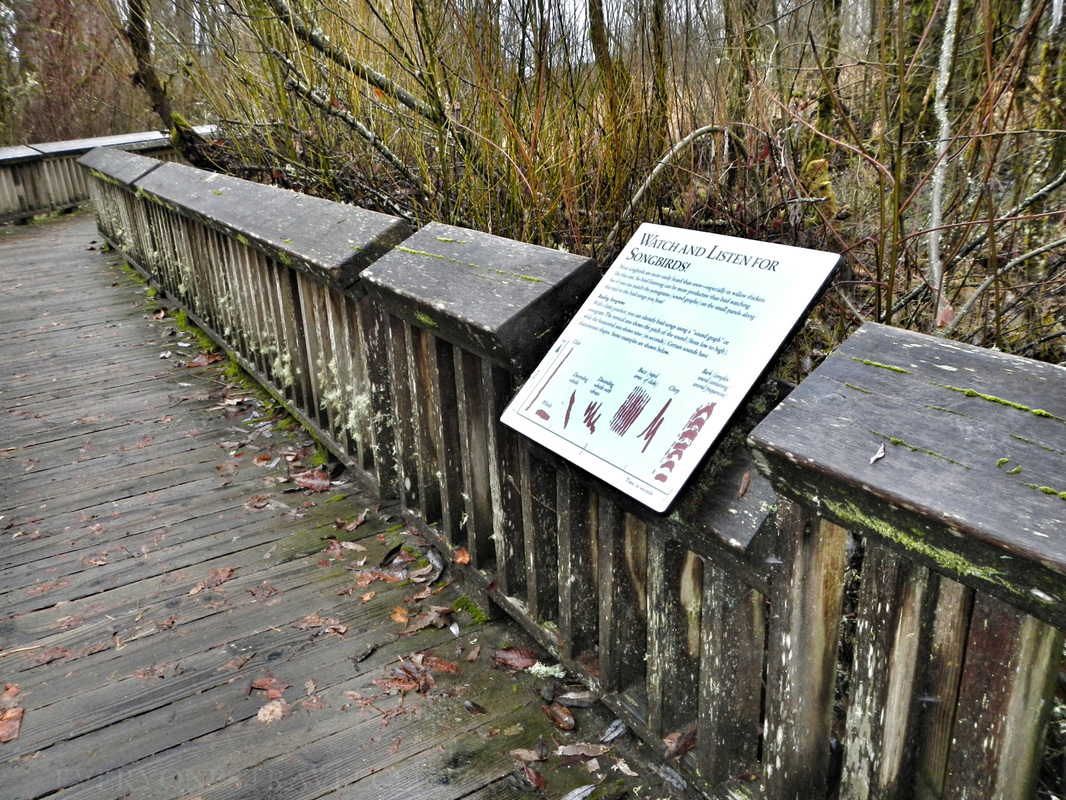 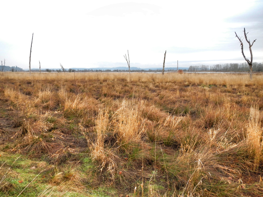 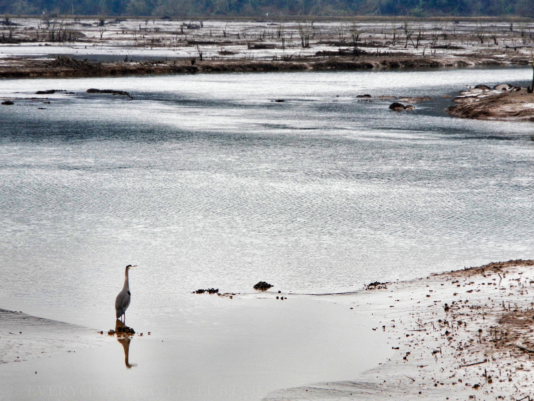 From a paddlers point of view, most of the area is off limits to boats (that includes kayaks). The picture below of a couple canoeing is from McAlister Creek - located adjacent to the refuge. A nearby boat ramp gives great access to the creek. Personally, I'd wait until waterfowl hunting season is over to paddle around here just to be safe…or at least wear some orange? The season in WA usually happens October-ish to February-ish. Here's a link with more info. 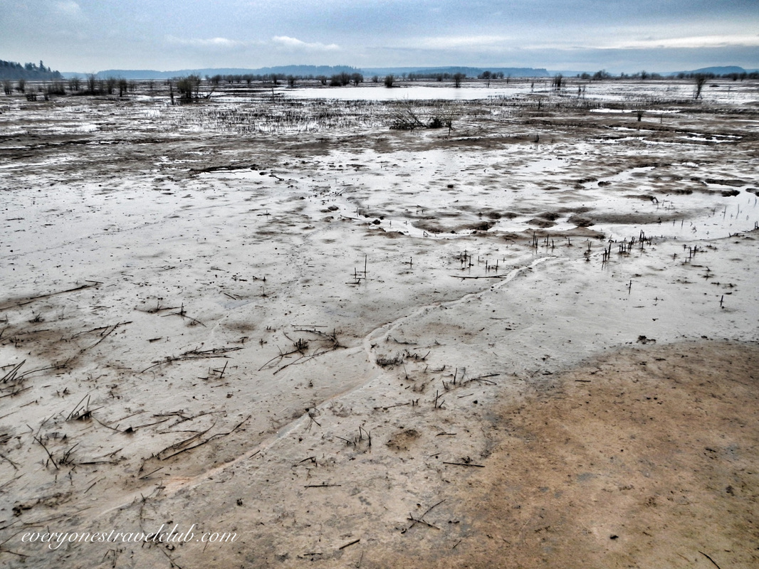 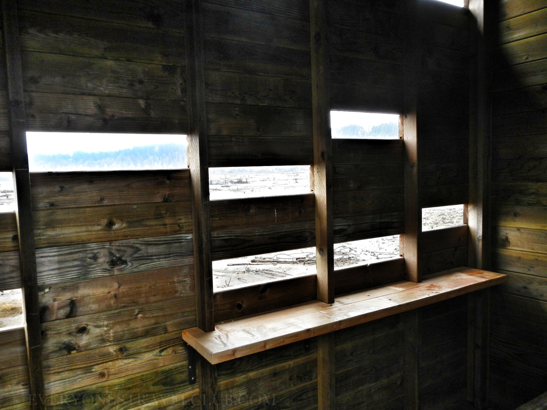 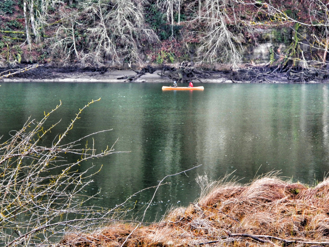 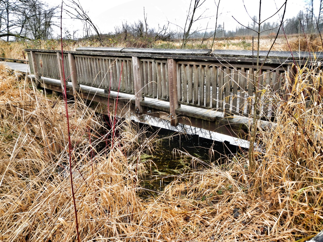    That about covers the facts, what did I uncover post-visit about the history of the place? Well, let's start out with a shout-out to the Nisqually Tribe who have lived & fished salmon on the Nisqually River for…wait for it…thousands of years. (the river starts miles away on the south side of Mt. Rainier, otherwise known as Volcano Rainier). Just step back and think about that for a minute. Thousands of years. Enter the white man in the mid 18oos and a treaty that was eventually signed between them and the Nisqually tribe. Actually, we are pretty sure that Chief Leschi (Leschi neighborhood of Seattle anyone?) of the Nisqually didn't, or at least didn't want to, sign this treaty - called the Medicine Creek Treaty (P.S. Medicine Creek is now called McAlister Creek - the one in the picture above with the canoeing couple). At any rate, the tribe was relocated and the white man obviously settled. There's also now a military base on part of the tribal land. I think we can, if anything, at least know and respect this history while playing/walking/taking pictures/kayaking/hunting on the Nisqually.  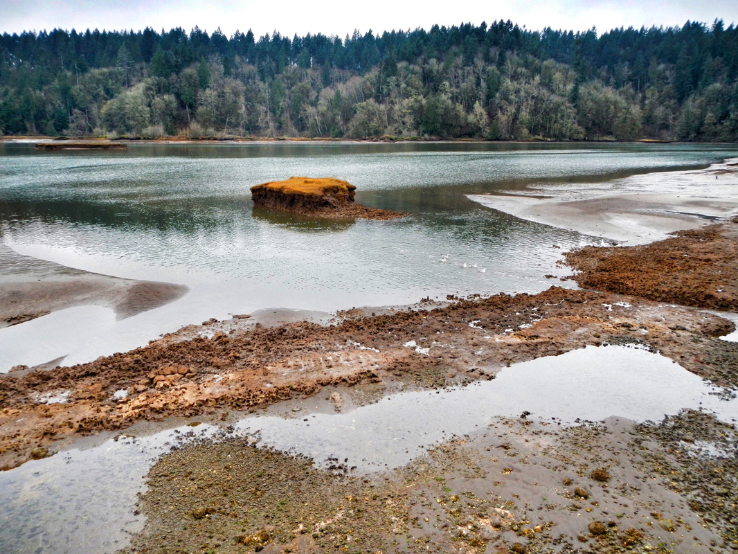 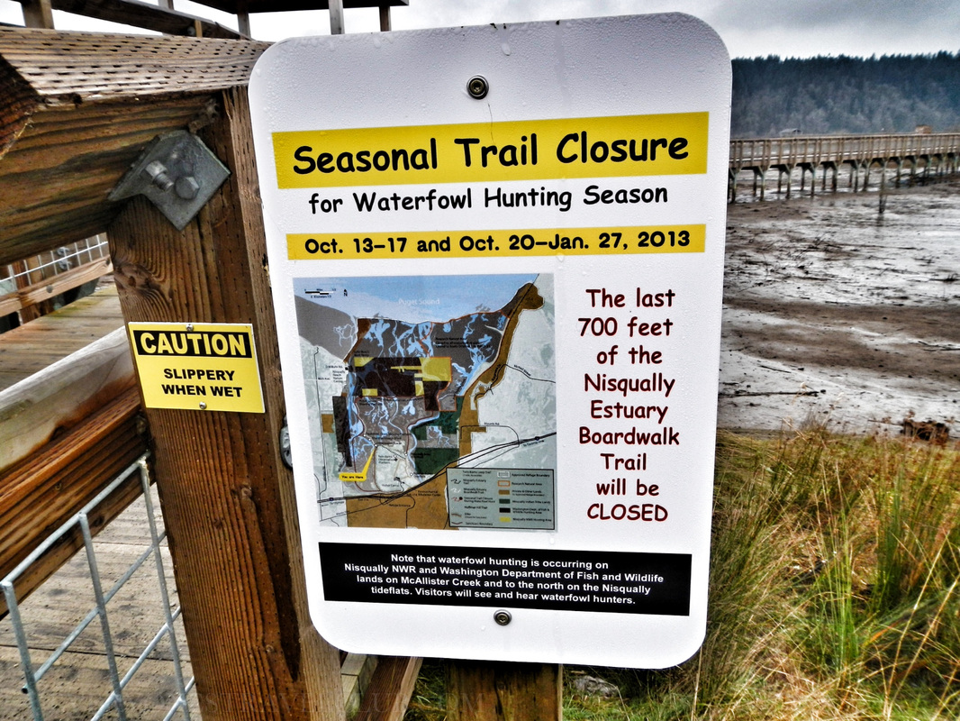 That's a wrap! We highly recommend checking out the Nisqually National Wildlife Refuge. Take a lunch - there are plenty of tables for a break. Take a zoom lens for your camera & binoculars too. Word on the creek is there are snowy owls there right now! Check the tides before you go if you want to see the mudflats (mudflats sometimes = better birding). If you want to kayak near the reserve, use the boat ramp adjacent to the park (the map at the beginning of this post). When you're there, imagine the thousands of years that people have lived on this delta & river…amazing stuff. Oh ya, if you see one, don't kiss the poisonous newts. ~Paul & Amber ETC 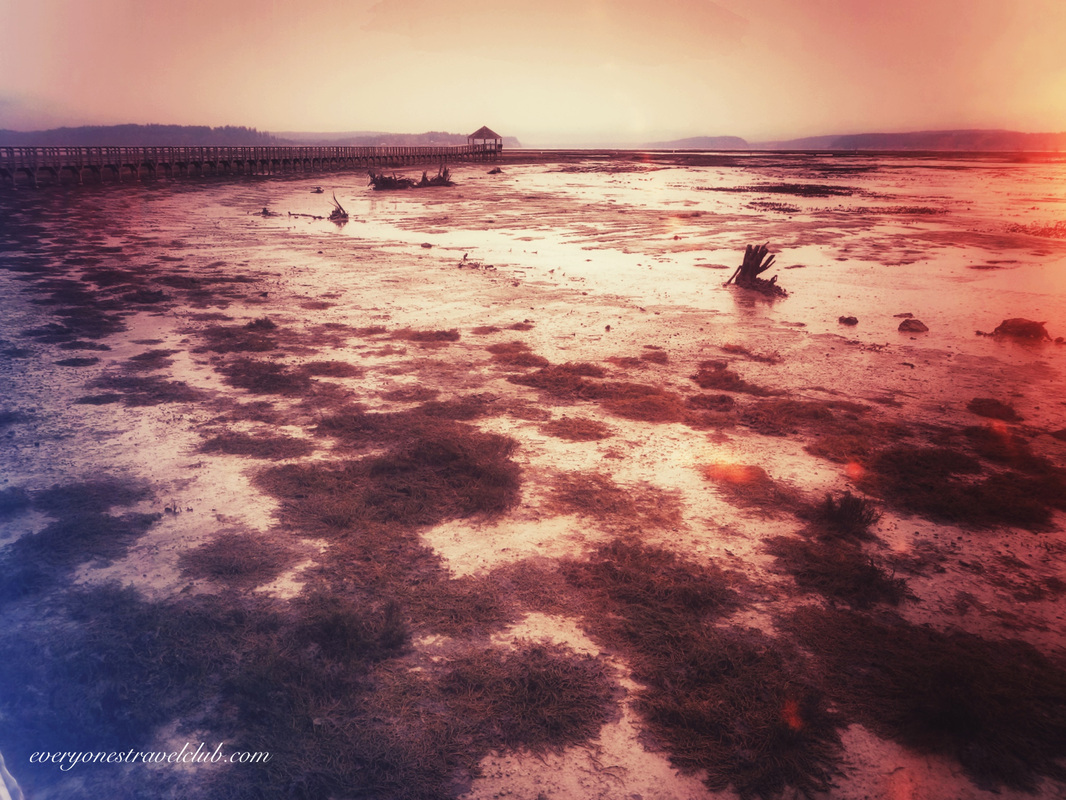 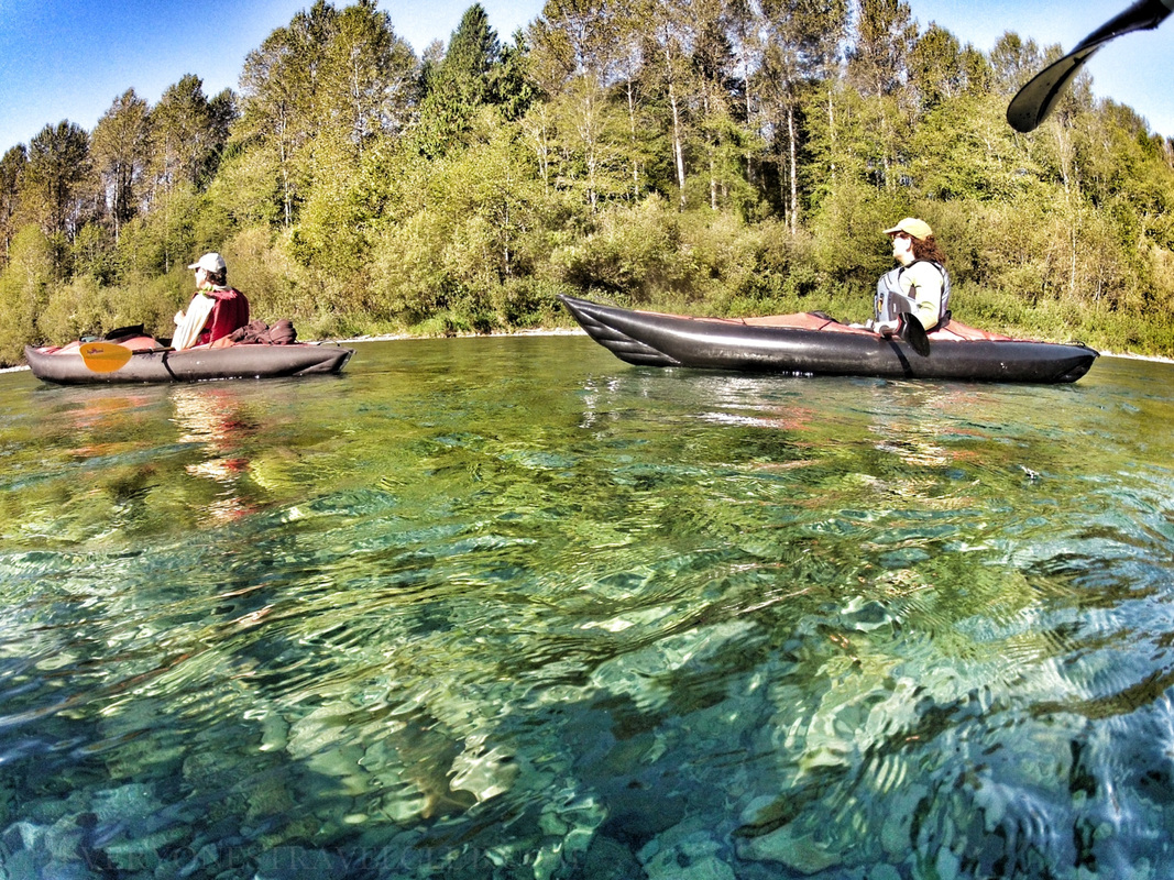
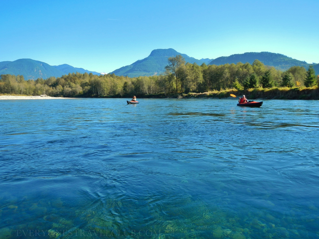
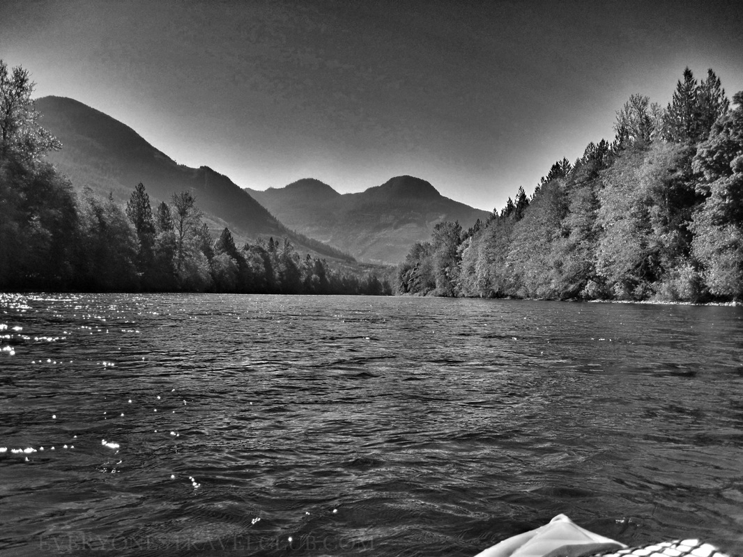
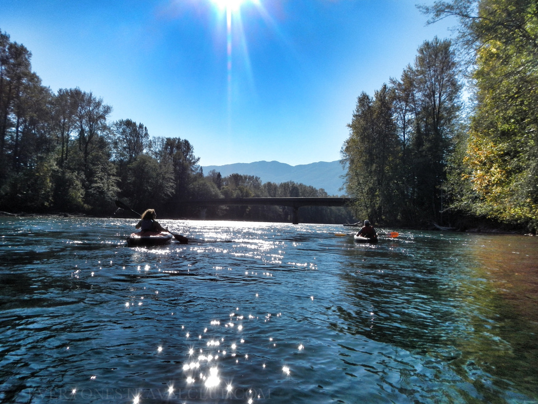
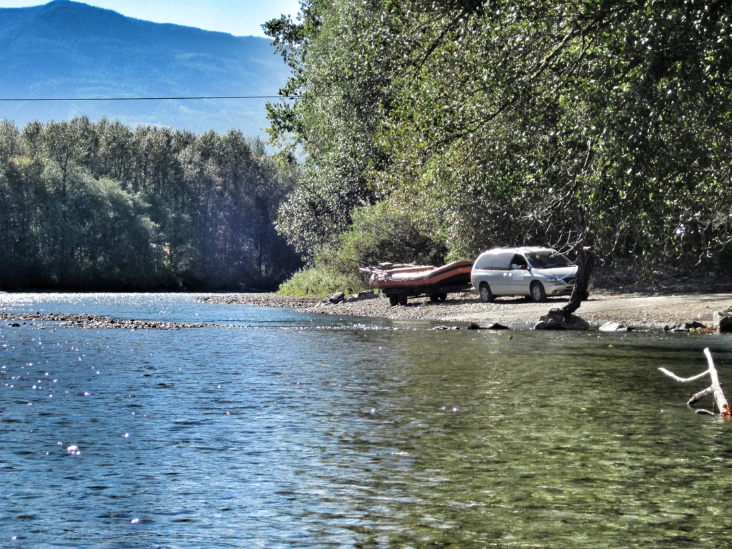
On what seemed to be the last sunny day of the year here in the Pacific Northwest, ETC took to the mountains and paddled a gorgeous stretch of the Skagit River - from Marblemount to Rockport. This stretch of river is well known in the area for it's high concentration of wintering bald eagles and plentiful salmon & trout. Beautiful Fall colors, mountain vistas, clear greenish/blue water, and abundant wildlife makes for quite an adventure - it all starts by taking two cars up SR 20 (the North Cascades highway) toward the Ross Lake National Recreation Area. Leaving the smaller car downstream in the free parking area at Howard Miller Steelhead Park in Rockport WA (map above) lets you pack your people & gear in the larger one and travel upstream to the put-in at Marblemount (link to Marblemount map/info). There's a few historical landmarks at Steelhead Park to check out (pic below), along with a quaint riverside RV park and some small rentable cabins. 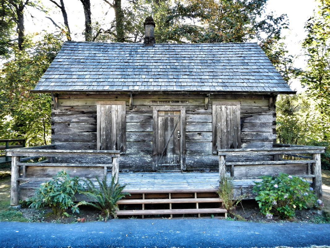
Sadly you can't rent this cabin - it's historic
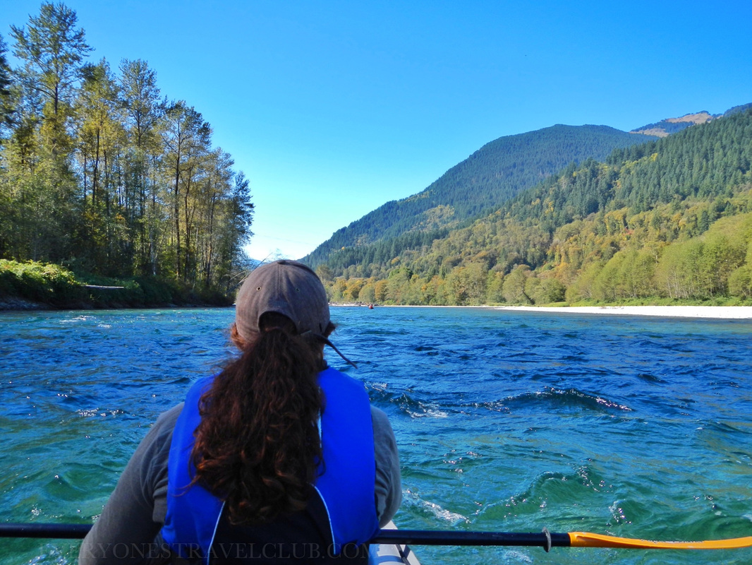
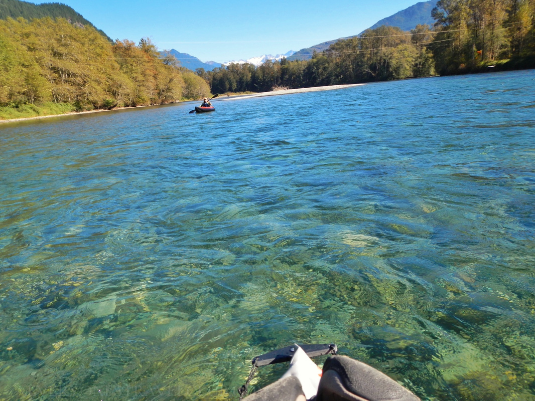
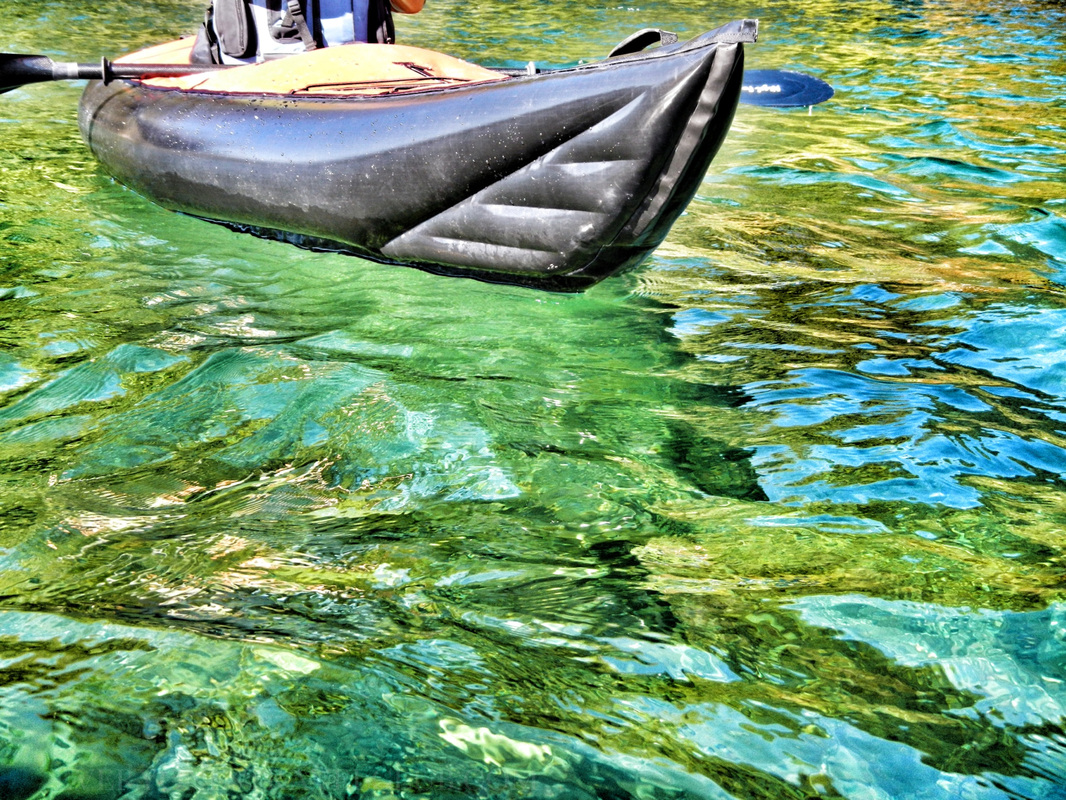
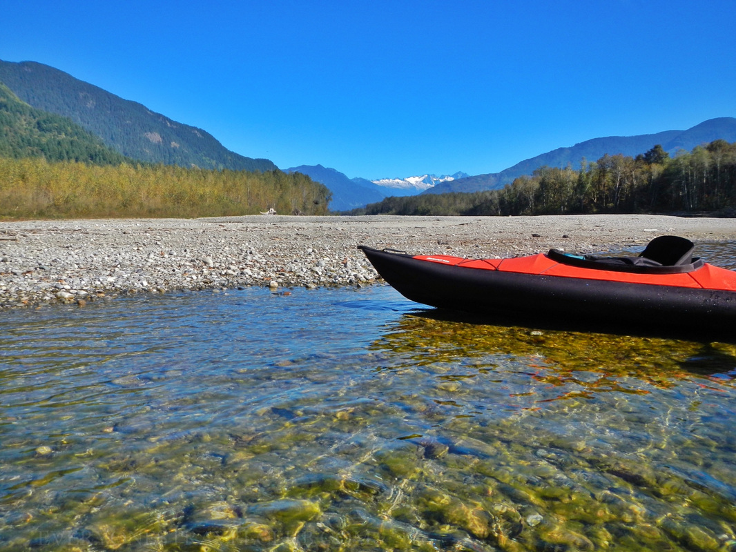
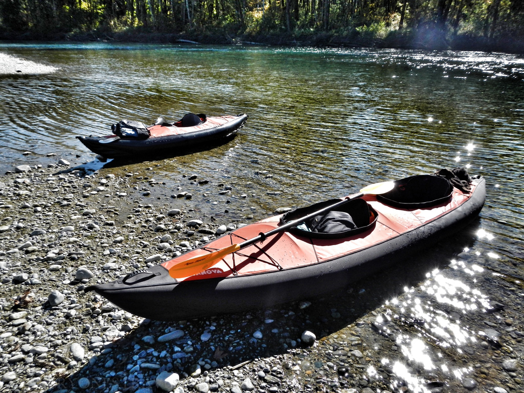
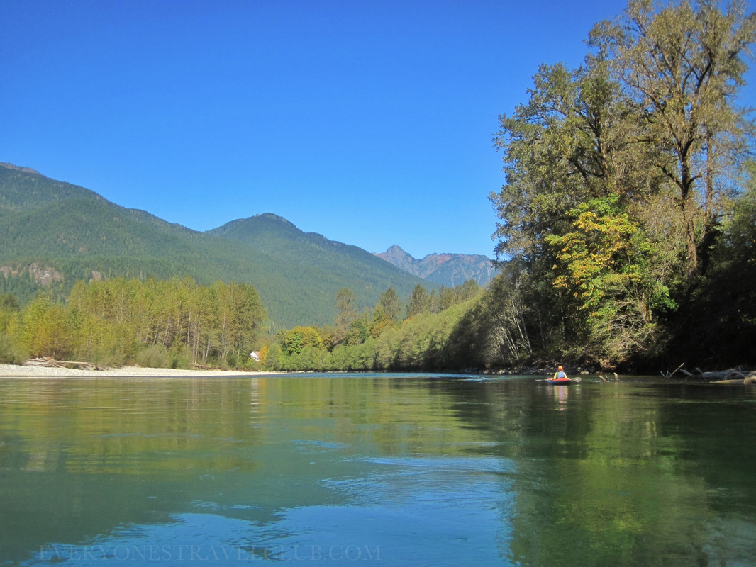
Taking the other car to the put-in at Marblemount is a breeze. The road follows the river and you're there in minutes. The launch site is just off SR 20 in Marblemount - veer onto Cascade River Road to cross the river. Look for the boat launch sign pictured below. Don't worry about parking, there is lots of it and even some national forest-type bathrooms for any pre-departure needs.  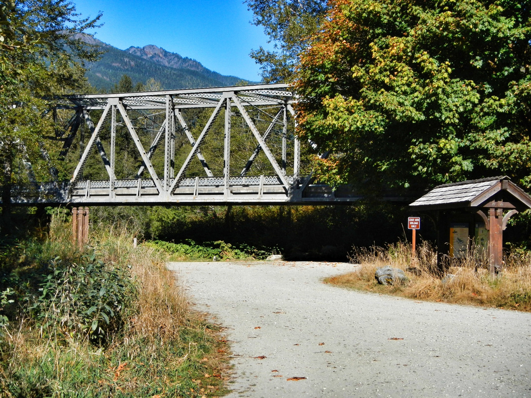 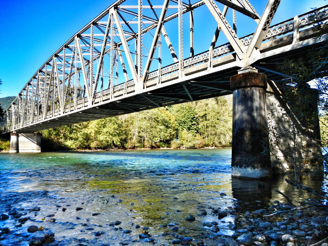 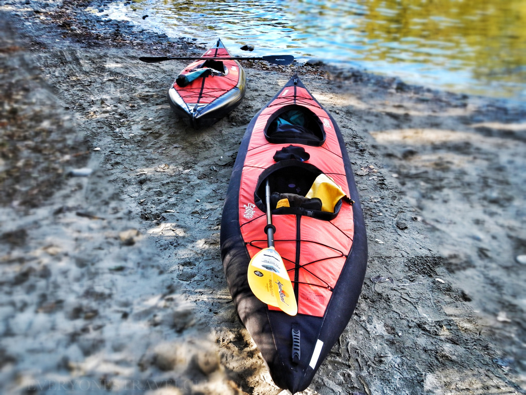 We were able to pack all of our people & gear into the second car because of these little babies. We paddled Innova inflatable kayaks - a Helios II & the new Swing I & Swing II. The covered decks of the Swings worked great for this trip - this part of the Skagit is class 1+/ 2 ish - a.k.a. an occasional splash of icy-cold water comes into the boat. The whitewater that came into my Helios got me wet and I had to pump out occasionally to avoid an icy cold seat all day. The Swings? Well, the water just runs right off of the covered decks. Overall, all of the boats performed great and even though it was shallow a lot of the way, I still advise using a optional skeg or rudder to help with tracking if you've got one. The Helios II had the leg up here because the optional Helios rudder is on a hinge and comes up out of the water when the going gets shallow & rocky. 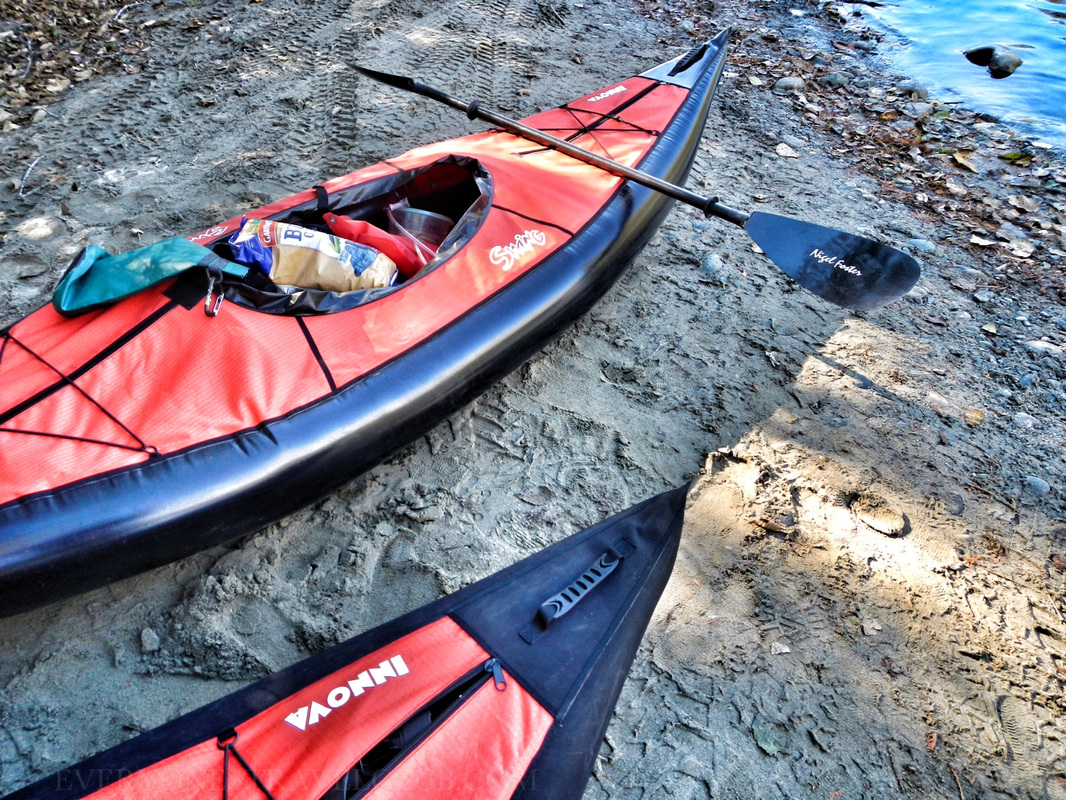 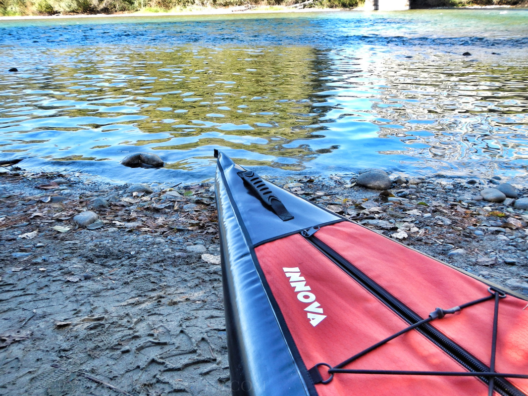  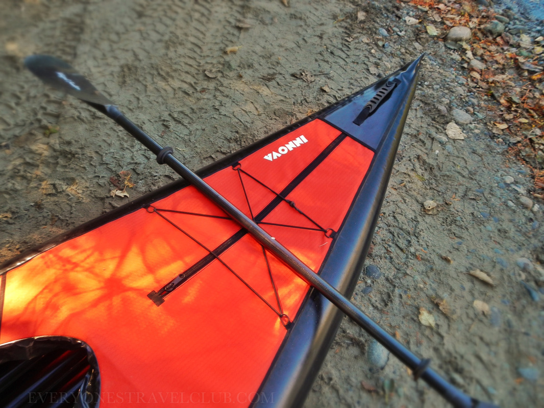  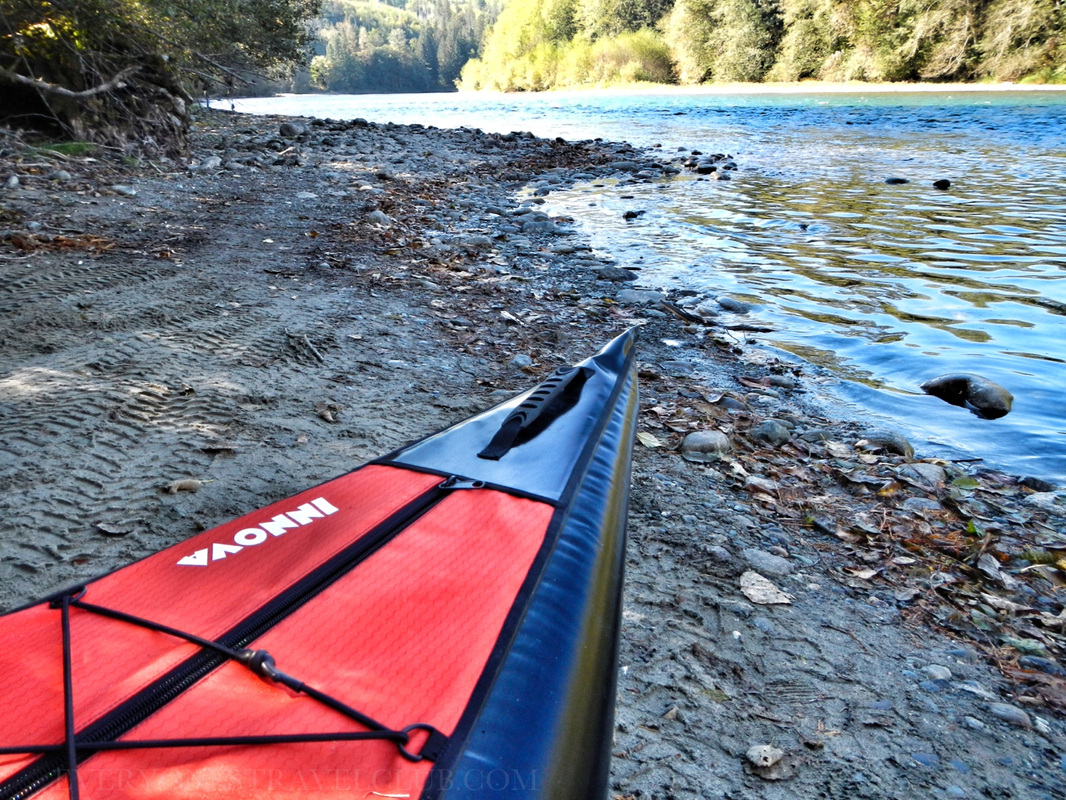 Paddling the river in kayaks this time of year (early October), requires a little strategy. The river, like many across the country, seemed lower than usual. A dry summer (our summers are usually fairly dry, but we really had a dry one this year) means there are quite a few shallow spots you'll have to navigate. Also, the occasional whitewater makes this trip splashy enough to be fun and keep you on your toes, but not crazy enough to cause my wife and I to yell at each other around every bend:) We are still pretty new to river paddling and are more used to slow moving, tidal-wind-& wave influenced saltwater trips in the nearby Puget Sound. After the first whitewater early on this paddle (that sound of loud rushing water in the distance!) we wondered if it was gonna be the smallest on the trip or the biggest…gulp…it turns out it was the biggest, so the rest of the day was pretty much smooth paddling with still fun, but smaller whitewater portions. 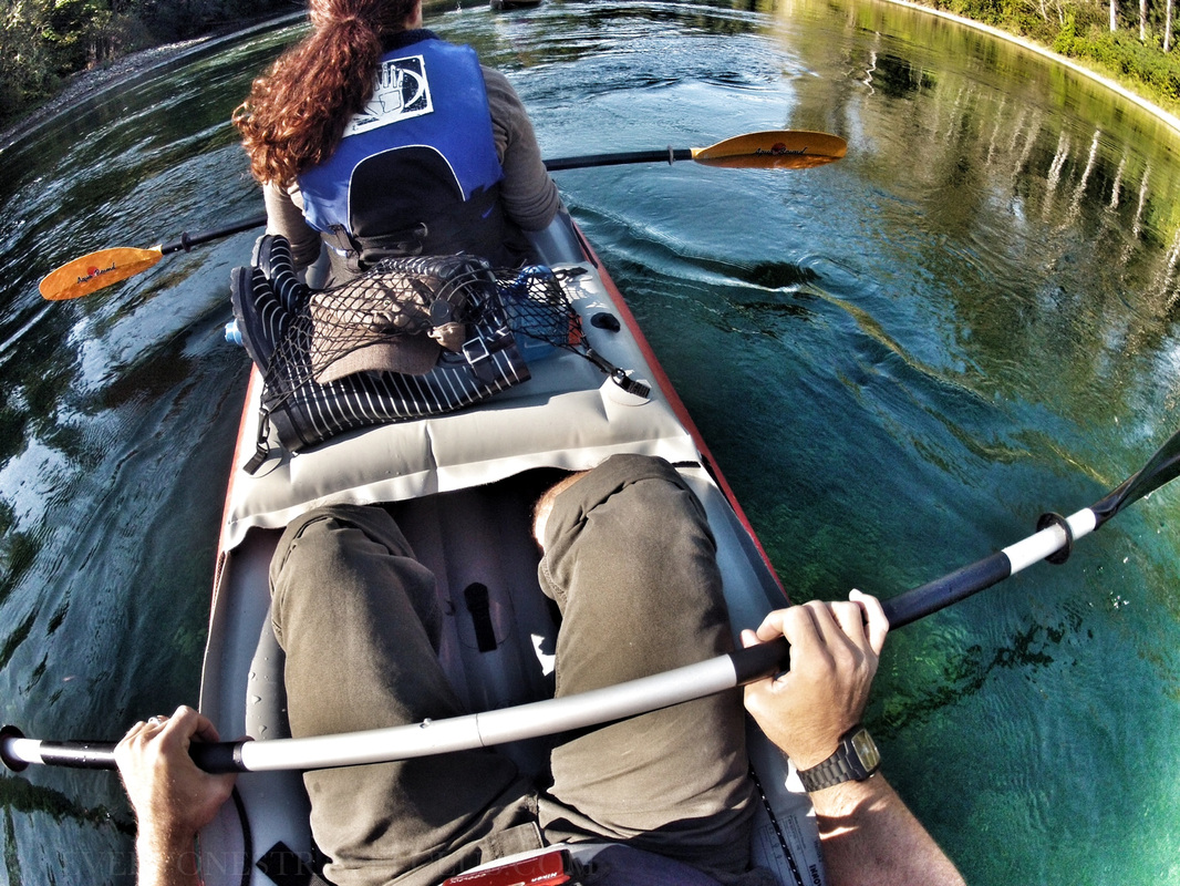
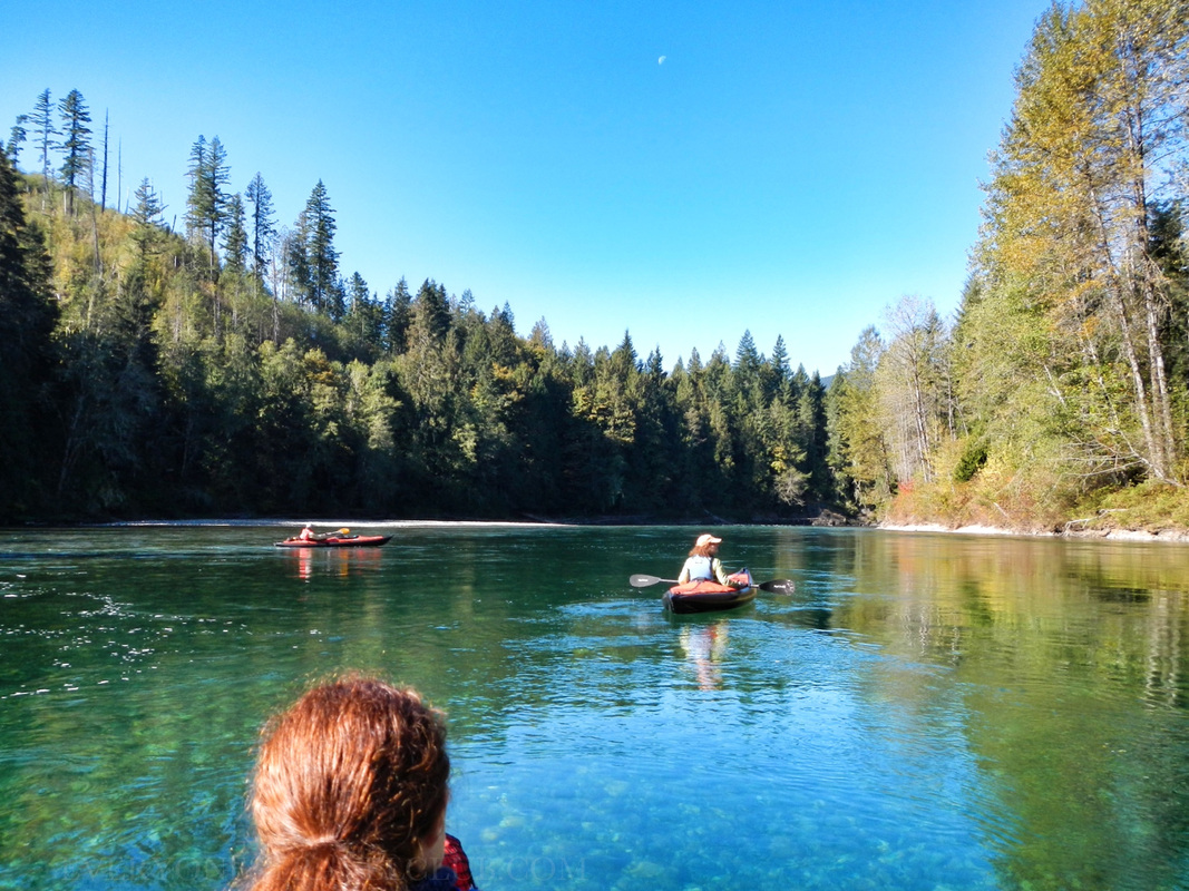    As you cruise down the river from Marblemount you'll start to notice the beautiful mountain views behind you - you are on the aquatic version of the North Cascades Highway after all!  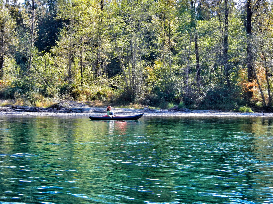 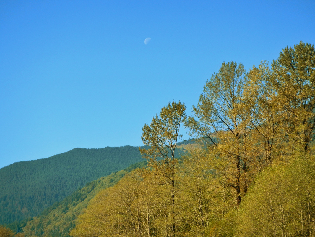 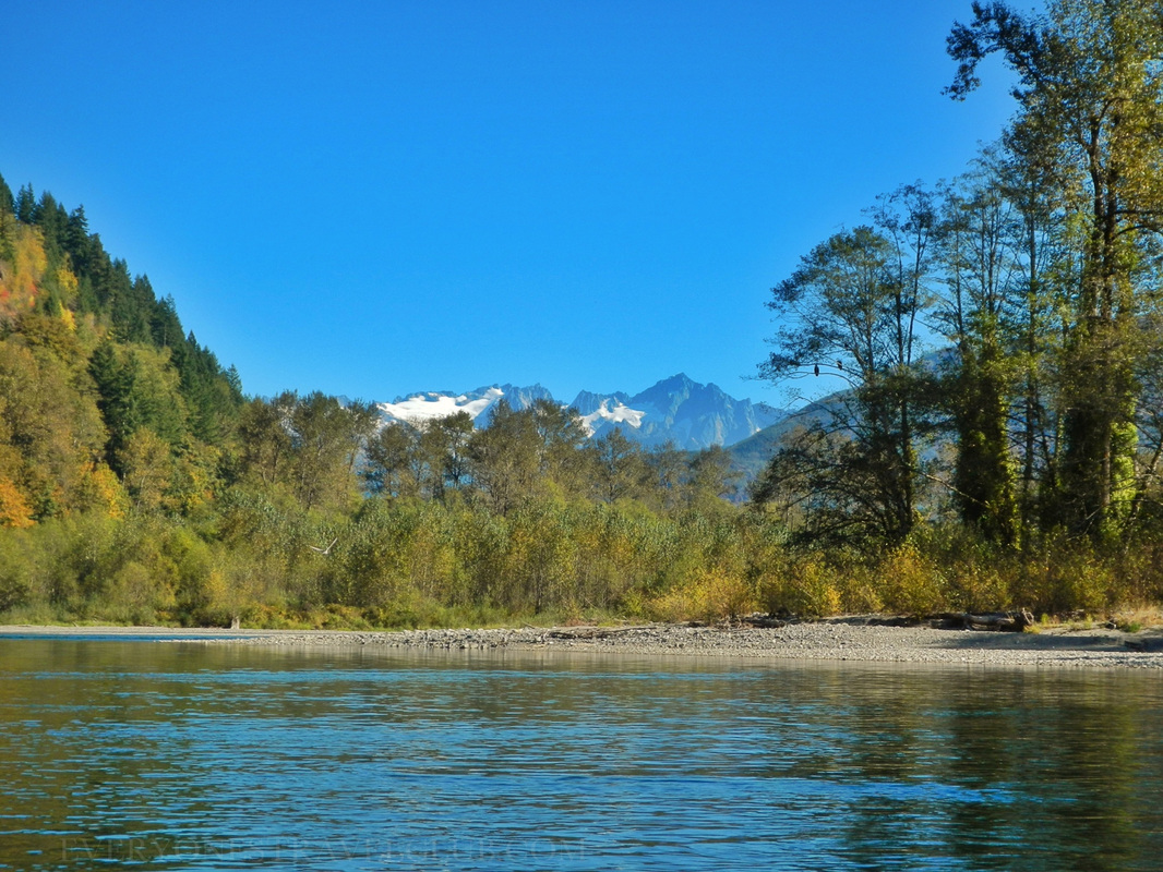
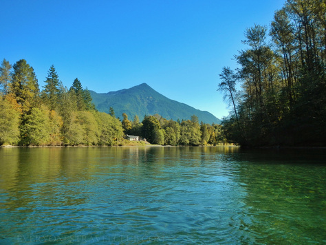
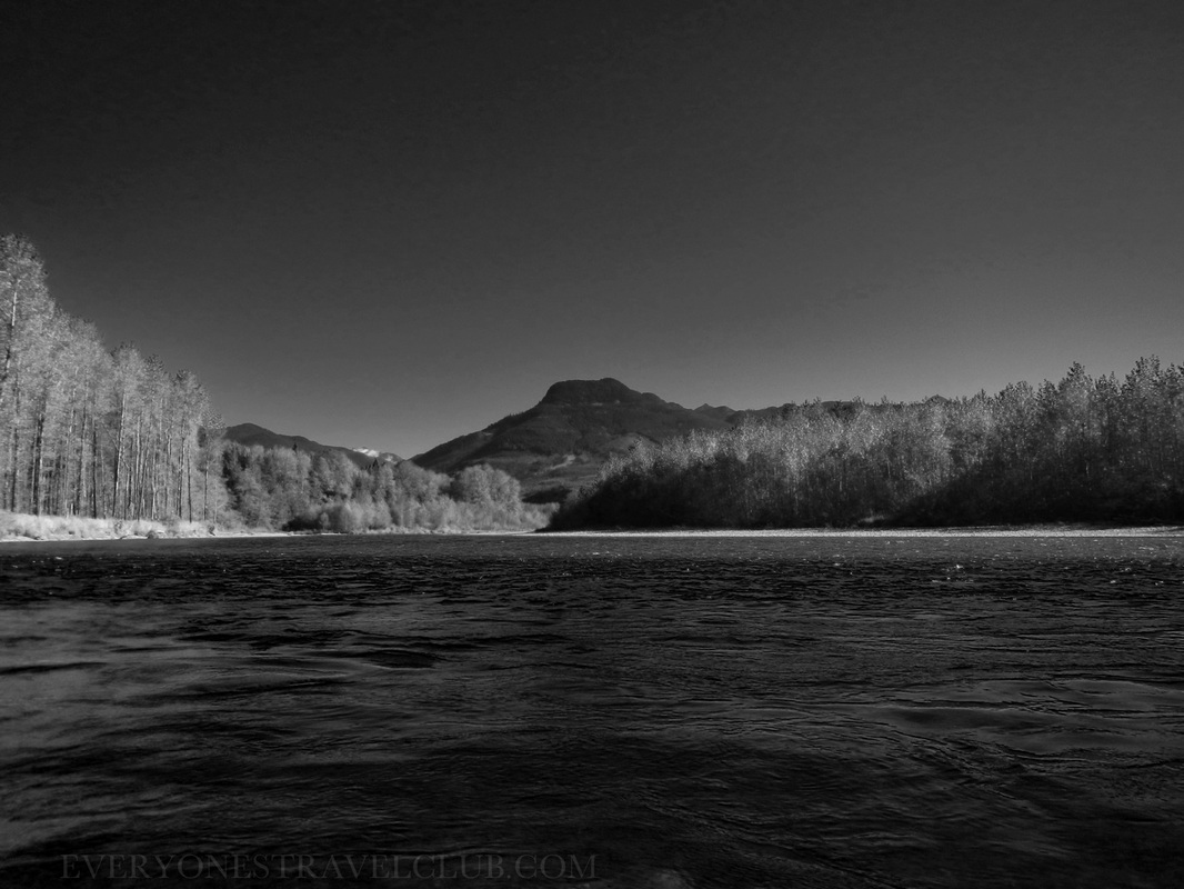
I couldn't help but go a little Ansel Adams on the whole situation. 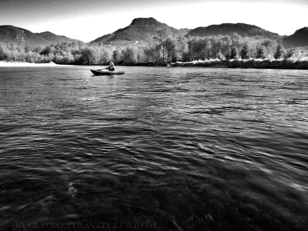
  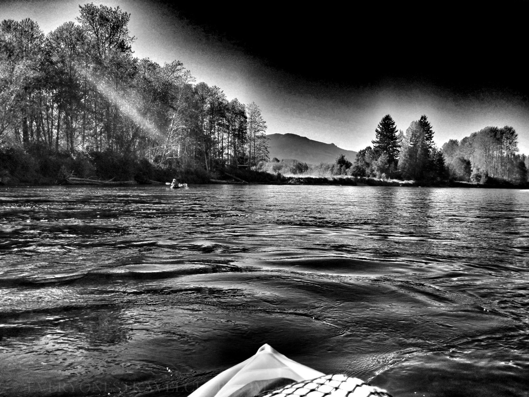 
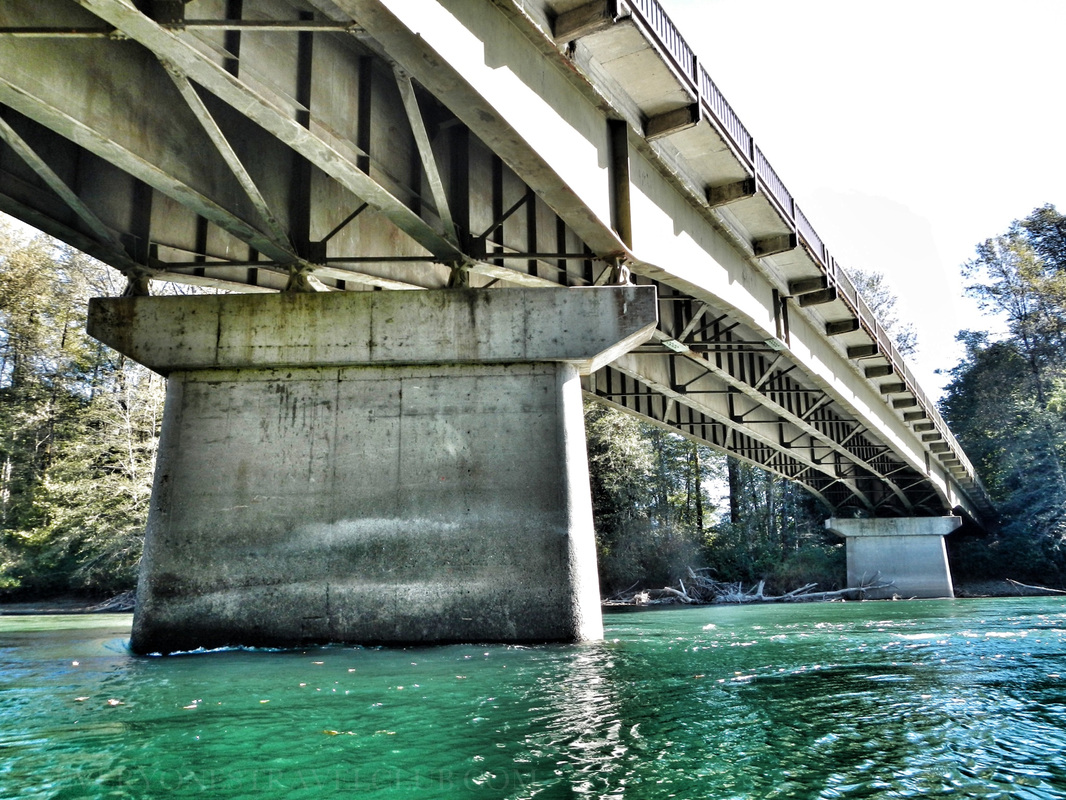
   Another nice thing about this paddle is you put in at one bridge and you take out at the next one...or just yards past the next one anyway. You may see some tour rafts just under the bridge at Rockport like we did - but just keep paddling about 100 yards more for the official launch/take-out site. We completed the trip, with a decent lunch break, in about 3 hours and 15 minutes. As I've tried to show with my photos - it's a gorgeous paddle with lots to see. Check the links below for more info, especially if you plan to go during the winter eagle season - there are a few restrictions. Want a little longer of a paddle? Try putting in a little more up river across from Copper Creek. Don't have two cars? Contact one of the raft tours to give you a lift! Be safe & have fun! ~Paul, Amber, Mandy, Karl ETC Nature Conservancy Skagit River visitors guide Allaboutrivers info page on the route with numbers for current river conditions Innova kayak Skagit River Bald Eagle Interpretive Center in Rockport Marblemount boat launch info 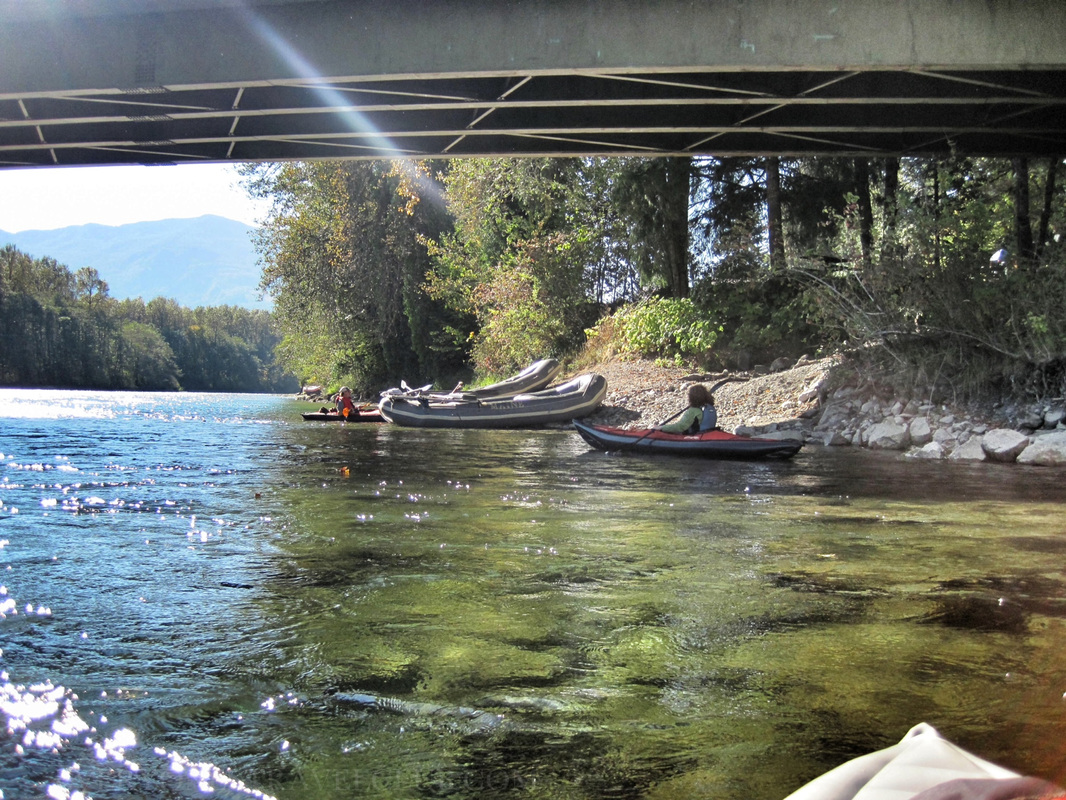
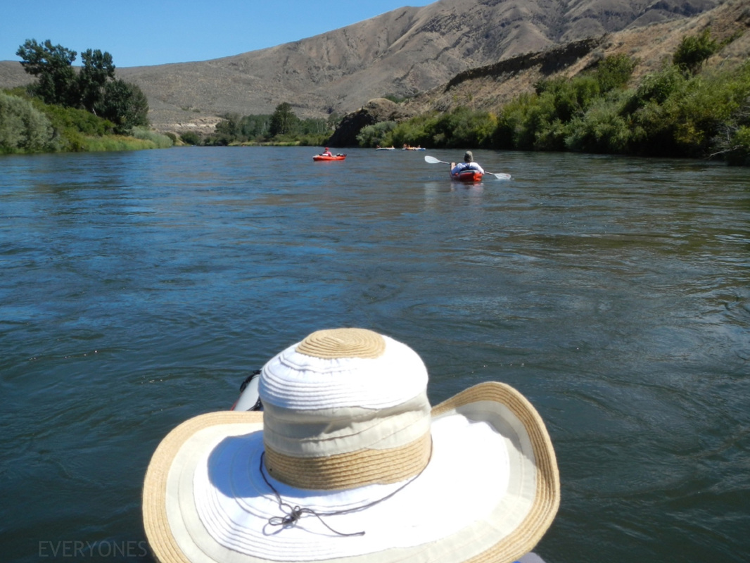
The Seattle summer doesn't seem complete until we pack up the gear, throw on some extra sunscreen, head east over the Mountains towards Ellensburg, and float the Yakima River. 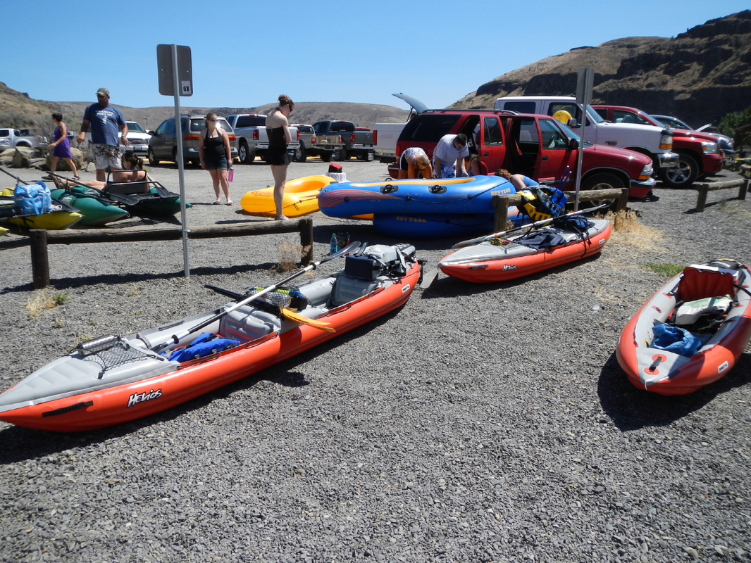
Parking lot at Umtanum
Thing is, our launch-site at Umtanum isn't so secretive, especially on the weekends in the summer. It does have plenty of parking, bathrooms, and room to setup. The popular Washington Discover Pass, a one-time or annual pass that usually lets you park on State lands doesn't apply here though, you'll have to pay a little extra:( Drop off your people and gear here, then take two cars down river to Roza, leave one, and come back. 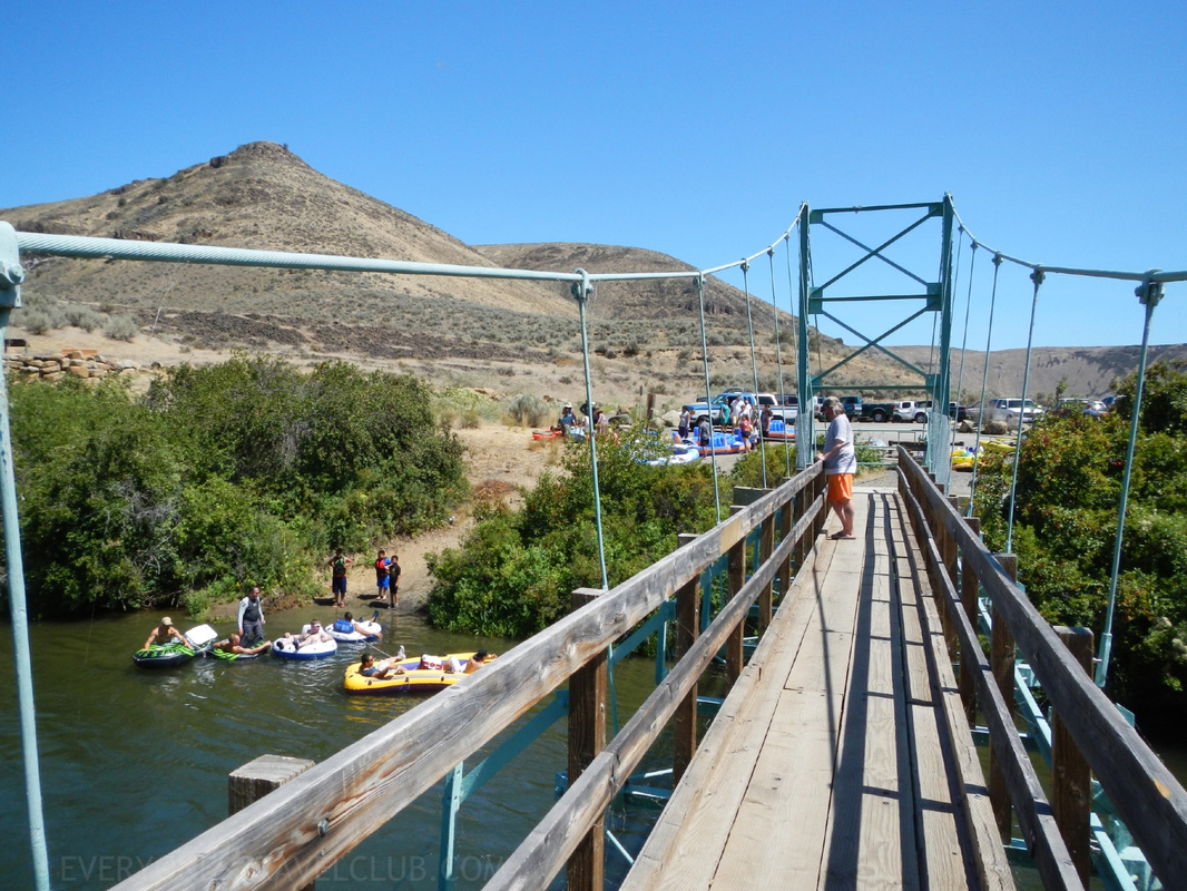
Pedestrian bridge and launch site at Umtanum.
This is the small launch site at Umtanum, we had to wait in line to launch but it was quick and the people were friendly and having fun. After that, the paddle was on. 
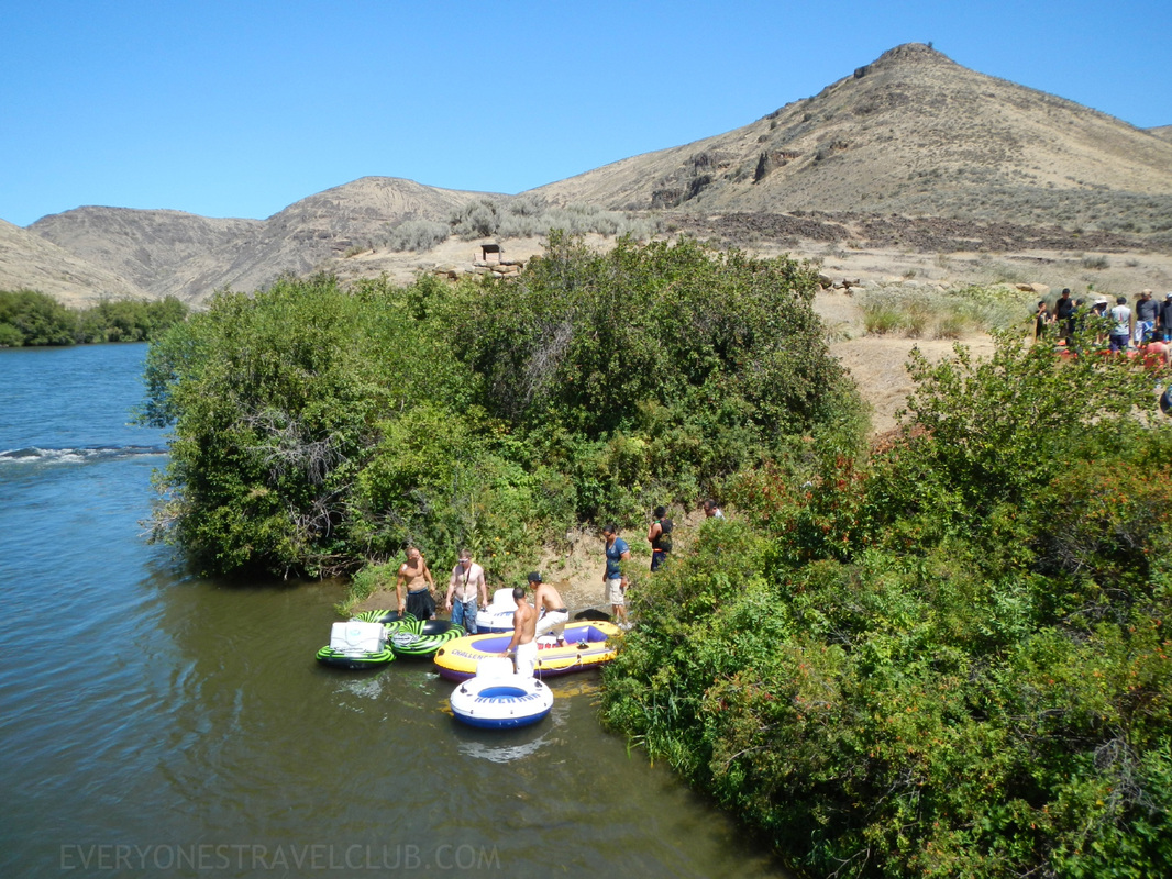
         I'd love to give you a specific time for this float but there are a lot of factors involved in that number - time of year, how often you stop, whether or not we had a lot of snow, type of boat/tube, etc. We floated it in late July, 2012, in our Innova kayaks (which were moving a lot faster than all the other tubes, rafts, and boats on the river that day, and we were only paddling to steer). It took us a little less than 3 hours. This being the case we felt like it was a little short, in kayaks anyway, and we'd probably shoot for a longer run next time, probably Ringer to Roza (it's a more catchy title too). If I was tubing it this time of year, the Umtanum to Roza would be perfect. ~Paul, Amber, Keith, Vic ETC P.S. Here's a link to a great map of the entire route... 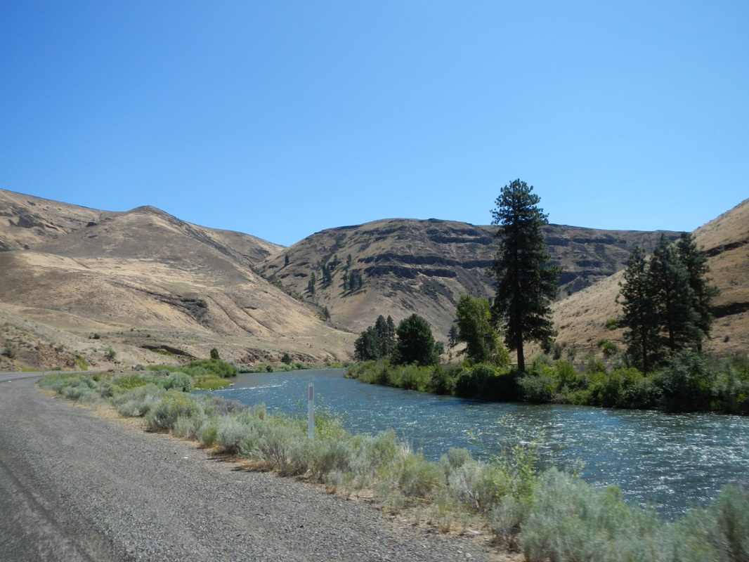
|
Follow us on Twitter and receive updates when we post (click the birdie).
 Archives
March 2014
|
 RSS Feed

|
Connect:Contact: |
everyonestravelclub@gmail.com |